TopoQuest Logo
Do you find TopoQuest useful?
Help keep TopoQuest running and adding new maps/features by donating!
Bitcoin:  19c7KJd3qBynnjoSw5npx9KScwjBe4ifkT
Litecoin:  LXs6TkuXGGXo1vDsWCkWVdjQX94eUKd6ui
Home View Maps Find Maps Find Places Resources & Links


Manatawny, Pennsylvania Topographic Map

USGS Map Title: Manatawny, PA
USGS Map MRC: 40075D6
DRG (GeoTIFF) Download: o40075d6.tif


Neighboring USGS Topographic Map Quads:


  Kutztown, PA  
40075E7
 

  Topton, PA  
40075E6
 

  Allentown West, PA  
40075E5
 

  Fleetwood, PA  
40075D7
 

  Manatawny, PA  
40075D6
 

  East Greenville, PA  
40075D5
 

  Birdsboro, PA  
40075C7
 

  Boyertown, PA  
40075C6
 

  Sassamansville, PA  
40075C5


Map MRC Location:

N41°
W76°
N41°
W75°
H8 H7 H6 H5 H4 H3 H2 H1
G8 G7 G6 G5 G4 G3 G2 G1
F8 F7 F6 F5 F4 F3 F2 F1
E8 E7 E6 E5 E4 E3 E2 E1
D8 D7 D6 D5 D4 D3 D2 D1
C8 C7 C6 C5 C4 C3 C2 C1
B8 B7 B6 B5 B4 B3 B2 B1
A8 A7 A6 A5 A4 A3 A2 A1
N40°
W76°
N40°
W75°

Manatawny, PA USGS 1:24K Topographic Map Preview:
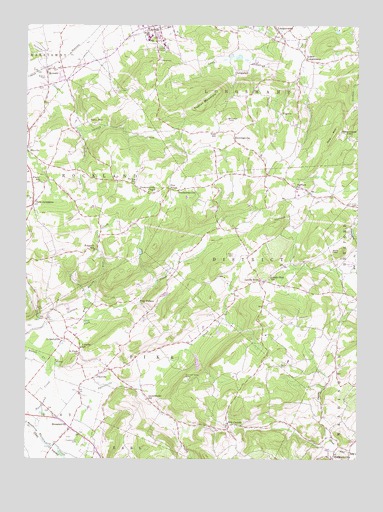
Manatawny, PA USGS Topographic Map
Click on map above to begin viewing in our Map Viewer.

This topographic map contains these locations and features:
Feature Name Type Latitude Longitude GNIS ID View Map
Area 52 AirportAirportN40.4320°W75.6269°1193980View Map
Bethel Romanian Independent Pentecostal ChurchChurchN40.4384°W75.7490°2487822View Map
Bieber CreekStreamN40.3973°W75.7399°1169472View Map
BowersPopulated PlaceN40.4873°W75.7421°1170048View Map
Bowers Census Designated PlaceCensusN40.4848°W75.7423°2631252View Map
Bowers ParkParkN40.4848°W75.7424°1170054View Map
Bowers Post OfficePost OfficeN40.4879°W75.7371°2772610View Map
Brandywine Community LibraryBuildingN40.4956°W75.6985°2487884View Map
Brandywine Heights Middle SchoolSchoolN40.4967°W75.7033°2487886View Map
Bush SchoolSchoolN40.4693°W75.6774°1170769View Map
Chimney RocksSummitN40.4086°W75.7222°2547846View Map
Christ DeLong United Church of ChristChurchN40.4877°W75.7392°2487951View Map
Christ DeLong United Church of Christ CemeteryCemeteryN40.4870°W75.7385°2487952View Map
Community Rod and Gun ClubLocaleN40.3833°W75.6369°2487994View Map
Corn Church CreekStreamN40.3833°W75.6878°2420615View Map
Devil HeadSummitN40.4354°W75.6310°1173196View Map
Dieners Daal CreekStreamN40.3850°W75.6942°2420616View Map
District Township GarageBuildingN40.4245°W75.6428°2488036View Map
District Township Municipal BuildingBuildingN40.4117°W75.6602°2488037View Map
District-Topton Elementary CenterSchoolN40.5000°W75.7051°2488038View Map
Diversion DamDamN40.4079°W75.7363°1208937View Map
Doe Mountain Ski AreaLocaleN40.4754°W75.6285°1205841View Map
Drumheller School CreekStreamN40.3964°W75.7075°2420617View Map
Drumhellers SchoolSchoolN40.3920°W75.7038°1173487View Map
DryvillePopulated PlaceN40.4643°W75.7496°1192376View Map
Five PointsPopulated PlaceN40.4532°W75.6957°1203583View Map
FredericksvillePopulated PlaceN40.4532°W75.6891°1203626View Map
Fredericksville ChapelChurchN40.4520°W75.7035°1175196View Map
Funks SchoolSchoolN40.4548°W75.7446°1175342View Map
Gap HillSummitN40.4690°W75.6335°1175421View Map
Glen RunStreamN40.4890°W75.6646°2742358View Map
Gordon ParkParkN40.4107°W75.6598°2488730View Map
Haas FieldParkN40.4118°W75.6598°2488771View Map
Heilig School CreekStreamN40.4203°W75.7089°2420618View Map
HenningsvillePopulated PlaceN40.4668°W75.6710°1203782View Map
Herzog SchoolSchoolN40.4545°W75.7088°1176906View Map
Hill ChurchLocaleN40.3848°W75.6730°1177070View Map
Hill Church Union CemeteryCemeteryN40.3843°W75.6725°2488819View Map
Hoch Family CemeteryCemeteryN40.3961°W75.7495°2776234View Map
Jacob Keim Farmstead Family Burial GroundCemeteryN40.4135°W75.7491°2776238View Map
Landis StorePopulated PlaceN40.4265°W75.6607°1178851View Map
Landis Well SchoolSchoolN40.4276°W75.6571°1178853View Map
Little Manatawny CreekStreamN40.3823°W75.7452°1179591View Map
Little Sacony CreekStreamN40.4704°W75.7310°1179665View Map
Lobachs SchoolSchoolN40.4070°W75.7288°1179739View Map
LobachsvillePopulated PlaceN40.4095°W75.7349°1179740View Map
LongsdalePopulated PlaceN40.4873°W75.6707°1204057View Map
LongswampPopulated PlaceN40.4982°W75.6549°1179926View Map
Longswamp Union CemeteryCemeteryN40.4969°W75.6551°2488163View Map
Longswamp United Church of ChristChurchN40.4958°W75.6565°2488164View Map
Lower LongswampPopulated PlaceN40.4909°W75.6446°1180022View Map
ManatawnyPopulated PlaceN40.3837°W75.7327°1180258View Map
Martin Stone QuarriesMineN40.3817°W75.6283°2706881View Map
Mensch Mill Conference and Retreat CenterLocaleN40.4399°W75.6269°2488619View Map
Mensch Mill DamDamN40.4404°W75.6263°1208945View Map
Morning Star FellowshipChurchN40.3766°W75.6269°2488654View Map
Moser RunStreamN40.3831°W75.6781°2420619View Map
Mountain Mary CreekStreamN40.3850°W75.6939°2420620View Map
Mountain Marys GraveCemeteryN40.3987°W75.6894°1199205View Map
New JerusalemPopulated PlaceN40.4481°W75.7471°1182336View Map
Oreville SchoolSchoolN40.4851°W75.6996°1195932View Map
Oysterville CreekStreamN40.3754°W75.7346°1193075View Map
Pike Township BuildingBuildingN40.3937°W75.7049°2488279View Map
PikevillePopulated PlaceN40.3984°W75.7235°1183737View Map
PilgertsPopulated PlaceN40.4745°W75.6535°1204392View Map
Pine CreekStreamN40.3970°W75.7399°1183768View Map
Pine WatersPopulated PlaceN40.4207°W75.7071°1204404View Map
Pleasantville Covered BridgeBridgeN40.3791°W75.7388°2488293View Map
Pleasantville Evangelical ChurchChurchN40.3823°W75.7351°2488294View Map
Pleasantville ParkParkN40.3809°W75.7299°1184103View Map
Pleasantville Union CemeteryCemeteryN40.3818°W75.7324°2776273View Map
Rittenhouse GapPopulated PlaceN40.4678°W75.6284°2488384View Map
Rittenhouse GapGapN40.4679°W75.6296°1185117View Map
Rockland Elementary SchoolSchoolN40.4579°W75.7486°2488404View Map
Roebuck SchoolSchoolN40.4534°W75.6480°1185384View Map
Rupperts SchoolSchoolN40.4351°W75.7241°1185629View Map
Saint John-Hill United Church of ChristChurchN40.3838°W75.6733°2488539View Map
Saint Pauls CemeteryCemeteryN40.4041°W75.7304°2488583View Map
Saint Pauls ChurchChurchN40.4045°W75.7299°1186597View Map
Sally AnnPopulated PlaceN40.4723°W75.7266°1204578View Map
Show Top FarmsLocaleN40.4628°W75.6606°2707287View Map
Stone Roll CreekStreamN40.4064°W75.6894°2084370View Map
The Bridge InnBuildingN40.3839°W75.7326°2488947View Map
The Inn at Bally Spring FarmBuildingN40.4308°W75.6263°2488949View Map
Topton Lutheran HomeBuildingN40.4944°W75.6973°2488971View Map
Topton MountainSummitN40.4770°W75.6824°1189664View Map
Township of DistrictCivilN40.4344°W75.6595°1215922View Map
Township of LongswampCivilN40.4908°W75.6603°1215930View Map
Township of PikeCivilN40.4015°W75.6961°1215942View Map
Township of RocklandCivilN40.4476°W75.7414°1215945View Map
WBYO-FM (Boyertown)TowerN40.4043°W75.6521°1200220View Map
Weidner Number 2 CemeteryCemeteryN40.3956°W75.7490°2776235View Map
Weller CemeteryCemeteryN40.4018°W75.6532°1190808View Map
West Branch Pine CreekStreamN40.4145°W75.7266°1190923View Map

Note: Coordinates in the location and feature list above are referenced to NAD83 datum.


Copyright (C) 2008-2024 Ryan Niemi / Sunset Dynamics ... All Rights Reserved