TopoQuest Logo
Do you find TopoQuest useful?
Help keep TopoQuest running and adding new maps/features by donating!
Bitcoin:  19c7KJd3qBynnjoSw5npx9KScwjBe4ifkT
Litecoin:  LXs6TkuXGGXo1vDsWCkWVdjQX94eUKd6ui
Home View Maps Find Maps Find Places Resources & Links


Mangas Mountain, New Mexico Topographic Map

USGS Map Title: Mangas Mountain, NM
USGS Map MRC: 34108A3
DRG (GeoTIFF) Download: o34108a3.tif


Neighboring USGS Topographic Map Quads:


  Escondido Mountain, NM  
34108B4
 

  Mangas, NM  
34108B3
 

  Alegres Mountain, NM  
34108B2
 

  Slaughter Mesa, NM  
34108A4
 

  Mangas Mountain, NM  
34108A3
 

  Wallace Mesa, NM  
34108A2
 

  Tularosa Canyon, NM  
33108H4
 

  Bell Peak, NM  
33108H3
 

  Horse Mountain West, NM  
33108H2


Map MRC Location:

N35°
W109°
N35°
W108°
H8 H7 H6 H5 H4 H3 H2 H1
G8 G7 G6 G5 G4 G3 G2 G1
F8 F7 F6 F5 F4 F3 F2 F1
E8 E7 E6 E5 E4 E3 E2 E1
D8 D7 D6 D5 D4 D3 D2 D1
C8 C7 C6 C5 C4 C3 C2 C1
B8 B7 B6 B5 B4 B3 B2 B1
A8 A7 A6 A5 A4 A3 A2 A1
N34°
W109°
N34°
W108°

Mangas Mountain, NM USGS 1:24K Topographic Map Preview:
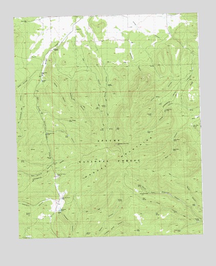
Mangas Mountain, NM USGS Topographic Map
Click on map above to begin viewing in our Map Viewer.

This topographic map contains these locations and features:
Feature Name Type Latitude Longitude GNIS ID View Map
Alamocito TankReservoirN34.0243°W108.2866°1854062View Map
Bear Well SpringSpringN34.0611°W108.2558°1854039View Map
Bell CanyonValleyN34.1209°W108.3328°1854032View Map
Bell Pit TankReservoirN34.0454°W108.3518°1854051View Map
Bell SpringSpringN34.0609°W108.3156°1854043View Map
Big TankReservoirN34.0727°W108.3190°1854041View Map
Box Canyon TankReservoirN34.0662°W108.3399°1854046View Map
Burro SpringSpringN34.0442°W108.3701°1854053View Map
CaballerizaSpringN34.0362°W108.3478°902571View Map
Caballeriza CanyonValleyN34.0203°W108.3506°1854027View Map
Cassidera CanyonValleyN34.0914°W108.3640°1854030View Map
Cienaga TankReservoirN34.0009°W108.3673°1854055View Map
El Toro CanyonValleyN34.0076°W108.2514°1854024View Map
Familia SpringSpringN34.0140°W108.3671°1854054View Map
Gabaldon CanyonValleyN34.1073°W108.3490°1854034View Map
Gabaldon WindmillLocaleN34.1064°W108.3484°1854029View Map
Gallina SpringSpringN34.0200°W108.3049°1854059View Map
Green CanyonValleyN34.0939°W108.3612°1854031View Map
Hollow TankReservoirN34.0021°W108.3295°1854058View Map
Indian SpringSpringN34.0279°W108.2907°1854063View Map
J D Pit TankReservoirN34.0422°W108.3516°1854052View Map
Little TankReservoirN34.0604°W108.3073°1854042View Map
Lower Bear TankReservoirN34.0536°W108.2690°1854037View Map
Lower Cat TankReservoirN34.0707°W108.2732°1854040View Map
Mangas MountainSummitN34.0509°W108.3059°908387View Map
Mangas Mountain Lookout Complex Historic SiteLocaleN34.0509°W108.3059°933600View Map
Mangas TankReservoirN34.0888°W108.3572°1854026View Map
Mangas Work CenterLocaleN34.0920°W108.3573°1877559View Map
Mud SpringSpringN34.0206°W108.2912°1854061View Map
Oak SpringSpringN34.0128°W108.2823°1854064View Map
Padilla CanyonValleyN34.1181°W108.3262°1854065View Map
Padilla SpringSpringN34.0737°W108.3142°1854044View Map
Padilla WindmillLocaleN34.0856°W108.3123°1854035View Map
Patterson TankReservoirN34.0156°W108.3470°2038612View Map
Quemado DivisionCivilN34.0462°W108.2768°1937571View Map
Rincon WellWellN34.1226°W108.3665°1854025View Map
San Antone CanyonValleyN34.1031°W108.3531°1854028View Map
Sawmill PondLakeN34.0683°W108.2831°1877558View Map
Sheep Camp TankReservoirN34.0027°W108.2652°1854050View Map
Sleeping Steer TankReservoirN34.0589°W108.3543°1854045View Map
Spike TankReservoirN34.0165°W108.2551°1854048View Map
Tordcha TankReservoirN34.0074°W108.2524°1854049View Map
Trail TankReservoirN34.0575°W108.3397°1854047View Map
Tub PeakSummitN34.0031°W108.2956°1854060View Map
Upper Bear TankReservoirN34.0481°W108.2695°1854036View Map
Upper Cat TankReservoirN34.0588°W108.2864°1854038View Map
Valle Tio Vinces SpringSpringN34.0354°W108.3483°1854057View Map
Valle Tio Vinces TankReservoirN34.0221°W108.3457°1854056View Map
Vereda CanyonValleyN34.0923°W108.3567°1854033View Map

Note: Coordinates in the location and feature list above are referenced to NAD83 datum.


Copyright (C) 2008-2025 Ryan Niemi / Sunset Dynamics ... All Rights Reserved