TopoQuest Logo
Do you find TopoQuest useful?
Help keep TopoQuest running and adding new maps/features by donating!
Bitcoin:  19c7KJd3qBynnjoSw5npx9KScwjBe4ifkT
Litecoin:  LXs6TkuXGGXo1vDsWCkWVdjQX94eUKd6ui
Home View Maps Find Maps Find Places Resources & Links


Manistique East, Michigan Topographic Map

USGS Map Title: Manistique East, MI
USGS Map MRC: 45086H2
DRG (GeoTIFF) Download: o45086h2.tif


Neighboring USGS Topographic Map Quads:


  Smith Lake, MI  
46086A2
 

  Merwin Lake, MI  
46086A1


  Manistique East, MI  
45086H2
 

  Gulliver, MI  
45086H1
 

  Point Aux Barques, MI  
45086G3


Map MRC Location:

N46°
W87°
N46°
W86°
H8 H7 H6 H5 H4 H3 H2 H1
G8 G7 G6 G5 G4 G3 G2 G1
F8 F7 F6 F5 F4 F3 F2 F1
E8 E7 E6 E5 E4 E3 E2 E1
D8 D7 D6 D5 D4 D3 D2 D1
C8 C7 C6 C5 C4 C3 C2 C1
B8 B7 B6 B5 B4 B3 B2 B1
A8 A7 A6 A5 A4 A3 A2 A1
N45°
W87°
N45°
W86°

Manistique East, MI USGS 1:24K Topographic Map Preview:
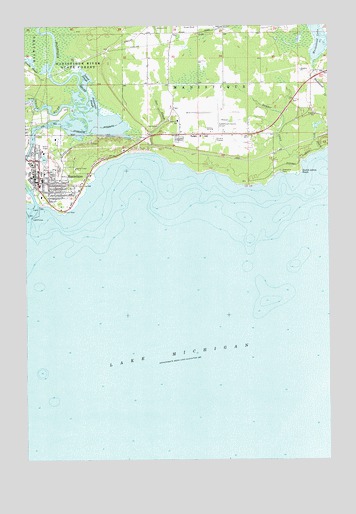
Manistique East, MI USGS Topographic Map
Click on map above to begin viewing in our Map Viewer.

This topographic map contains these locations and features:
Feature Name Type Latitude Longitude GNIS ID View Map
Bethel Baptist Christian SchoolSchoolN45.9617°W86.2478°2356700View Map
Bethel Baptist ChurchChurchN45.9617°W86.2478°2356687View Map
Dry CreekStreamN45.9641°W86.1265°624896View Map
Dutch Johns PointCapeN45.9561°W86.1376°625032View Map
Emerald Elementary SchoolSchoolN45.9558°W86.2356°2356703View Map
Fairview CemeteryCemeteryN45.9675°W86.1879°625762View Map
Fairview SchoolSchoolN45.9728°W86.1879°625778View Map
First Baptist ChurchChurchN45.9564°W86.2439°2356690View Map
First United Methodist ChurchChurchN45.9611°W86.2458°2356696View Map
Goulds SloughStreamN45.9866°W86.2438°1620046View Map
Indian RiverStreamN45.9761°W86.2310°1620307View Map
Island SloughGutN45.9850°W86.2251°629135View Map
Jamestown SloughLakeN45.9741°W86.2228°629208View Map
Kingdom Hall of Jehovah's WitnessesChurchN45.9514°W86.2300°2356695View Map
Lakeview CemeteryCemeteryN45.9589°W86.2365°630047View Map
Lakeview ParkParkN45.9464°W86.2350°2356707View Map
Lime Kilns Historical Marker (historical)ParkN45.9856°W86.1333°2356722View Map
ManistiquePopulated PlaceN45.9578°W86.2463°1620685View Map
Manistique Ambulance ServiceBuildingN45.9640°W86.2439°2626783View Map
Manistique City HallBuildingN45.9639°W86.2439°2356679View Map
Manistique Department of Public Safety Fire StationBuildingN45.9644°W86.2438°2356680View Map
Manistique Harbor Pentecostal ChurchChurchN45.9522°W86.2306°2356694View Map
Manistique High SchoolSchoolN45.9583°W86.2458°2356702View Map
Manistique LightLocaleN45.9450°W86.2474°1618735View Map
Manistique Municipal MarinaLocaleN45.9522°W86.2465°1618158View Map
Manistique Post OfficePost OfficeN45.9550°W86.2461°2356685View Map
Manistique Public LibraryBuildingN45.9583°W86.2458°2356701View Map
Manistique RiverStreamN45.9483°W86.2457°1620687View Map
Manistique Township ParkParkN45.9578°W86.1460°1618733View Map
Marblehead LakeLakeN45.9953°W86.1292°631538View Map
Orr CreekStreamN45.9633°W86.1971°634109View Map
Presbyterian ChurchChurchN45.9581°W86.2431°2356692View Map
Rural Health ClinicHospitalN45.9583°W86.2403°2356681View Map
Saint Alban's Episcopal ChurchChurchN45.9553°W86.2400°2356693View Map
Saint Francis de Sales ChurchChurchN45.9556°W86.2431°2356688View Map
Saint Francis De Sales SchoolSchoolN45.9558°W86.2431°2356699View Map
Schoolcraft County AirportAirportN45.9701°W86.1740°1624024View Map
Schoolcraft County CourthouseBuildingN45.9572°W86.2436°2356683View Map
Schoolcraft County FairgroundsLocaleN45.9603°W86.2403°2356705View Map
Schoolcraft County Sheriff's OfficeBuildingN45.9574°W86.2437°2356684View Map
Seventh Day Adventist ChurchChurchN45.9564°W86.2406°2356691View Map
Siphon BridgeBridgeN45.9619°W86.2497°2356676View Map
Snyder CreekStreamN45.9608°W86.1354°638218View Map
United States Forest ServiceLocaleN45.9478°W86.2338°1618734View Map
United States Forest Service Manistique Ranger StationBuildingN45.9488°W86.2393°2626869View Map
West Breakwater LightLocaleN45.9455°W86.2488°1618156View Map
West Pierh LightLocaleN45.9480°W86.2465°1618157View Map
Zion Lutheran ChurchChurchN45.9547°W86.2406°2356689View Map

Note: Coordinates in the location and feature list above are referenced to NAD83 datum.


Copyright (C) 2008-2024 Ryan Niemi / Sunset Dynamics ... All Rights Reserved