TopoQuest Logo
Do you find TopoQuest useful?
Help keep TopoQuest running and adding new maps/features by donating!
Bitcoin:  19c7KJd3qBynnjoSw5npx9KScwjBe4ifkT
Litecoin:  LXs6TkuXGGXo1vDsWCkWVdjQX94eUKd6ui
Home View Maps Find Maps Find Places Resources & Links


Manlius, Illinois Topographic Map

USGS Map Title: Manlius, IL
USGS Map MRC: 41089D6
DRG (GeoTIFF) Download: o41089d6.tif


Neighboring USGS Topographic Map Quads:


  Yorktown, IL  
41089E7
 

  New Bedford, IL  
41089E6
 

  Walnut, IL  
41089E5
 

  Mineral, IL  
41089D7
 

  Manlius, IL  
41089D6
 

  Buda NE, IL  
41089D5
 

  Neponset, IL  
41089C7
 

  Buda, IL  
41089C6
 

  Wyanet, IL  
41089C5


Map MRC Location:

N42°
W90°
N42°
W89°
H8 H7 H6 H5 H4 H3 H2 H1
G8 G7 G6 G5 G4 G3 G2 G1
F8 F7 F6 F5 F4 F3 F2 F1
E8 E7 E6 E5 E4 E3 E2 E1
D8 D7 D6 D5 D4 D3 D2 D1
C8 C7 C6 C5 C4 C3 C2 C1
B8 B7 B6 B5 B4 B3 B2 B1
A8 A7 A6 A5 A4 A3 A2 A1
N41°
W90°
N41°
W89°

Manlius, IL USGS 1:24K Topographic Map Preview:
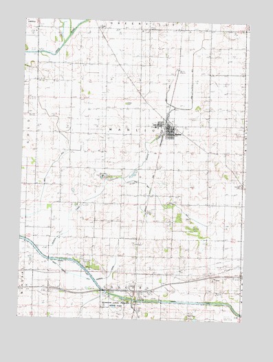
Manlius, IL USGS Topographic Map
Click on map above to begin viewing in our Map Viewer.

This topographic map contains these locations and features:
Feature Name Type Latitude Longitude GNIS ID View Map
Bureau Valley Elementary School-ManliusSchoolN41.4559°W89.6762°1822635View Map
Bureau Valley High SchoolSchoolN41.4567°W89.6768°1822636View Map
Condon School (historical)SchoolN41.4200°W89.6940°406460View Map
Cook School (historical)SchoolN41.4009°W89.6843°406504View Map
Cunningham School (historical)SchoolN41.4634°W89.7232°406897View Map
Devils Slough DitchCanalN41.3934°W89.7195°1720992View Map
Ditch Number 4CanalN41.4264°W89.6790°1720971View Map
Ditch Number 5CanalN41.4770°W89.6562°1720972View Map
Ditch Number 6CanalN41.4236°W89.6637°1720973View Map
Follett CemeteryCemeteryN41.4653°W89.6926°1720976View Map
Grace United Brethren ChurchChurchN41.4570°W89.6751°1984830View Map
Hasbrook Lateral DitchCanalN41.3998°W89.6959°1720980View Map
Hennepin Canal Parkway State ParkParkN41.3789°W89.6915°1720982View Map
Hickory CreekStreamN41.4050°W89.7401°422182View Map
Hickory Grove School (historical)SchoolN41.4017°W89.6551°410162View Map
Hunt School (historical)SchoolN41.4981°W89.7412°410692View Map
Interchange 45CrossingN41.3870°W89.6870°1822667View Map
Krebs School (historical)SchoolN41.4817°W89.6279°411621View Map
Littlefield School (historical)SchoolN41.4309°W89.7282°412441View Map
ManliusPopulated PlaceN41.4564°W89.6690°412891View Map
Manlius AmbulanceBuildingN41.4563°W89.6720°2673762View Map
Manlius CemeteryCemeteryN41.4516°W89.6697°1822684View Map
Manlius Fire Protection DistrictBuildingN41.4560°W89.6680°2640420View Map
Manlius Post OfficePost OfficeN41.4560°W89.6697°1984827View Map
New Bedford Chapel CemeteryCemeteryN41.4969°W89.7088°1720964View Map
Old Manlius School (historical)SchoolN41.4242°W89.6462°415028View Map
Prather School (historical)SchoolN41.3942°W89.7334°416187View Map
Red School (historical)SchoolN41.4814°W89.6970°416466View Map
Ridge School (historical)SchoolN41.4531°W89.6270°416640View Map
Sand Hill Baptist CemeteryCemeteryN41.4315°W89.6280°1721020View Map
Sand Hill Church (historical)ChurchN41.4314°W89.6270°417940View Map
Sisson School (historical)SchoolN41.4500°W89.7037°418552View Map
Smith DitchCanalN41.4373°W89.7343°418635View Map
Township of ManliusCivilN41.4529°W89.6846°429318View Map
Trinity Lutheran ChurchChurchN41.4550°W89.6657°1984831View Map
Village of ManliusCivilN41.4553°W89.6685°2399243View Map
West DitchCanalN41.4695°W89.6704°1721027View Map

Note: Coordinates in the location and feature list above are referenced to NAD83 datum.


Copyright (C) 2008-2024 Ryan Niemi / Sunset Dynamics ... All Rights Reserved