TopoQuest Logo
Do you find TopoQuest useful?
Help keep TopoQuest running and adding new maps/features by donating!
Bitcoin:  19c7KJd3qBynnjoSw5npx9KScwjBe4ifkT
Litecoin:  LXs6TkuXGGXo1vDsWCkWVdjQX94eUKd6ui
Home View Maps Find Maps Find Places Resources & Links


Marengo South, Illinois Topographic Map

USGS Map Title: Marengo South, IL
USGS Map MRC: 42088B5
DRG (GeoTIFF) Download: o42088b5.tif


Neighboring USGS Topographic Map Quads:


  Garden Prairie, IL  
42088C6
 

  Marengo North, IL  
42088C5
 

  Woodstock, IL  
42088C4
 

  Riley, IL  
42088B6
 

  Marengo South, IL  
42088B5
 

  Huntley, IL  
42088B4
 

  Genoa, IL  
42088A6
 

  Hampshire, IL  
42088A5
 

  Pingree Grove, IL  
42088A4


Map MRC Location:

N43°
W89°
N43°
W88°
H8 H7 H6 H5 H4 H3 H2 H1
G8 G7 G6 G5 G4 G3 G2 G1
F8 F7 F6 F5 F4 F3 F2 F1
E8 E7 E6 E5 E4 E3 E2 E1
D8 D7 D6 D5 D4 D3 D2 D1
C8 C7 C6 C5 C4 C3 C2 C1
B8 B7 B6 B5 B4 B3 B2 B1
A8 A7 A6 A5 A4 A3 A2 A1
N42°
W89°
N42°
W88°

Marengo South, IL USGS 1:24K Topographic Map Preview:
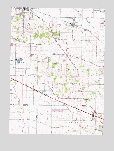
Marengo South, IL USGS Topographic Map
Click on map above to begin viewing in our Map Viewer.

This topographic map contains these locations and features:
Feature Name Type Latitude Longitude GNIS ID View Map
Aldens FarmsLocaleN42.1914°W88.5708°2680926View Map
Anthony School (historical)SchoolN42.1903°W88.6070°1719039View Map
Bean School (historical)SchoolN42.1303°W88.5256°1719045View Map
BrowntownSchoolN42.1972°W88.5212°1719042View Map
Casa De Aero ParkAirportN42.1486°W88.5598°427348View Map
City of MarengoCivilN42.2322°W88.5975°2395004View Map
Coniston FarmsLocaleN42.1894°W88.5756°2705961View Map
CoralPopulated PlaceN42.2172°W88.5645°406579View Map
Coral CemeteryCemeteryN42.2142°W88.5615°406580View Map
Dr Joseph W Esser Airport (historical)AirportN42.1306°W88.5029°427347View Map
Edward Getzelman AirportAirportN42.1296°W88.5300°427349View Map
Emerick AirportAirportN42.1837°W88.5973°427508View Map
Far FieldAirportN42.1984°W88.6228°427511View Map
Ferris FieldAirportN42.1861°W88.6043°427507View Map
First Baptist ChurchChurchN42.2489°W88.6051°1808364View Map
First Presbyterian ChurchChurchN42.2492°W88.6101°1808370View Map
Fox Valley NurseryBuildingN42.1833°W88.5292°2705965View Map
HarmonyPopulated PlaceN42.1611°W88.5265°409799View Map
Harmony CemeteryCemeteryN42.1603°W88.5404°409802View Map
Heath School (historical)SchoolN42.2189°W88.5315°1719041View Map
Hilbert's Funny Farm AirportAirportN42.2111°W88.5186°427877View Map
Illinois Railway MuseumBuildingN42.2114°W88.5265°1808399View Map
Locust Elementary SchoolSchoolN42.2417°W88.5990°1808430View Map
MacGovern School (historical)SchoolN42.2256°W88.5995°1719040View Map
MarengoPopulated PlaceN42.2486°W88.6084°412993View Map
Marengo City HallBuildingN42.2497°W88.6070°1808433View Map
Marengo High SchoolSchoolN42.2450°W88.5951°1719048View Map
Marengo Post OfficePost OfficeN42.2476°W88.6067°2788871View Map
Marengo Public LibraryBuildingN42.2492°W88.6073°1808434View Map
Marengo United Methodist ChurchChurchN42.2489°W88.6073°1808435View Map
Ney School (historical)SchoolN42.1395°W88.6168°1719047View Map
Oak Grove School (historical)SchoolN42.2039°W88.5579°1719043View Map
Reid School (historical)SchoolN42.1334°W88.5737°1719046View Map
Sewald School (historical)SchoolN42.2372°W88.5818°1719038View Map
Sky Soaring AirportAirportN42.1542°W88.5161°427878View Map
Township of CoralCivilN42.1974°W88.5306°428843View Map
UnionPopulated PlaceN42.2331°W88.5423°420010View Map
Union CemeteryCemeteryN42.2306°W88.5506°420033View Map
Union Fire Protection DistrictBuildingN42.2325°W88.5426°2682056View Map
Union Post OfficePost OfficeN42.2338°W88.5445°2788816View Map
Union Village Police DepartmentBuildingN42.2404°W88.5423°2756811View Map
Village of UnionCivilN42.2314°W88.5447°2400020View Map
West Harmony School (historical)SchoolN42.1697°W88.5698°1719044View Map

Note: Coordinates in the location and feature list above are referenced to NAD83 datum.


Copyright (C) 2008-2024 Ryan Niemi / Sunset Dynamics ... All Rights Reserved