TopoQuest Logo
Do you find TopoQuest useful?
Help keep TopoQuest running and adding new maps/features by donating!
Bitcoin:  19c7KJd3qBynnjoSw5npx9KScwjBe4ifkT
Litecoin:  LXs6TkuXGGXo1vDsWCkWVdjQX94eUKd6ui
Home View Maps Find Maps Find Places Resources & Links


Agua Dulce, Texas Topographic Map

USGS Map Title: Agua Dulce, TX
USGS Map MRC: 27097G8
DRG (GeoTIFF) Download: o27097g8.tif


Neighboring USGS Topographic Map Quads:


  San Diego NE, TX  
27098H1
 

  Orange Grove, TX  
27097H8
 

  San Patricio, TX  
27097H7
 

  Alice North, TX  
27098G1
 

  Agua Dulce, TX  
27097G8
 

  Banquete, TX  
27097G7
 

  Alice South, TX  
27098F1
 

  Kingsville NW, TX  
27097F8
 

  Driscoll West, TX  
27097F7


Map MRC Location:

N28°
W98°
N28°
W97°
H8 H7 H6 H5 H4 H3 H2 H1
G8 G7 G6 G5 G4 G3 G2 G1
F8 F7 F6 F5 F4 F3 F2 F1
E8 E7 E6 E5 E4 E3 E2 E1
D8 D7 D6 D5 D4 D3 D2 D1
C8 C7 C6 C5 C4 C3 C2 C1
B8 B7 B6 B5 B4 B3 B2 B1
A8 A7 A6 A5 A4 A3 A2 A1
N27°
W98°
N27°
W97°

Agua Dulce, TX USGS 1:24K Topographic Map Preview:
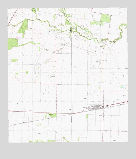
Agua Dulce, TX USGS Topographic Map
Click on map above to begin viewing in our Map Viewer.

This topographic map contains these locations and features:
Feature Name Type Latitude Longitude GNIS ID View Map
Agua DulcePopulated PlaceN27.7817°W97.9086°1329253View Map
Agua Dulce City HallBuildingN27.7814°W97.9110°2753478View Map
Agua Dulce Elementary SchoolSchoolN27.7855°W97.9135°2434480View Map
Agua Dulce High SchoolSchoolN27.7855°W97.9135°2434290View Map
Agua Dulce Post OfficePost OfficeN27.7814°W97.9108°2732135View Map
Agua Dulce Volunteer Fire DepartmentBuildingN27.7814°W97.9112°2334299View Map
Alfred Census Designated PlaceCensusN27.8741°W97.9798°2584601View Map
BentonvillePopulated PlaceN27.7759°W97.9581°1377994View Map
City of Agua DulceCivilN27.7827°W97.9098°2409667View Map
Harvest Acres ColoniaPopulated PlaceN27.7672°W97.9464°2011522View Map
Palo Hueco CreekStreamN27.8536°W97.9275°1343491View Map
Palo Hueco Estates ColoniaPopulated PlaceN27.8584°W97.9964°2011461View Map
Rosita CreekStreamN27.8467°W97.9100°1345603View Map
Tecolate CreekStreamN27.8644°W97.9694°2573432View Map
Tecolote CreekStreamN27.8653°W97.9697°1348317View Map
Water City Estates ColoniaPopulated PlaceN27.7703°W97.9503°2011425View Map

Note: Coordinates in the location and feature list above are referenced to NAD83 datum.


Copyright (C) 2008-2025 Ryan Niemi / Sunset Dynamics ... All Rights Reserved