TopoQuest Logo
Do you find TopoQuest useful?
Help keep TopoQuest running and adding new maps/features by donating!
Bitcoin:  19c7KJd3qBynnjoSw5npx9KScwjBe4ifkT
Litecoin:  LXs6TkuXGGXo1vDsWCkWVdjQX94eUKd6ui
Home View Maps Find Maps Find Places Resources & Links


Marion, Montana Topographic Map

USGS Map Title: Marion, MT
USGS Map MRC: 48114A6
DRG (GeoTIFF) Download: o48114a6.tif


Neighboring USGS Topographic Map Quads:


  Dahl Lake, MT  
48114B7
 

  Pleasant Valley Mountain, MT  
48114B6
 

  Lone Lake, MT  
48114B5
 

  McGregor Peak, MT  
48114A7
 

  Marion, MT  
48114A6
 

  Haskill Mountain, MT  
48114A5
 

  Murr Peak, MT  
47114H7
 

  Hubbart Reservoir, MT  
47114H6
 

  Kofford Ridge, MT  
47114H5


Map MRC Location:

N49°
W115°
N49°
W114°
H8 H7 H6 H5 H4 H3 H2 H1
G8 G7 G6 G5 G4 G3 G2 G1
F8 F7 F6 F5 F4 F3 F2 F1
E8 E7 E6 E5 E4 E3 E2 E1
D8 D7 D6 D5 D4 D3 D2 D1
C8 C7 C6 C5 C4 C3 C2 C1
B8 B7 B6 B5 B4 B3 B2 B1
A8 A7 A6 A5 A4 A3 A2 A1
N48°
W115°
N48°
W114°

Marion, MT USGS 1:24K Topographic Map Preview:
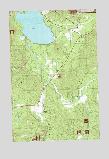
Marion, MT USGS Topographic Map
Click on map above to begin viewing in our Map Viewer.

This topographic map contains these locations and features:
Feature Name Type Latitude Longitude GNIS ID View Map
Cabin Creek LandingAirportN48.0719°W114.6804°2650693View Map
First Baptist ChurchChurchN48.1055°W114.6632°1795807View Map
Granger CreekStreamN48.0433°W114.6526°778787View Map
Granger MeadowFlatN48.0027°W114.6557°784157View Map
Hanson AirportAirportN48.0375°W114.6735°2650664View Map
Hidden LakesLakeN48.0038°W114.7165°784846View Map
Kalispell Southwest DivisionCivilN48.0270°W114.7120°1940653View Map
Little Bitterroot DamDamN48.0933°W114.6976°795662View Map
Little Bitterroot LakeReservoirN48.1143°W114.7156°795663View Map
Little Bitterroot Lake Census Designated PlaceCensusN48.1180°W114.7206°2583823View Map
MarionPopulated PlaceN48.1055°W114.6632°786848View Map
Marion (historical)LocaleN48.1061°W114.6468°1795996View Map
Marion AmbulanceBuildingN48.0988°W114.6477°2637832View Map
Marion Branch LibraryBuildingN48.1055°W114.6632°1795933View Map
Marion Census Designated PlaceCensusN48.0858°W114.6710°2583826View Map
Marion Post OfficePost OfficeN48.1056°W114.6618°1795995View Map
Marion Rural Fire District Battalion 1BuildingN48.1038°W114.6642°1796124View Map
Marion SchoolSchoolN48.1034°W114.6623°1796281View Map
Moore SpringsSpringN48.0430°W114.6515°787621View Map
Pine PrairiePopulated PlaceN48.0288°W114.7054°799065View Map
Rest-A-Day CampgroundLocaleN48.1027°W114.6371°1795906View Map
Sickler CreekStreamN48.0588°W114.6968°790472View Map
Skookum LakeLakeN48.0231°W114.7434°790605View Map
Wilderness Treatment CenterHospitalN48.0319°W114.7079°1795880View Map

Note: Coordinates in the location and feature list above are referenced to NAD83 datum.


Copyright (C) 2008-2025 Ryan Niemi / Sunset Dynamics ... All Rights Reserved