TopoQuest Logo
Do you find TopoQuest useful?
Help keep TopoQuest running and adding new maps/features by donating!
Bitcoin:  19c7KJd3qBynnjoSw5npx9KScwjBe4ifkT
Litecoin:  LXs6TkuXGGXo1vDsWCkWVdjQX94eUKd6ui
Home View Maps Find Maps Find Places Resources & Links


Marne, Michigan Topographic Map

USGS Map Title: Marne, MI
USGS Map MRC: 43085A7
DRG (GeoTIFF) Download: o43085a7.tif


Neighboring USGS Topographic Map Quads:


  Ravenna, MI  
43085B8
 

  Casnovia, MI  
43085B7
 

  Sparta, MI  
43085B6
 

  Coopersville, MI  
43085A8
 

  Marne, MI  
43085A7
 

  Cedar Springs SW, MI  
43085A6
 

  Allendale, MI  
42085H8
 

  Grandville, MI  
42085H7
 

  Grand Rapids West, MI  
42085H6


Map MRC Location:

N44°
W86°
N44°
W85°
H8 H7 H6 H5 H4 H3 H2 H1
G8 G7 G6 G5 G4 G3 G2 G1
F8 F7 F6 F5 F4 F3 F2 F1
E8 E7 E6 E5 E4 E3 E2 E1
D8 D7 D6 D5 D4 D3 D2 D1
C8 C7 C6 C5 C4 C3 C2 C1
B8 B7 B6 B5 B4 B3 B2 B1
A8 A7 A6 A5 A4 A3 A2 A1
N43°
W86°
N43°
W85°

Marne, MI USGS 1:24K Topographic Map Preview:
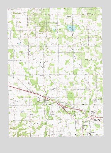
Marne, MI USGS Topographic Map
Click on map above to begin viewing in our Map Viewer.

This topographic map contains these locations and features:
Feature Name Type Latitude Longitude GNIS ID View Map
Alpine Township Fire Department Station 2BuildingN43.0744°W85.7645°2635962View Map
Beach Grove SchoolSchoolN43.0317°W85.7648°620799View Map
Berlin Baptist ChurchChurchN43.0367°W85.8256°2573244View Map
Big Spring Post Office (historical)Post OfficeN43.1189°W85.8481°2572977View Map
Big Springs CemeteryCemeteryN43.1189°W85.8389°2571627View Map
Big Springs SchoolSchoolN43.1192°W85.8492°621357View Map
Boyd SchoolSchoolN43.0895°W85.7678°621820View Map
Carroll SchoolSchoolN43.0495°W85.8473°622790View Map
Clayton SchoolSchoolN43.0595°W85.8089°623397View Map
Country Village Mobile ParkPopulated PlaceN43.0350°W85.8667°2573247View Map
Cranberry LakeLakeN43.1053°W85.7904°623976View Map
Cross CemeteryCemeteryN43.0739°W85.7569°2567122View Map
Diamond SchoolSchoolN43.0320°W85.8684°624641View Map
Fruit Ridge CenterPopulated PlaceN43.1181°W85.7692°626538View Map
HerringtonPopulated PlaceN43.0603°W85.8284°628146View Map
Herrington Post Office (historical)Post OfficeN43.0603°W85.8283°2572873View Map
Herrington Station (historical)LocaleN43.0603°W85.8272°2572843View Map
Interchange 23CrossingN43.0383°W85.8275°2571657View Map
Interchange 24CrossingN43.0308°W85.8069°2571656View Map
Interchange 25CrossingN43.0292°W85.8014°2571655View Map
Interchange 26CrossingN43.0181°W85.7628°2566430View Map
Kauff DamCanalN43.0786°W85.8403°2106573View Map
Kenowa Hills Intermediate SchoolSchoolN43.0139°W85.7742°2106549View Map
Kent City Post OfficePost OfficeN43.0519°W85.7511°2565355View Map
Kent City Township LibraryBuildingN43.0525°W85.7511°2565357View Map
KinneyPopulated PlaceN43.0159°W85.7684°629735View Map
Kinney Post Office (historical)Post OfficeN43.0158°W85.7683°2570724View Map
Kinney Station (historical)LocaleN43.0147°W85.7669°2570801View Map
Laubach Inter-County DrainCanalN43.0800°W85.7847°2106550View Map
MarnePopulated PlaceN43.0361°W85.8278°631597View Map
Marne CemeteryCemeteryN43.0305°W85.8239°2571631View Map
Marne Elementary SchoolSchoolN43.0314°W85.8242°2573243View Map
Marne Post OfficePost OfficeN43.0356°W85.8278°2573241View Map
Marne StationLocaleN43.0386°W85.8236°2573248View Map
Marne United Methodist ChurchChurchN43.0361°W85.8231°2573242View Map
Miller SchoolSchoolN43.0884°W85.8481°632397View Map
Mud LakeLakeN43.1038°W85.8137°632957View Map
Pleasant Post Office (historical)Post OfficeN43.0889°W85.7783°2570699View Map
Remembrance Reformed ChurchChurchN43.0128°W85.7833°2570467View Map
RenoPopulated PlaceN43.0750°W85.8387°635799View Map
Reno Post Office (historical)Post OfficeN43.0750°W85.8386°2572860View Map
Reno Station (historical)LocaleN43.0750°W85.8375°2572842View Map
Saint Joseph Catholic ChurchChurchN43.1094°W85.8072°2573054View Map
Saint Joseph SchoolSchoolN43.1094°W85.8072°2573055View Map
Saint Joseph's CemeteryCemeteryN43.1103°W85.8069°2571632View Map
Saint Mary's CemeteryCemeteryN43.0450°W85.8444°2571644View Map
Saint Marys ChurchChurchN43.0453°W85.8445°636902View Map
Sand Creek Golf ClubLocaleN43.0181°W85.8361°2573245View Map
Star School 13SchoolN43.0017°W85.8059°638743View Map
Township of WrightCivilN43.0747°W85.8479°1627293View Map
WalkerPopulated PlaceN43.0014°W85.7681°1615688View Map
Walker City Fire DepartmentBuildingN43.0081°W85.7757°2570655View Map
Walker LibraryBuildingN43.0058°W85.7736°2570656View Map
Walker Police DepartmentBuildingN43.0070°W85.7734°2737551View Map
Walker Station SchoolSchoolN43.0022°W85.7661°2106548View Map
Walker United Reformed ChurchChurchN43.0006°W85.7689°2570468View Map
Wells CemeteryCemeteryN43.0736°W85.8267°1615990View Map
Western Greens Country ClubLocaleN43.0208°W85.8444°2573246View Map
Wilson SchoolSchoolN43.0592°W85.7739°1616597View Map
WrightPopulated PlaceN43.1109°W85.8087°1616829View Map
Wright - Tallmadge Fire Department Station 1BuildingN43.0368°W85.8270°2636232View Map
Wright and Alpine DrainCanalN43.0828°W85.7870°1616831View Map
Wright Post Office (historical)Post OfficeN43.1108°W85.8086°2572849View Map

Note: Coordinates in the location and feature list above are referenced to NAD83 datum.


Copyright (C) 2008-2024 Ryan Niemi / Sunset Dynamics ... All Rights Reserved