TopoQuest Logo
Do you find TopoQuest useful?
Help keep TopoQuest running and adding new maps/features by donating!
Bitcoin:  19c7KJd3qBynnjoSw5npx9KScwjBe4ifkT
Litecoin:  LXs6TkuXGGXo1vDsWCkWVdjQX94eUKd6ui
Home View Maps Find Maps Find Places Resources & Links


Martinsburg, Nebraska Topographic Map

USGS Map Title: Martinsburg, NE
USGS Map MRC: 42096E7
DRG (GeoTIFF) Download: o42096e7.tif


Neighboring USGS Topographic Map Quads:


  Maskell, NE  
42096F8
 

  Burbank, SD  
42096F7
 

  Elk Point, SD  
42096F6
 

  Martinsburg SW, NE  
42096E8
 

  Martinsburg, NE  
42096E7
 

  Ponca, NE  
42096E6
 

  Concord, NE  
42096D8
 

  Allen, NE  
42096D7
 

  Waterbury, NE  
42096D6


Map MRC Location:

N43°
W97°
N43°
W96°
H8 H7 H6 H5 H4 H3 H2 H1
G8 G7 G6 G5 G4 G3 G2 G1
F8 F7 F6 F5 F4 F3 F2 F1
E8 E7 E6 E5 E4 E3 E2 E1
D8 D7 D6 D5 D4 D3 D2 D1
C8 C7 C6 C5 C4 C3 C2 C1
B8 B7 B6 B5 B4 B3 B2 B1
A8 A7 A6 A5 A4 A3 A2 A1
N42°
W97°
N42°
W96°

Martinsburg, NE USGS 1:24K Topographic Map Preview:
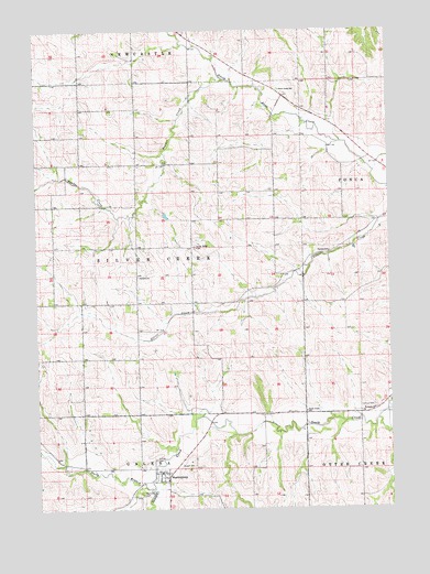
Martinsburg, NE USGS Topographic Map
Click on map above to begin viewing in our Map Viewer.

This topographic map contains these locations and features:
Feature Name Type Latitude Longitude GNIS ID View Map
Aowa Creek Dam 12-8DamN42.5583°W96.8037°1767524View Map
Aowa Creek Dam 31-1DamN42.6033°W96.8353°1767526View Map
Aowa Creek Reservoir 12-8ReservoirN42.5583°W96.8037°1767525View Map
Aowa Creek Reservoir 31-1ReservoirN42.6033°W96.8353°1767527View Map
Calvary CemeteryCemeteryN42.5269°W96.7559°827871View Map
Curry DamDamN42.5767°W96.8303°1767668View Map
Daily BranchStreamN42.5053°W96.8353°828552View Map
MartinsburgPopulated PlaceN42.5083°W96.8309°831075View Map
Martinsburg CemeteryCemeteryN42.5039°W96.8386°831076View Map
Martinsburg Post Office (historical)Post OfficeN42.5083°W96.8309°1884144View Map
Martinsburg Volunteer Fire DepartmentBuildingN42.5096°W96.8309°1884143View Map
Powder CreekStreamN42.6119°W96.8078°832334View Map
Putman SchoolSchoolN42.5669°W96.7714°832417View Map
Saint Pauls ChurchChurchN42.5256°W96.7559°833083View Map
Sand CreekStreamN42.5058°W96.8378°833182View Map
Silver Ridge CemeteryCemeteryN42.5686°W96.8192°833450View Map
Silver Ridge Post Office (historical)Post OfficeN42.5694°W96.8212°1884087View Map
South Creek SchoolSchoolN42.5253°W96.7806°833572View Map
Township of SilvercreekCivilN42.5682°W96.8395°838254View Map
Trinity CemeteryCemeteryN42.5128°W96.8339°834170View Map
Village of MartinsburgCivilN42.5086°W96.8320°2399266View Map
West Union SchoolSchoolN42.6094°W96.7881°834632View Map

Note: Coordinates in the location and feature list above are referenced to NAD83 datum.


Copyright (C) 2008-2024 Ryan Niemi / Sunset Dynamics ... All Rights Reserved