TopoQuest Logo
Do you find TopoQuest useful?
Help keep TopoQuest running and adding new maps/features by donating!
Bitcoin:  19c7KJd3qBynnjoSw5npx9KScwjBe4ifkT
Litecoin:  LXs6TkuXGGXo1vDsWCkWVdjQX94eUKd6ui
Home View Maps Find Maps Find Places Resources & Links


Marvin, South Dakota Topographic Map

USGS Map Title: Marvin, SD
USGS Map MRC: 45096C8
DRG (GeoTIFF) Download: o45096c8.tif


Neighboring USGS Topographic Map Quads:


  Summit NE, SD  
45097D1
 

  Wilmot NW, SD  
45096D8
 

  Wilmot, SD  
45096D7
 

  Summit, SD  
45097C1
 

  Marvin, SD  
45096C8
 

  Corona, SD  
45096C7
 

  Still Lake NE, SD  
45097B1
 

  Antelope Valley, SD  
45096B8
 

  Twin Brooks, SD  
45096B7


Map MRC Location:

N46°
W97°
N46°
W96°
H8 H7 H6 H5 H4 H3 H2 H1
G8 G7 G6 G5 G4 G3 G2 G1
F8 F7 F6 F5 F4 F3 F2 F1
E8 E7 E6 E5 E4 E3 E2 E1
D8 D7 D6 D5 D4 D3 D2 D1
C8 C7 C6 C5 C4 C3 C2 C1
B8 B7 B6 B5 B4 B3 B2 B1
A8 A7 A6 A5 A4 A3 A2 A1
N45°
W97°
N45°
W96°

Marvin, SD USGS 1:24K Topographic Map Preview:
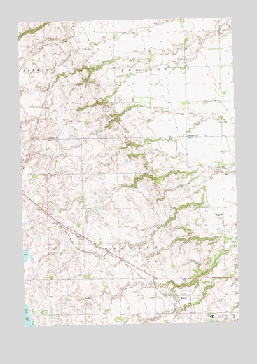
Marvin, SD USGS Topographic Map
Click on map above to begin viewing in our Map Viewer.

This topographic map contains these locations and features:
Feature Name Type Latitude Longitude GNIS ID View Map
Blue Cloud AbbeyChurchN45.2527°W96.8906°1253978View Map
Blue Cloud Abbey CemeteryCemeteryN45.2525°W96.8891°2773681View Map
Eastman CemeteryCemeteryN45.3357°W96.9038°1254869View Map
Grade Siding Station (historical)LocaleN45.2569°W96.9142°1263707View Map
MarvinPopulated PlaceN45.2614°W96.9126°1256341View Map
Marvin Post OfficePost OfficeN45.2614°W96.9127°2710571View Map
Marvin Volunteer Fire DepartmentBuildingN45.2604°W96.9134°2580991View Map
Osceola (historical)LocaleN45.3139°W96.8865°1263706View Map
Osceola 1 CemeteryCemeteryN45.2638°W96.9126°2773691View Map
Osceola 2 CemeteryCemeteryN45.2615°W96.9062°2773690View Map
Rode Hasvold Road DamDamN45.2533°W96.9270°1259428View Map
School Number 3 (historical)SchoolN45.3697°W96.9426°1263990View Map
School Number 4 (historical)SchoolN45.3425°W96.9462°1263988View Map
School Number 5 (historical)SchoolN45.3541°W96.8815°1263989View Map
Town of MarvinCivilN45.2605°W96.9154°1267472View Map
Township of OsceolaCivilN45.2815°W96.9390°1268506View Map
Township of SpringdaleCivilN45.3690°W96.9221°1268575View Map

Note: Coordinates in the location and feature list above are referenced to NAD83 datum.


Copyright (C) 2008-2025 Ryan Niemi / Sunset Dynamics ... All Rights Reserved