TopoQuest Logo
Do you find TopoQuest useful?
Help keep TopoQuest running and adding new maps/features by donating!
Bitcoin:  19c7KJd3qBynnjoSw5npx9KScwjBe4ifkT
Litecoin:  LXs6TkuXGGXo1vDsWCkWVdjQX94eUKd6ui
Home View Maps Find Maps Find Places Resources & Links


Mason Butte, Nevada Topographic Map

USGS Map Title: Mason Butte, NV
USGS Map MRC: 39119A2
DRG (GeoTIFF) Download: o39119a2.tif


Neighboring USGS Topographic Map Quads:


  Churchill Canyon Well, NV  
39119B3
 

  Wabuska, NV  
39119B2
 

  Parker Butte, NV  
39119B1
 

  Lincoln Flat, NV  
39119A3
 

  Mason Butte, NV  
39119A2
 

  Hinkson Slough, NV  
39119A1
 

  Artesia Lake, NV  
38119H3
 

  Yerington, NV  
38119H2
 

  Yerington NE, NV  
38119H1


Map MRC Location:

N40°
W120°
N40°
W119°
H8 H7 H6 H5 H4 H3 H2 H1
G8 G7 G6 G5 G4 G3 G2 G1
F8 F7 F6 F5 F4 F3 F2 F1
E8 E7 E6 E5 E4 E3 E2 E1
D8 D7 D6 D5 D4 D3 D2 D1
C8 C7 C6 C5 C4 C3 C2 C1
B8 B7 B6 B5 B4 B3 B2 B1
A8 A7 A6 A5 A4 A3 A2 A1
N39°
W120°
N39°
W119°

Mason Butte, NV USGS 1:24K Topographic Map Preview:
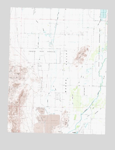
Mason Butte, NV USGS Topographic Map
Click on map above to begin viewing in our Map Viewer.

This topographic map contains these locations and features:
Feature Name Type Latitude Longitude GNIS ID View Map
CampbellLocaleN39.0621°W119.2007°847809View Map
Campbell DitchCanalN39.0069°W119.1746°839296View Map
Campbell RanchCivilN39.0782°W119.2082°848690View Map
Carson HillSummitN39.0585°W119.2379°839326View Map
East Campbell DitchCanalN39.0435°W119.1732°840258View Map
Farias WellWellN39.1169°W119.2440°858610View Map
Fort Churchill Cooling PondsReservoirN39.1189°W119.1315°848470View Map
GreenvillePopulated PlaceN39.0374°W119.1827°856785View Map
L - M FeedlotLocaleN39.1084°W119.1900°2576422View Map
Lyon CountyCivilN39.0204°W119.1892°858645View Map
Mason ButteSummitN39.0802°W119.1607°841956View Map
Mason ValleyBasinN39.0863°W119.1432°856310View Map
McGowan CornerLocaleN39.0263°W119.1818°846310View Map
McKay (historical)LocaleN39.0424°W119.2021°847810View Map
McLeod HillSummitN39.0113°W119.1771°845559View Map
Nichols-Merritt DitchCanalN39.0230°W119.1357°842471View Map
Poli RanchLocaleN39.0538°W119.1638°847811View Map
Rite of Passage High SchoolSchoolN39.0699°W119.2185°2089671View Map
Sand Ridge DitchCanalN39.0608°W119.1296°843488View Map
Spragg-Alcorn-Bewley DitchCanalN39.0677°W119.1474°843922View Map
Wabuska DrainCanalN39.1188°W119.1904°844602View Map
West Campbell DitchCanalN39.0549°W119.1996°844714View Map
West Hyland DitchCanalN39.0538°W119.1613°844725View Map
Yerington Mill DamDamN39.0166°W119.2343°863504View Map
Yerington Mill Number Two DamDamN39.0166°W119.1927°863560View Map
Yerington Mill Pond AA DamDamN39.0183°W119.2060°863541View Map
Yerington Mill Pond BB DamDamN39.0099°W119.2043°863542View Map
Yerington Municipal AirportAirportN39.0009°W119.1583°864139View Map

Note: Coordinates in the location and feature list above are referenced to NAD83 datum.


Copyright (C) 2008-2024 Ryan Niemi / Sunset Dynamics ... All Rights Reserved