TopoQuest Logo
Do you find TopoQuest useful?
Help keep TopoQuest running and adding new maps/features by donating!
Bitcoin:  19c7KJd3qBynnjoSw5npx9KScwjBe4ifkT
Litecoin:  LXs6TkuXGGXo1vDsWCkWVdjQX94eUKd6ui
Home View Maps Find Maps Find Places Resources & Links


Maxville, Missouri Topographic Map

USGS Map Title: Maxville, MO
USGS Map MRC: 38090D4
DRG (GeoTIFF) Download: o38090d4.tif


Neighboring USGS Topographic Map Quads:


  Manchester, MO  
38090E5
 

  Kirkwood, MO  
38090E4
 

  Webster Groves, MO  
38090E3
 

  House Springs, MO  
38090D5
 

  Maxville, MO  
38090D4
 

  Oakville, MO  
38090D3
 

  Belews Creek, MO  
38090C5
 

  Herculaneum, MO  
38090C4
 

  Valmeyer, IL  
38090C3


Map MRC Location:

N39°
W91°
N39°
W90°
H8 H7 H6 H5 H4 H3 H2 H1
G8 G7 G6 G5 G4 G3 G2 G1
F8 F7 F6 F5 F4 F3 F2 F1
E8 E7 E6 E5 E4 E3 E2 E1
D8 D7 D6 D5 D4 D3 D2 D1
C8 C7 C6 C5 C4 C3 C2 C1
B8 B7 B6 B5 B4 B3 B2 B1
A8 A7 A6 A5 A4 A3 A2 A1
N38°
W91°
N38°
W90°

Maxville, MO USGS 1:24K Topographic Map Preview:
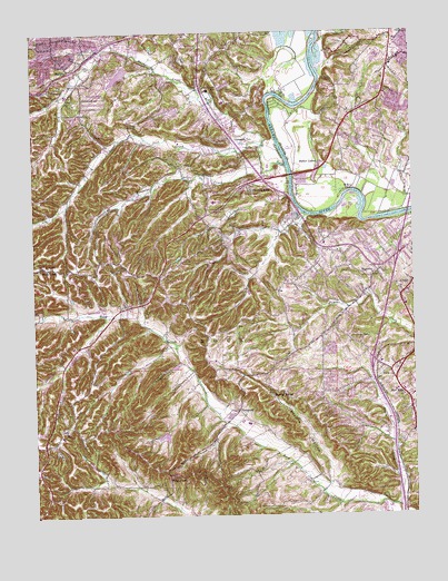
Maxville, MO USGS Topographic Map
Click on map above to begin viewing in our Map Viewer.

This topographic map contains these locations and features:
Feature Name Type Latitude Longitude GNIS ID View Map
ArnoldPopulated PlaceN38.4328°W90.3776°713393View Map
Arnold Crossroads Shopping CenterLocaleN38.4463°W90.3767°2468978View Map
Arnold Police DepartmentBuildingN38.4227°W90.3759°2752348View Map
BeckPopulated PlaceN38.4117°W90.3829°713842View Map
Black CreekStreamN38.3767°W90.3804°714286View Map
Bowles School (historical)SchoolN38.4798°W90.4843°742663View Map
Butler LakesReservoirN38.4656°W90.4052°755839View Map
Fon-Du-Lac DamDamN38.4884°W90.4685°761341View Map
Fon-Du-Lac ReservoirReservoirN38.4888°W90.4715°761342View Map
Four Ridge DamDamN38.3967°W90.4568°764247View Map
Four Ridge LakeReservoirN38.3955°W90.4575°764248View Map
Four Ridge SchoolSchoolN38.3967°W90.4904°748181View Map
Frisco HillSummitN38.3853°W90.4562°718253View Map
General American Life Insurance Lake DamDamN38.4917°W90.3868°765174View Map
George Guffey Elementary SchoolSchoolN38.4844°W90.4476°2469384View Map
Glen Rose Lake DamDamN38.4251°W90.4551°761343View Map
Gospel Assembly ChurchChurchN38.4878°W90.3837°2468430View Map
Hageman School (historical)SchoolN38.4728°W90.3912°757408View Map
Heneke (historical)LocaleN38.4095°W90.3876°748183View Map
Hermitage Hills Lake DamDamN38.4801°W90.4518°761279View Map
High Ridge Fire Protection District Station 2BuildingN38.4853°W90.4949°2621316View Map
Interchange 190CrossingN38.4128°W90.3892°2468321View Map
Interchange 191CrossingN38.4420°W90.3801°2468322View Map
Jefferson County Plaza Shopping CenterLocaleN38.4134°W90.3911°2469046View Map
Jefferson HeightsPopulated PlaceN38.3934°W90.4973°735971View Map
KCWA-FM (Arnold)TowerN38.4431°W90.4001°759023View Map
KDHX-FM (St Louis)TowerN38.4170°W90.4332°759009View Map
KETC-TV (St Louis)TowerN38.4823°W90.3982°759300View Map
La Beau Tract (historical)CivilN38.4662°W90.4129°757488View Map
Lake Glen RoseReservoirN38.4260°W90.4542°761344View Map
Leight SchoolSchoolN38.4392°W90.4887°748180View Map
Lone Dell SchoolSchoolN38.4362°W90.4296°748182View Map
Mastodon State ParkParkN38.3792°W90.3948°742921View Map
MaxvillePopulated PlaceN38.4364°W90.3887°736322View Map
McCormack CemeteryCemeteryN38.4831°W90.4834°722057View Map
Mehlville Fire Protection District Station 4BuildingN38.4896°W90.3835°2620656View Map
MurphyPopulated PlaceN38.4903°W90.4871°723069View Map
Murphy Census Designated PlaceCensusN38.4922°W90.4855°2393142View Map
New Hope ChurchChurchN38.4059°W90.3790°723254View Map
Number 216 ReservoirReservoirN38.4796°W90.4531°761280View Map
Oak Ridge FarmLocaleN38.3934°W90.3807°748185View Map
Oak Ridge School (historical)SchoolN38.4062°W90.3793°748184View Map
Paulina HillsPopulated PlaceN38.4609°W90.4285°724106View Map
Pine LakeReservoirN38.4084°W90.4985°764250View Map
Pine Lake DamDamN38.4084°W90.4985°764249View Map
Prairie HollowValleyN38.3837°W90.4032°724862View Map
Richard Simpson Elementary SchoolSchoolN38.4146°W90.3936°2468841View Map
Richardson CemeteryCemeteryN38.4204°W90.3962°725259View Map
Richardson Crossing Shopping CenterLocaleN38.4152°W90.3944°2469098View Map
Richardson Square Shopping CenterLocaleN38.4110°W90.3842°2469099View Map
Ridgewood Middle SchoolSchoolN38.4578°W90.4193°2468842View Map
Rock Community Fire Protection District - Station 1BuildingN38.4331°W90.3781°2467595View Map
Rock Community Fire Protection District - Station 5BuildingN38.4071°W90.3753°2621293View Map
Rock Community Fire Protection District House 3BuildingN38.4329°W90.4196°2621295View Map
Rock Community Fire Protection District House 4BuildingN38.4069°W90.4063°2621294View Map
Rock CreekPopulated PlaceN38.4398°W90.4976°725437View Map
Rockport Heights Elementary SchoolSchoolN38.4086°W90.3811°2468848View Map
Romaine CreekStreamN38.4637°W90.4229°725544View Map
Saint Johns CemeteryCemeteryN38.4406°W90.4976°725771View Map
Saint Johns ChurchChurchN38.4395°W90.4982°737690View Map
Saline CreekStreamN38.4712°W90.4240°725954View Map
Saline School (historical)SchoolN38.4762°W90.4376°748179View Map
SeckmanPopulated PlaceN38.4023°W90.4335°726174View Map
Seckman Elementary SchoolSchoolN38.3989°W90.4283°2468875View Map
Seckman Middle SchoolSchoolN38.3988°W90.4280°2468876View Map
Seckman SchoolSchoolN38.3931°W90.4171°748186View Map
Seckman Senior High SchoolSchoolN38.3987°W90.4278°2468877View Map
Shady Valley Fire Protection DistrictBuildingN38.4168°W90.4886°2621134View Map
Sherwood Elementary SchoolSchoolN38.4423°W90.3997°2468881View Map
Southmoor Golf CourseLocaleN38.4859°W90.3882°756743View Map
Spring ForestPopulated PlaceN38.4053°W90.4171°726914View Map
Spring Lake ParkParkN38.4856°W90.4385°726944View Map
Springdale Fire Protection District Station 1 HeadquartersBuildingN38.4785°W90.4416°2620975View Map
Springdale Fire Protection District Station 2BuildingN38.4767°W90.4653°2620280View Map
Springdale ParkParkN38.4717°W90.4304°726961View Map
Sugar CreekStreamN38.4639°W90.4229°727226View Map
Suson ParkParkN38.4728°W90.3915°756775View Map
Township of RockCivilN38.4634°W90.4725°766827View Map
Township of Tesson FerryCivilN38.4928°W90.3828°2397882View Map
Township of WindsorCivilN38.4044°W90.3993°2397900View Map
WILFM-FM (St Louis)TowerN38.4823°W90.3982°759047View Map

Note: Coordinates in the location and feature list above are referenced to NAD83 datum.


Copyright (C) 2008-2025 Ryan Niemi / Sunset Dynamics ... All Rights Reserved