TopoQuest Logo
Do you find TopoQuest useful?
Help keep TopoQuest running and adding new maps/features by donating!
Bitcoin:  19c7KJd3qBynnjoSw5npx9KScwjBe4ifkT
Litecoin:  LXs6TkuXGGXo1vDsWCkWVdjQX94eUKd6ui
Home View Maps Find Maps Find Places Resources & Links


Maxwell SW, Nebraska Topographic Map

USGS Map Title: Maxwell SW, NE
USGS Map MRC: 41100A6
DRG (GeoTIFF) Download: o41100a6.tif


Neighboring USGS Topographic Map Quads:


  North Platte West, NE  
41100B7
 

  North Platte East, NE  
41100B6
 

  Maxwell NE, NE  
41100B5
 

  Lake Maloney, NE  
41100A7
 

  Maxwell SW, NE  
41100A6
 

  Maxwell, NE  
41100A5
 

  Dickens NE, NE  
40100H7
 

  Wellfleet NW, NE  
40100H6
 

  Wellfleet NE, NE  
40100H5


Map MRC Location:

N42°
W101°
N42°
W100°
H8 H7 H6 H5 H4 H3 H2 H1
G8 G7 G6 G5 G4 G3 G2 G1
F8 F7 F6 F5 F4 F3 F2 F1
E8 E7 E6 E5 E4 E3 E2 E1
D8 D7 D6 D5 D4 D3 D2 D1
C8 C7 C6 C5 C4 C3 C2 C1
B8 B7 B6 B5 B4 B3 B2 B1
A8 A7 A6 A5 A4 A3 A2 A1
N41°
W101°
N41°
W100°

Maxwell SW, NE USGS 1:24K Topographic Map Preview:
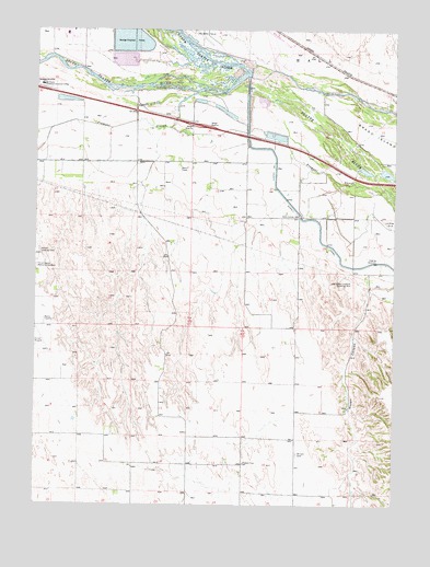
Maxwell SW, NE USGS Topographic Map
Click on map above to begin viewing in our Map Viewer.

This topographic map contains these locations and features:
Feature Name Type Latitude Longitude GNIS ID View Map
Brandy IslandIslandN41.1003°W100.6407°827623View Map
East Hinman Election Precinct (historical)CivilN41.1225°W100.7204°1928835View Map
Fremont SloughGutN41.0989°W100.6829°829412View Map
Fremont Slough State Wildlife Management AreaParkN41.0972°W100.6671°1838547View Map
Gannett (historical)LocaleN41.1139°W100.6421°1838511View Map
Harden Airstrip (historical)AirportN41.0650°W100.7285°837653View Map
Interchange 179CrossingN41.1056°W100.7274°1838680View Map
Iron Eagle Golf CourseLocaleN41.1083°W100.7324°1838555View Map
Lincoln CountyCivilN41.0478°W100.7452°835877View Map
Mariam CemeteryCemeteryN41.0136°W100.6585°831052View Map
Mid Plains Technical CollegeSchoolN41.1106°W100.7482°831253View Map
Moran CanyonValleyN41.0574°W100.6278°831409View Map
North Platte Post OfficePost OfficeN41.1214°W100.7402°1838717View Map
North Platte RiverStreamN41.1139°W100.6758°204647View Map
Platte State Wildlife Management AreaParkN41.0914°W100.6476°1838546View Map
Pleasant View School (historical)SchoolN41.0106°W100.6774°832258View Map
Simon HeliportAirportN41.1047°W100.7443°837652View Map
Sioux Lookout Historical MonumentParkN41.0586°W100.6454°833464View Map
Sioux Lookout School (historical)SchoolN41.0761°W100.6588°833465View Map
South Platte RiverStreamN41.1133°W100.6771°833610View Map
Upper Diversion DamDamN41.1117°W100.6738°1768762View Map
White Horse CreekStreamN41.1144°W100.6668°835989View Map

Note: Coordinates in the location and feature list above are referenced to NAD83 datum.


Copyright (C) 2008-2024 Ryan Niemi / Sunset Dynamics ... All Rights Reserved