TopoQuest Logo
Do you find TopoQuest useful?
Help keep TopoQuest running and adding new maps/features by donating!
Bitcoin:  19c7KJd3qBynnjoSw5npx9KScwjBe4ifkT
Litecoin:  LXs6TkuXGGXo1vDsWCkWVdjQX94eUKd6ui
Home View Maps Find Maps Find Places Resources & Links


Maypearl, Texas Topographic Map

USGS Map Title: Maypearl, TX
USGS Map MRC: 32097C1
DRG (GeoTIFF) Download: o32097c1.tif


Neighboring USGS Topographic Map Quads:


  Alvarado, TX  
32097D2
 

  Venus, TX  
32097D1
 

  Midlothian, TX  
32096D8
 

  Grandview, TX  
32097C2
 

  Maypearl, TX  
32097C1
 

  Boz, TX  
32096C8
 

  Itasca, TX  
32097B2
 

  Files Valley, TX  
32097B1
 

  Italy, TX  
32096B8


Map MRC Location:

N33°
W98°
N33°
W97°
H8 H7 H6 H5 H4 H3 H2 H1
G8 G7 G6 G5 G4 G3 G2 G1
F8 F7 F6 F5 F4 F3 F2 F1
E8 E7 E6 E5 E4 E3 E2 E1
D8 D7 D6 D5 D4 D3 D2 D1
C8 C7 C6 C5 C4 C3 C2 C1
B8 B7 B6 B5 B4 B3 B2 B1
A8 A7 A6 A5 A4 A3 A2 A1
N32°
W98°
N32°
W97°

Maypearl, TX USGS 1:24K Topographic Map Preview:
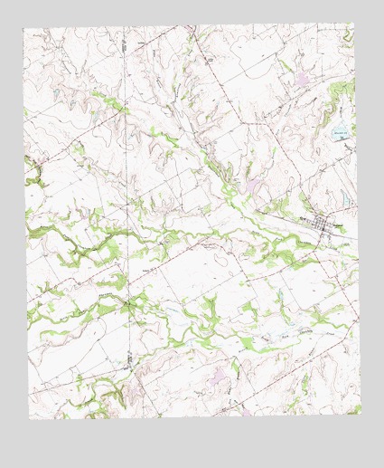
Maypearl, TX USGS Topographic Map
Click on map above to begin viewing in our Map Viewer.

This topographic map contains these locations and features:
Feature Name Type Latitude Longitude GNIS ID View Map
Armstrong CreekStreamN32.3349°W97.0608°1329686View Map
AuburnPopulated PlaceN32.2974°W97.0772°1377962View Map
Auburn CemeteryCemeteryN32.3060°W97.0719°1329834View Map
Boggy BranchStreamN32.3499°W97.0686°1331000View Map
Boggy CreekStreamN32.3088°W97.0736°1331010View Map
Buck Ranch Dam Number 4DamN32.3135°W97.1036°1862785View Map
Buck Ranch Reservoir Number 4ReservoirN32.3135°W97.1036°1862786View Map
City of MaypearlCivilN32.3139°W97.0055°2411053View Map
Coffee BranchStreamN32.2757°W97.0131°1333055View Map
Cottonwood CreekStreamN32.3093°W97.0300°1333466View Map
Coyote Crossing AirportAirportN32.2963°W97.0544°2675933View Map
Double A AirportAirportN32.3209°W97.0996°2676595View Map
Draggintail Acres AirportAirportN32.2948°W97.0868°2675772View Map
East Fork Chambers CreekStreamN32.3043°W97.0144°1334915View Map
East Fork Weakly BranchStreamN32.2560°W97.0492°1334939View Map
GriffithPopulated PlaceN32.3693°W97.0783°1378388View Map
Griffith ChapelChurchN32.3635°W97.0550°1337030View Map
Island CreekStreamN32.2749°W97.0700°1374244View Map
Itasca CreekStreamN32.2546°W97.1056°1374246View Map
Jackson CemeteryCemeteryN32.3254°W97.0467°1338579View Map
Lazy R Stock Farm Airport (historical)AirportN32.3057°W97.1211°1386760View Map
Leger AirportAirportN32.3587°W97.0424°2717062View Map
MaypearlPopulated PlaceN32.3132°W97.0117°1341124View Map
Maypearl City HallBuildingN32.3094°W97.0127°2753194View Map
Maypearl Police DepartmentBuildingN32.3091°W97.0127°2738998View Map
Maypearl Post OfficePost OfficeN32.3077°W97.0148°2731474View Map
Maypearl Volunteer Fire DepartmentBuildingN32.3101°W97.0127°2551423View Map
Mesquite BranchStreamN32.3232°W97.0003°1341404View Map
Odom CemeteryCemeteryN32.2865°W97.1211°1343071View Map
Ozro CemeteryCemeteryN32.3374°W97.0542°1343394View Map
Soil Conservation Service Site 53 DamDamN32.3535°W97.0203°1856812View Map
Soil Conservation Service Site 53 ReservoirReservoirN32.3535°W97.0203°1856813View Map
Soil Conservation Service Site 54 DamDamN32.3218°W97.0403°1856814View Map
Soil Conservation Service Site 54 ReservoirReservoirN32.3218°W97.0403°1856815View Map
Soil Conservation Service Site 55 DamDamN32.3385°W97.0053°1856816View Map
Soil Conservation Service Site 55 ReservoirReservoirN32.3385°W97.0053°1856817View Map
Soil Conservation Service Site 75b DamDamN32.2651°W97.0519°1856810View Map
Soil Conservation Service Site 75b ReservoirReservoirN32.2651°W97.0519°1856811View Map
Soil Conservation Service Site 77 DamDamN32.2518°W97.0019°1856818View Map
Soil Conservation Service Site 77 ReservoirReservoirN32.2518°W97.0019°1856819View Map
Spring BranchStreamN32.3693°W97.0603°1347693View Map
Valley BranchStreamN32.2757°W97.0233°1349162View Map
Weakly BranchStreamN32.2671°W97.0481°1349570View Map
West Fork Weakly BranchStreamN32.2557°W97.0489°1349738View Map
Wilemon LakeReservoirN32.3184°W97.0047°1856821View Map
Wilemon Lake DamDamN32.3168°W97.0053°1856820View Map

Note: Coordinates in the location and feature list above are referenced to NAD83 datum.


Copyright (C) 2008-2025 Ryan Niemi / Sunset Dynamics ... All Rights Reserved