TopoQuest Logo
Do you find TopoQuest useful?
Help keep TopoQuest running and adding new maps/features by donating!
Bitcoin:  19c7KJd3qBynnjoSw5npx9KScwjBe4ifkT
Litecoin:  LXs6TkuXGGXo1vDsWCkWVdjQX94eUKd6ui
Home View Maps Find Maps Find Places Resources & Links


Agua Nueva NW, Texas Topographic Map

USGS Map Title: Agua Nueva NW, TX
USGS Map MRC: 26098H6
DRG (GeoTIFF) Download: o26098h6.tif


Neighboring USGS Topographic Map Quads:


  San Pablo Ranch, TX  
27098A7
 

  Alta Vista Ranch SW, TX  
27098A6
 

  Alta Vista Ranch, TX  
27098A5
 

  San Antonio Viejo, TX  
26098H7
 

  Agua Nueva NW, TX  
26098H6
 

  Agua Nueva, TX  
26098H5
 

  Cuevitas, TX  
26098G7
 

  Borregos Ranch, TX  
26098G6
 

  Agua Nueva SE, TX  
26098G5


Map MRC Location:

N27°
W99°
N27°
W98°
H8 H7 H6 H5 H4 H3 H2 H1
G8 G7 G6 G5 G4 G3 G2 G1
F8 F7 F6 F5 F4 F3 F2 F1
E8 E7 E6 E5 E4 E3 E2 E1
D8 D7 D6 D5 D4 D3 D2 D1
C8 C7 C6 C5 C4 C3 C2 C1
B8 B7 B6 B5 B4 B3 B2 B1
A8 A7 A6 A5 A4 A3 A2 A1
N26°
W99°
N26°
W98°

Agua Nueva NW, TX USGS 1:24K Topographic Map Preview:
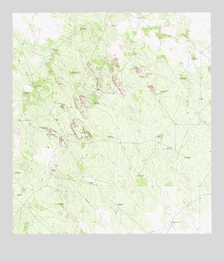
Agua Nueva NW, TX USGS Topographic Map
Click on map above to begin viewing in our Map Viewer.

This topographic map contains these locations and features:
Feature Name Type Latitude Longitude GNIS ID View Map
Agua Verde WindmillLocaleN26.8975°W98.7478°1329270View Map
Atole WindmillLocaleN26.9492°W98.6978°1329827View Map
Barbacoa WindmillLocaleN26.9181°W98.6411°1330018View Map
Borregos WindmillLocaleN26.8814°W98.6497°1331097View Map
Buenos Aires WindmillLocaleN26.9298°W98.6864°1331550View Map
Canello WindmillLocaleN26.9567°W98.6972°1332067View Map
Casa Blanca WindmillLocaleN26.8917°W98.6842°1332270View Map
Coma WindmillLocaleN26.9931°W98.6875°1333163View Map
Corrales WindmillLocaleN26.9231°W98.6506°1333392View Map
Descalso WindmillLocaleN26.9798°W98.7242°1334279View Map
East Oil FieldOilfieldN26.9120°W98.7295°1334973View Map
El Sauz WindmillLocaleN26.9659°W98.6631°1335273View Map
Farris WindmillLocaleN26.9284°W98.6250°1335722View Map
Gas Well Lilly WindmillLocaleN26.9314°W98.7272°1336429View Map
Hayes WindmillLocaleN26.9112°W98.7256°1337498View Map
Huisache WindmillLocaleN26.9742°W98.6364°1338260View Map
Indiana WindmillLocaleN26.9098°W98.7481°1338464View Map
Jardin WindmillLocaleN26.9589°W98.7361°1338641View Map
Leoncitos WindmillLocaleN26.9081°W98.6703°1339831View Map
Little Jardin WindmillLocaleN26.9553°W98.7425°1340122View Map
Little Medanito WindmillLocaleN26.9350°W98.7289°1340137View Map
Paisano WindmillLocaleN26.9912°W98.7059°1343446View Map
San Felipe WindmillLocaleN26.8920°W98.7214°1346338View Map
San Pedro WindmillLocaleN26.9631°W98.6442°1346459View Map
Santo Domingo WindmillLocaleN26.9662°W98.7125°1346685View Map
South Jim Hogg DivisionCivilN26.9642°W98.6787°1939214View Map
Venada Brazil WindmillLocaleN26.9556°W98.6561°1349223View Map
Venada RanchLocaleN26.9395°W98.7436°1349224View Map
Venada WindmillLocaleN26.9300°W98.6567°1349226View Map
Weil RanchLocaleN26.9975°W98.6695°1349605View Map

Note: Coordinates in the location and feature list above are referenced to NAD83 datum.


Copyright (C) 2008-2024 Ryan Niemi / Sunset Dynamics ... All Rights Reserved