TopoQuest Logo
Do you find TopoQuest useful?
Help keep TopoQuest running and adding new maps/features by donating!
Bitcoin:  19c7KJd3qBynnjoSw5npx9KScwjBe4ifkT
Litecoin:  LXs6TkuXGGXo1vDsWCkWVdjQX94eUKd6ui
Home View Maps Find Maps Find Places Resources & Links


McComb Corner, Michigan Topographic Map

USGS Map Title: McComb Corner, MI
USGS Map MRC: 46088G1
DRG (GeoTIFF) Download: o46088g1.tif


Neighboring USGS Topographic Map Quads:


  Skanee North, MI  
46088H2
 

  Glovers Corner, MI  
46088H1
 

  Howe Lake, MI  
46087H8
 

  Skanee South, MI  
46088G2
 

  McComb Corner, MI  
46088G1
 

  Mountain Lake, MI  
46087G8
 

  Mount Curwood, MI  
46088F2
 

  Summit Lake, MI  
46088F1
 

  Bulldog Lake, MI  
46087F8


Map MRC Location:

N47°
W89°
N47°
W88°
H8 H7 H6 H5 H4 H3 H2 H1
G8 G7 G6 G5 G4 G3 G2 G1
F8 F7 F6 F5 F4 F3 F2 F1
E8 E7 E6 E5 E4 E3 E2 E1
D8 D7 D6 D5 D4 D3 D2 D1
C8 C7 C6 C5 C4 C3 C2 C1
B8 B7 B6 B5 B4 B3 B2 B1
A8 A7 A6 A5 A4 A3 A2 A1
N46°
W89°
N46°
W88°

McComb Corner, MI USGS 1:24K Topographic Map Preview:
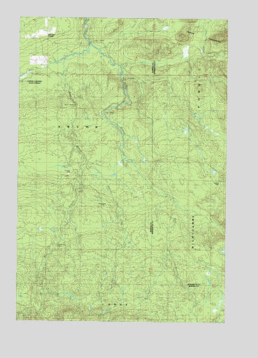
McComb Corner, MI USGS Topographic Map
Click on map above to begin viewing in our Map Viewer.

This topographic map contains these locations and features:
Feature Name Type Latitude Longitude GNIS ID View Map
Big Eric's Bridge State Forest CampgroundLocaleN46.8647°W88.0833°2129138View Map
Big Erick's FallsFallsN46.8655°W88.0837°2117710View Map
Big FallsFallsN46.8388°W88.0710°621319View Map
Black CreekStreamN46.8583°W88.0985°621497View Map
East Branch FallsFallsN46.8497°W88.0633°2099865View Map
East Branch Huron RiverStreamN46.8641°W88.0821°625137View Map
Ectasy FallsFallsN46.8601°W88.0759°2117714View Map
Eliason CampLocaleN46.8163°W88.0410°625436View Map
Elmblad CampLocaleN46.7947°W88.0954°625516View Map
Elmblad CampLocaleN46.8085°W88.0051°625517View Map
Erickson CampLocaleN46.8102°W88.0946°625625View Map
Letherby FallsFallsN46.7816°W88.1021°630334View Map
Lower FallsFallsN46.8655°W88.0823°631167View Map
Lower Letherby FallsFallsN46.8076°W88.0871°2117719View Map
McComb CornerPopulated PlaceN46.8660°W88.1085°1617709View Map
Northwood CampLocaleN46.8010°W88.0757°633731View Map
Robarge CreekStreamN46.8169°W88.0854°636027View Map
Sirard CampLocaleN46.8624°W88.0157°638006View Map
West Branch FallsFallsN46.8388°W88.0898°1616034View Map
West Branch Huron RiverStreamN46.8638°W88.0821°1616044View Map

Note: Coordinates in the location and feature list above are referenced to NAD83 datum.


Copyright (C) 2008-2024 Ryan Niemi / Sunset Dynamics ... All Rights Reserved