TopoQuest Logo
Do you find TopoQuest useful?
Help keep TopoQuest running and adding new maps/features by donating!
Bitcoin:  19c7KJd3qBynnjoSw5npx9KScwjBe4ifkT
Litecoin:  LXs6TkuXGGXo1vDsWCkWVdjQX94eUKd6ui
Home View Maps Find Maps Find Places Resources & Links


McCone Heights, Montana Topographic Map

USGS Map Title: McCone Heights, MT
USGS Map MRC: 47104E5
DRG (GeoTIFF) Download: o47104e5.tif


Neighboring USGS Topographic Map Quads:


  Fox Lake, MT  
47104F6
 

  Lambert, MT  
47104F5
 

  Crane NW, MT  
47104F4
 

  Butler Table, MT  
47104E6
 

  McCone Heights, MT  
47104E5
 

  Larson School, MT  
47104E4
 

  Intake NW, MT  
47104D6
 

  Allard Ranch, MT  
47104D5
 

  Knife River Mine, MT  
47104D4


Map MRC Location:

N48°
W105°
N48°
W104°
H8 H7 H6 H5 H4 H3 H2 H1
G8 G7 G6 G5 G4 G3 G2 G1
F8 F7 F6 F5 F4 F3 F2 F1
E8 E7 E6 E5 E4 E3 E2 E1
D8 D7 D6 D5 D4 D3 D2 D1
C8 C7 C6 C5 C4 C3 C2 C1
B8 B7 B6 B5 B4 B3 B2 B1
A8 A7 A6 A5 A4 A3 A2 A1
N47°
W105°
N47°
W104°

McCone Heights, MT USGS 1:24K Topographic Map Preview:
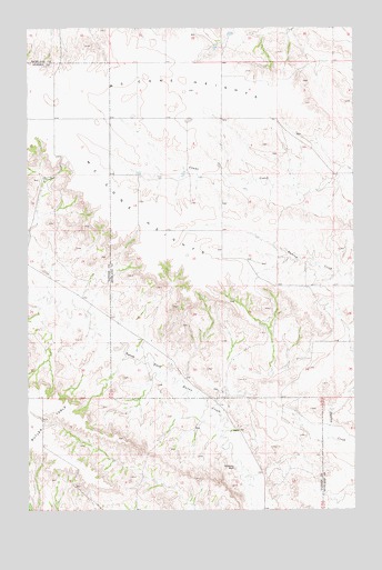
McCone Heights, MT USGS Topographic Map
Click on map above to begin viewing in our Map Viewer.

This topographic map contains these locations and features:
Feature Name Type Latitude Longitude GNIS ID View Map
20N56E01DBCC01 WellWellN47.5181°W104.5186°823554View Map
20N56E02DBBC01 WellWellN47.5206°W104.5450°823571View Map
20N56E03DBAA01 WellWellN47.5214°W104.5616°823578View Map
20N56E04DDDA01 WellWellN47.5161°W104.5777°823537View Map
20N56E05AACB01 SpringSpringN47.5270°W104.6038°823607View Map
20N56E05BCAD01 WellWellN47.5245°W104.6155°823599View Map
20N56E08ABCC01 WellWellN47.5133°W104.6083°823505View Map
20N56E08DDCD01 WellWellN47.5006°W104.6019°823426View Map
20N56E08DDCD02 WellWellN47.5006°W104.6019°823427View Map
20N56E09ADCB01 WellWellN47.5083°W104.5797°823469View Map
20N56E12BCBC01 WellWellN47.5097°W104.5347°823482View Map
21N55E02AADA01 WellWellN47.6128°W104.6158°824056View Map
21N55E11ADAC01 WellWellN47.5964°W104.6177°823963View Map
21N55E14ABAD01 WellWellN47.5856°W104.6211°823898View Map
21N55E25DCCA01 WellWellN47.5453°W104.6030°823706View Map
21N56E10BDBA01 WellWellN47.5972°W104.5222°823968View Map
21N56E20CABC01 WellWellN47.5642°W104.5666°823791View Map
21N56E21DBAD01 WellWellN47.5636°W104.5352°823789View Map
21N56E28ADDC01 WellWellN47.5517°W104.5311°823731View Map
21N56E32DDAC01 WellWellN47.5314°W104.5527°823634View Map
21N56E33BCAD01 WellWellN47.5392°W104.5469°823677View Map
21N56E34BDBD01 WellWellN47.5392°W104.5225°823676View Map
22N56E33CCCC01 WellWellN47.6167°W104.5497°824088View Map
Chimney RockPillarN47.5108°W104.5466°769840View Map
McCone HeightsPlainN47.5980°W104.5868°773980View Map

Note: Coordinates in the location and feature list above are referenced to NAD83 datum.


Copyright (C) 2008-2025 Ryan Niemi / Sunset Dynamics ... All Rights Reserved