TopoQuest Logo
Do you find TopoQuest useful?
Help keep TopoQuest running and adding new maps/features by donating!
Bitcoin:  19c7KJd3qBynnjoSw5npx9KScwjBe4ifkT
Litecoin:  LXs6TkuXGGXo1vDsWCkWVdjQX94eUKd6ui
Home View Maps Find Maps Find Places Resources & Links


McCoy, Colorado Topographic Map

USGS Map Title: McCoy, CO
USGS Map MRC: 39106H6
DRG (GeoTIFF) Download: o39106h6.tif


Neighboring USGS Topographic Map Quads:


  Toponas, CO  
40106A7
 

  Lynx Pass, CO  
40106A6
 

  Gore Pass, CO  
40106A5
 

  Blue Hill, CO  
39106H7
 

  McCoy, CO  
39106H6
 

  Radium, CO  
39106H5
 

  Castle Peak, CO  
39106G7
 

  State Bridge, CO  
39106G6
 

  Lava Creek, CO  
39106G5


Map MRC Location:

N40°
W107°
N40°
W106°
H8 H7 H6 H5 H4 H3 H2 H1
G8 G7 G6 G5 G4 G3 G2 G1
F8 F7 F6 F5 F4 F3 F2 F1
E8 E7 E6 E5 E4 E3 E2 E1
D8 D7 D6 D5 D4 D3 D2 D1
C8 C7 C6 C5 C4 C3 C2 C1
B8 B7 B6 B5 B4 B3 B2 B1
A8 A7 A6 A5 A4 A3 A2 A1
N39°
W107°
N39°
W106°

McCoy, CO USGS 1:24K Topographic Map Preview:
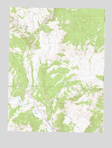
McCoy, CO USGS Topographic Map
Click on map above to begin viewing in our Map Viewer.

This topographic map contains these locations and features:
Feature Name Type Latitude Longitude GNIS ID View Map
Black MountainSummitN39.9869°W106.6564°175745View Map
Burns and McCoy MineMineN39.9100°W106.7436°1684165View Map
Cabin GulchValleyN39.8837°W106.6977°175755View Map
Congor MesaSummitN39.9400°W106.6961°175750View Map
Copper King MineMineN39.9328°W106.6811°1684168View Map
Copper Queen MineMineN39.9019°W106.6617°1684167View Map
Copper SpurPopulated PlaceN39.9105°W106.6884°175756View Map
CraterLocaleN39.9697°W106.6981°175746View Map
Egeria CreekStreamN39.9508°W106.7286°175749View Map
Kayser Mutual DitchCanalN39.9719°W106.6981°175747View Map
Kayser SpringSpringN39.9039°W106.6636°175751View Map
McCoyPopulated PlaceN39.9161°W106.7256°175753View Map
McCoy CemeteryCemeteryN39.9047°W106.7131°175754View Map
McCoy Census Designated PlaceCensusN39.9144°W106.7257°2583263View Map
McCoy DamDamN39.9383°W106.6439°200732View Map
McCoy Pit and QuarryMineN39.9628°W106.7017°1684169View Map
McCoy Post OfficePost OfficeN39.9163°W106.7258°2736008View Map
McCoy ReservoirReservoirN39.9392°W106.6439°200733View Map
Red Dirt CreekStreamN39.9469°W106.7298°173104View Map
Rio Grande MineMineN39.9019°W106.6617°1684166View Map
Rock CreekStreamN39.9022°W106.7306°173164View Map
Rock Creek Volunteer Fire DepartmentBuildingN39.9157°W106.7256°2667281View Map
Split Trough SpringSpringN39.9042°W106.6756°175757View Map
TippleLocaleN39.9733°W106.7000°175758View Map
Tipton Ranch MineMineN39.9100°W106.7320°1735882View Map
VolcanoLocaleN39.9858°W106.7192°175748View Map
Yarmany ReservoirReservoirN39.9296°W106.6671°199895View Map
Yarmony CreekStreamN39.9008°W106.7131°196516View Map
Yarmony DamDamN39.9300°W106.6673°199894View Map
Yarmony MountainSummitN39.9133°W106.6403°175752View Map

Note: Coordinates in the location and feature list above are referenced to NAD83 datum.


Copyright (C) 2008-2024 Ryan Niemi / Sunset Dynamics ... All Rights Reserved