TopoQuest Logo
Do you find TopoQuest useful?
Help keep TopoQuest running and adding new maps/features by donating!
Bitcoin:  19c7KJd3qBynnjoSw5npx9KScwjBe4ifkT
Litecoin:  LXs6TkuXGGXo1vDsWCkWVdjQX94eUKd6ui
Home View Maps Find Maps Find Places Resources & Links


Meade, Kansas Topographic Map

USGS Map Title: Meade, KS
USGS Map MRC: 37100C3
DRG (GeoTIFF) Download: o37100c3.tif


Neighboring USGS Topographic Map Quads:


  Meade NW, KS  
37100D4
 

  Meade NE, KS  
37100D3
 

  Fowler, KS  
37100D2
 

  Missler, KS  
37100C4
 

  Meade, KS  
37100C3
 

  Fowler SW, KS  
37100C2
 

  Lake Meade, KS  
37100B4
 

  Irish Flats NE, KS  
37100B3
 

  Proffitt Lake NW, KS  
37100B2


Map MRC Location:

N38°
W101°
N38°
W100°
H8 H7 H6 H5 H4 H3 H2 H1
G8 G7 G6 G5 G4 G3 G2 G1
F8 F7 F6 F5 F4 F3 F2 F1
E8 E7 E6 E5 E4 E3 E2 E1
D8 D7 D6 D5 D4 D3 D2 D1
C8 C7 C6 C5 C4 C3 C2 C1
B8 B7 B6 B5 B4 B3 B2 B1
A8 A7 A6 A5 A4 A3 A2 A1
N37°
W101°
N37°
W100°

Meade, KS USGS 1:24K Topographic Map Preview:
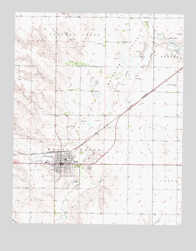
Meade, KS USGS Topographic Map
Click on map above to begin viewing in our Map Viewer.

This topographic map contains these locations and features:
Feature Name Type Latitude Longitude GNIS ID View Map
Artesian ValleyValleyN37.2975°W100.3266°470601View Map
Church of ChristChurchN37.2868°W100.3370°2688858View Map
Church of the NazareneChurchN37.2808°W100.3394°2688881View Map
City of MeadeCivilN37.2835°W100.3430°2395076View Map
Community Full Gospel ChurchChurchN37.2884°W100.3397°2688894View Map
Cudahay MineMineN37.3742°W100.3388°470588View Map
Dalton Gang HideoutBuildingN37.2810°W100.3370°2694239View Map
Emmanuel Mennonite ChurchChurchN37.2809°W100.3353°470642View Map
First Baptist ChurchChurchN37.2837°W100.3339°2688954View Map
Forst CenterBuildingN37.2863°W100.3454°2692940View Map
Graceland CemeteryCemeteryN37.2830°W100.3190°470597View Map
Hope Christian ChurchChurchN37.2880°W100.3502°2689075View Map
Lockhart CemeteryCemeteryN37.3432°W100.3179°470594View Map
Mayberry LakeReservoirN37.3611°W100.2671°470599View Map
MeadePopulated PlaceN37.2856°W100.3401°470596View Map
Meade City Fire DepartmentBuildingN37.2850°W100.3481°2111613View Map
Meade City HallBuildingN37.2847°W100.3396°2693364View Map
Meade City Municipal PlantLocaleN37.2852°W100.3323°2692468View Map
Meade Country ClubLocaleN37.2684°W100.3484°2694519View Map
Meade County CourthouseBuildingN37.2871°W100.3397°2625110View Map
Meade County Emergency Medical ServicesBuildingN37.2851°W100.3481°2696477View Map
Meade County FairgroundsLocaleN37.2898°W100.3481°481079View Map
Meade County Health DepartmentBuildingN37.2827°W100.3350°2695034View Map
Meade County Historical MuseumBuildingN37.2858°W100.3383°2694240View Map
Meade County JailBuildingN37.2871°W100.3390°2504356View Map
Meade County LandfillLocaleN37.3200°W100.3498°2692278View Map
Meade County Public Works DepartmentBuildingN37.2929°W100.3329°2693304View Map
Meade County Sheriff's OfficeBuildingN37.2871°W100.3390°2504107View Map
Meade District HospitalHospitalN37.2866°W100.3340°2499075View Map
Meade Elementary / Junior High SchoolSchoolN37.2880°W100.3365°481081View Map
Meade Elementary / Middle SchoolSchoolN37.2880°W100.3365°2427187View Map
Meade High SchoolSchoolN37.2775°W100.3298°481080View Map
Meade High SchoolSchoolN37.2775°W100.3298°2427222View Map
Meade Municipal AirportAirportN37.2837°W100.3581°470595View Map
Meade Police DepartmentBuildingN37.2850°W100.3481°2503819View Map
Meade Post OfficePost OfficeN37.2842°W100.3398°2693852View Map
Meade Public LibraryBuildingN37.2847°W100.3394°2692626View Map
Meade Rural Fire DepartmentBuildingN37.2850°W100.3481°2111614View Map
Meade Senior CenterBuildingN37.2859°W100.3469°2692949View Map
Meade United Methodist ChurchChurchN37.2868°W100.3430°2689484View Map
Meade Wastewater PlantLocaleN37.2694°W100.3151°2691966View Map
Saint Augustine Episcopal ChurchChurchN37.2885°W100.3416°2689164View Map
Saint John Lutheran ChurchChurchN37.2880°W100.3377°2689178View Map
Saint John the Baptist Catholic ChurchChurchN37.2859°W100.3450°2689180View Map
Sealock LakeReservoirN37.3575°W100.2538°470600View Map
Watson Landing Field (historical)AirportN37.3328°W100.2551°470598View Map

Note: Coordinates in the location and feature list above are referenced to NAD83 datum.


Copyright (C) 2008-2025 Ryan Niemi / Sunset Dynamics ... All Rights Reserved