TopoQuest Logo
Do you find TopoQuest useful?
Help keep TopoQuest running and adding new maps/features by donating!
Bitcoin:  19c7KJd3qBynnjoSw5npx9KScwjBe4ifkT
Litecoin:  LXs6TkuXGGXo1vDsWCkWVdjQX94eUKd6ui
Home View Maps Find Maps Find Places Resources & Links


Meadowlark Lake, Wyoming Topographic Map

USGS Map Title: Meadowlark Lake, WY
USGS Map MRC: 44107B2
DRG (GeoTIFF) Download: o44107b2.tif


Neighboring USGS Topographic Map Quads:


  Lake Solitude, WY  
44107C3
 

  Lake Helen, WY  
44107C2
 

  Lake Angeline, WY  
44107C1
 

  Brokenback Narrows, WY  
44107B3
 

  Meadowlark Lake, WY  
44107B2
 

  Powder River Pass, WY  
44107B1
 

  Old Maid Gulch, WY  
44107A3
 

  Onion Gulch, WY  
44107A2
 

  Hazelton Peak, WY  
44107A1


Map MRC Location:

N45°
W108°
N45°
W107°
H8 H7 H6 H5 H4 H3 H2 H1
G8 G7 G6 G5 G4 G3 G2 G1
F8 F7 F6 F5 F4 F3 F2 F1
E8 E7 E6 E5 E4 E3 E2 E1
D8 D7 D6 D5 D4 D3 D2 D1
C8 C7 C6 C5 C4 C3 C2 C1
B8 B7 B6 B5 B4 B3 B2 B1
A8 A7 A6 A5 A4 A3 A2 A1
N44°
W108°
N44°
W107°

Meadowlark Lake, WY USGS 1:24K Topographic Map Preview:
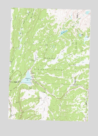
Meadowlark Lake, WY USGS Topographic Map
Click on map above to begin viewing in our Map Viewer.

This topographic map contains these locations and features:
Feature Name Type Latitude Longitude GNIS ID View Map
Baby Wagon CreekStreamN44.1977°W107.1709°1597856View Map
Bear LakeLakeN44.2214°W107.2356°1585266View Map
Bear ParkFlatN44.2375°W107.2003°1585271View Map
Bull CreekStreamN44.1711°W107.2156°1586091View Map
Bull Creek CampgroundLocaleN44.1694°W107.2131°1586096View Map
Deer Haven LodgeLocaleN44.1666°W107.2490°1587500View Map
Deer ParkFlatN44.2458°W107.2228°1587504View Map
Deer Park CampgroundLocaleN44.2441°W107.2248°1604647View Map
East Tensleep LakeLakeN44.2242°W107.1667°1588146View Map
Garnet CreekStreamN44.1744°W107.2167°1588823View Map
High ParkFlatN44.1416°W107.1940°1589536View Map
High Park LookoutLocaleN44.1494°W107.2020°1589537View Map
Indian CreekStreamN44.1286°W107.2470°1589879View Map
Island ParkFlatN44.2064°W107.2340°1594439View Map
Island Park CampgroundLocaleN44.2052°W107.2373°1604650View Map
Lake CreekStreamN44.1797°W107.2198°1600789View Map
Lake Creek CampgroundLocaleN44.2097°W107.1948°1590467View Map
Lake McLainLakeN44.2212°W107.1411°1591279View Map
Lake Point CampgroundLocaleN44.1677°W107.2317°1590478View Map
Lake View CampgroundLocaleN44.1772°W107.2153°1597560View Map
Maybelle LakeLakeN44.2196°W107.1307°1591364View Map
Meadow Lark Lake Census Designated PlaceCensusN44.1942°W107.2085°2408808View Map
Meadowlark LakeLakeN44.1750°W107.2256°1591442View Map
Meadowlark LodgeLocaleN44.1727°W107.2145°1591443View Map
Meadowlark Ski AreaLocaleN44.1605°W107.2181°1597563View Map
Middle Tensleep CreekStreamN44.2364°W107.2240°1601430View Map
Saint Christopher in the BighornChurchN44.1564°W107.1926°1593778View Map
Sitting Bull CampgroundLocaleN44.1911°W107.2126°1594390View Map
Sitting Bull ParkFlatN44.1966°W107.2092°1594391View Map
Stovepipe CreekStreamN44.1414°W107.2459°1595098View Map
Tensleep ReservoirReservoirN44.1705°W107.2219°1608105View Map
Tensleep Reservoir DamDamN44.1650°W107.2323°1608104View Map
Varneys Memorial CampLocaleN44.1300°W107.2428°1595920View Map
Virginia CreekStreamN44.1966°W107.1676°1603932View Map
Warner DrawValleyN44.2041°W107.2428°1596043View Map
Willow CreekStreamN44.1805°W107.2445°1596437View Map
Willow Park Picnic AreaLocaleN44.1808°W107.2378°1604649View Map

Note: Coordinates in the location and feature list above are referenced to NAD83 datum.


Copyright (C) 2008-2024 Ryan Niemi / Sunset Dynamics ... All Rights Reserved