TopoQuest Logo
Do you find TopoQuest useful?
Help keep TopoQuest running and adding new maps/features by donating!
Bitcoin:  19c7KJd3qBynnjoSw5npx9KScwjBe4ifkT
Litecoin:  LXs6TkuXGGXo1vDsWCkWVdjQX94eUKd6ui
Home View Maps Find Maps Find Places Resources & Links


Medicine Lodge, Kansas Topographic Map

USGS Map Title: Medicine Lodge, KS
USGS Map MRC: 37098C5
DRG (GeoTIFF) Download: o37098c5.tif


Neighboring USGS Topographic Map Quads:


  Sawyer, KS  
37098D6
 

  Isabel, KS  
37098D5
 

  Nashville, KS  
37098D4
 

  Medicine Lodge SW, KS  
37098C6
 

  Medicine Lodge, KS  
37098C5
 

  Sharon North, KS  
37098C4
 

  Hardtner NW, KS  
37098B6
 

  Gerlane, KS  
37098B5
 

  Sharon South, KS  
37098B4


Map MRC Location:

N38°
W99°
N38°
W98°
H8 H7 H6 H5 H4 H3 H2 H1
G8 G7 G6 G5 G4 G3 G2 G1
F8 F7 F6 F5 F4 F3 F2 F1
E8 E7 E6 E5 E4 E3 E2 E1
D8 D7 D6 D5 D4 D3 D2 D1
C8 C7 C6 C5 C4 C3 C2 C1
B8 B7 B6 B5 B4 B3 B2 B1
A8 A7 A6 A5 A4 A3 A2 A1
N37°
W99°
N37°
W98°

Medicine Lodge, KS USGS 1:24K Topographic Map Preview:
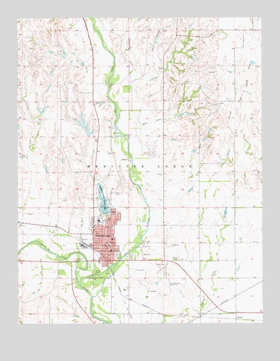
Medicine Lodge, KS USGS Topographic Map
Click on map above to begin viewing in our Map Viewer.

This topographic map contains these locations and features:
Feature Name Type Latitude Longitude GNIS ID View Map
Albee CreekStreamN37.3270°W98.5687°470447View Map
Barber County CourthouseBuildingN37.2798°W98.5779°2625152View Map
Barber County Health DepartmentBuildingN37.2804°W98.5782°2694983View Map
Barber County JailBuildingN37.2798°W98.5779°2504355View Map
Barber County Rural Fire Department Station 1BuildingN37.2899°W98.5684°2111122View Map
Barber County Sheriff's OfficeBuildingN37.2798°W98.5777°2503799View Map
Barber County State LakeReservoirN37.2977°W98.5812°470445View Map
Barber County State Lake DamDamN37.2953°W98.5804°479861View Map
Barber State Fishing LakeParkN37.2953°W98.5804°479791View Map
Barber State Fishing Lake and Wildlife AreaParkN37.2953°W98.5804°479769View Map
Bloom Oil FieldOilfieldN37.2686°W98.5870°470443View Map
Carrie Nation HouseBuildingN37.2756°W98.5820°2694294View Map
Carry A Nation HouseBuildingN37.2756°W98.5819°481085View Map
City of Medicine LodgeCivilN37.2851°W98.5813°2395083View Map
Community Bible FellowshipChurchN37.2886°W98.5522°2689681View Map
Elm CreekStreamN37.2625°W98.5934°470451View Map
First Assembly of God ChurchChurchN37.2883°W98.5878°2690449View Map
First Baptist ChurchChurchN37.2904°W98.5840°2688662View Map
First Christian ChurchChurchN37.2780°W98.5788°2688671View Map
First Southern Baptist ChurchChurchN37.2828°W98.5796°2688682View Map
Highland CemeteryCemeteryN37.2917°W98.5876°470444View Map
Holy Rosary Catholic ChurchChurchN37.2911°W98.5753°2689819View Map
Kansas Highway Patrol Troop F BarberBuildingN37.2870°W98.5871°2504256View Map
Lincoln LibraryBuildingN37.2821°W98.5796°2694725View Map
Medicine LodgePopulated PlaceN37.2811°W98.5804°470446View Map
Medicine Lodge AirportAirportN37.2682°W98.5486°470442View Map
Medicine Lodge City HallBuildingN37.2821°W98.5805°2693086View Map
Medicine Lodge Golf CourseLocaleN37.2737°W98.5529°2694586View Map
Medicine Lodge Grade SchoolSchoolN37.2847°W98.5773°481082View Map
Medicine Lodge Junior / Senior High SchoolSchoolN37.2921°W98.5841°481084View Map
Medicine Lodge Memorial HospitalHospitalN37.2894°W98.5773°2499103View Map
Medicine Lodge Memorial Hospital AmbulanceBuildingN37.2892°W98.5773°2696546View Map
Medicine Lodge Middle SchoolSchoolN37.2822°W98.5787°481083View Map
Medicine Lodge Police DepartmentBuildingN37.2821°W98.5802°2504174View Map
Medicine Lodge Post OfficePost OfficeN37.2809°W98.5802°2693853View Map
Medicine Lodge Presbyterian ChurchChurchN37.2821°W98.5780°2690591View Map
Medicine Lodge Senior Citizen CenterBuildingN37.2825°W98.5796°2692664View Map
Medicine Lodge United Methodist ChurchChurchN37.2833°W98.5780°2689485View Map
Medicine Lodge Volunteer Fire DepartmentBuildingN37.2821°W98.5796°2111615View Map
Medicine Lodge Water Treatment FacilityLocaleN37.2713°W98.5827°2693409View Map
Memorial Peace ParkParkN37.2778°W98.5723°481086View Map
PixleyPopulated PlaceN37.2520°W98.5137°484519View Map
Saint Mark's Episcopal ChurchChurchN37.2828°W98.5774°2690912View Map
Short CreekStreamN37.3495°W98.5573°470449View Map
The Stockade MuseumBuildingN37.2756°W98.5817°2694359View Map
Threemile CreekStreamN37.3506°W98.5695°470450View Map
Township of Medicine LodgeCivilN37.2974°W98.5501°470490View Map
Trinity Lutheran ChurchChurchN37.2913°W98.5840°2688784View Map

Note: Coordinates in the location and feature list above are referenced to NAD83 datum.


Copyright (C) 2008-2025 Ryan Niemi / Sunset Dynamics ... All Rights Reserved