TopoQuest Logo
Do you find TopoQuest useful?
Help keep TopoQuest running and adding new maps/features by donating!
Bitcoin:  19c7KJd3qBynnjoSw5npx9KScwjBe4ifkT
Litecoin:  LXs6TkuXGGXo1vDsWCkWVdjQX94eUKd6ui
Home View Maps Find Maps Find Places Resources & Links


Melstone NE, Montana Topographic Map

USGS Map Title: Melstone NE, MT
USGS Map MRC: 46107F7
DRG (GeoTIFF) Download: o46107f7.tif


Neighboring USGS Topographic Map Quads:


  Maxwell Ranch, MT  
46107G8
 

  Mosby SE, MT  
46107G7
 

  Kincheloe Ranch, MT  
46107G6
 

  Melstone NW, MT  
46107F8
 

  Melstone NE, MT  
46107F7
 

  Grebe Ranch, MT  
46107F6
 

  Queens Point, MT  
46107E8
 

  Melstone, MT  
46107E7
 

  Guthridge Ranch, MT  
46107E6


Map MRC Location:

N47°
W108°
N47°
W107°
H8 H7 H6 H5 H4 H3 H2 H1
G8 G7 G6 G5 G4 G3 G2 G1
F8 F7 F6 F5 F4 F3 F2 F1
E8 E7 E6 E5 E4 E3 E2 E1
D8 D7 D6 D5 D4 D3 D2 D1
C8 C7 C6 C5 C4 C3 C2 C1
B8 B7 B6 B5 B4 B3 B2 B1
A8 A7 A6 A5 A4 A3 A2 A1
N46°
W108°
N46°
W107°

Melstone NE, MT USGS 1:24K Topographic Map Preview:
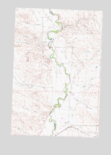
Melstone NE, MT USGS Topographic Map
Click on map above to begin viewing in our Map Viewer.

This topographic map contains these locations and features:
Feature Name Type Latitude Longitude GNIS ID View Map
11N31E11DA__01 WellWellN46.7333°W107.7715°818016View Map
11N31E11DBD_01 WellWellN46.7322°W107.7773°818015View Map
11N31E34DAC_01 WellWellN46.6739°W107.7962°817701View Map
11N31E36AADD01 WellWellN46.6800°W107.7534°817741View Map
BascomPopulated PlaceN46.6261°W107.7534°768537View Map
Bascom (historical)LocaleN46.6255°W107.7512°1716723View Map
Bascom Oil FieldOilfieldN46.6522°W107.7904°768538View Map
Bascom Post Office (historical)Post OfficeN46.6255°W107.7512°1716724View Map
Bascom School (historical)SchoolN46.6275°W107.7543°1716610View Map
BS Kincheloe Number 6 DamDamN46.6567°W107.7773°797125View Map
Butts CouleeValleyN46.6466°W107.8207°769460View Map
Butts School (historical)SchoolN46.6550°W107.7940°1716611View Map
Delphia Melstone DitchCanalN46.7378°W107.8215°770599View Map
East Keggy CouleeValleyN46.6839°W107.7898°771091View Map
Getchell CouleeValleyN46.7383°W107.7832°771747View Map
Gremmert CouleeValleyN46.7425°W107.8271°771988View Map
Home CreekStreamN46.6486°W107.8173°772494View Map
Ivanhoe Dome Oil FieldOilfieldN46.7200°W107.8412°772744View Map
Orchard CouleeValleyN46.6697°W107.7945°774976View Map
Rattlesnake CouleeValleyN46.7353°W107.8079°775583View Map
Seventynine CouleeValleyN46.7153°W107.8265°776374View Map
Stensvad Oil FieldOilfieldN46.7305°W107.7773°777198View Map
West Keggy CouleeValleyN46.6711°W107.8234°778295View Map

Note: Coordinates in the location and feature list above are referenced to NAD83 datum.


Copyright (C) 2008-2024 Ryan Niemi / Sunset Dynamics ... All Rights Reserved