TopoQuest Logo
Do you find TopoQuest useful?
Help keep TopoQuest running and adding new maps/features by donating!
Bitcoin:  19c7KJd3qBynnjoSw5npx9KScwjBe4ifkT
Litecoin:  LXs6TkuXGGXo1vDsWCkWVdjQX94eUKd6ui
Home View Maps Find Maps Find Places Resources & Links


Merced Falls, California Topographic Map

USGS Map Title: Merced Falls, CA
USGS Map MRC: 37120E3
DRG (GeoTIFF) Download: o37120e3.tif


Neighboring USGS Topographic Map Quads:


  La Grange, CA  
37120F4
 

  Penon Blanco Peak, CA  
37120F3
 

  Coulterville, CA  
37120F2
 

  Snelling, CA  
37120E4
 

  Merced Falls, CA  
37120E3
 

  Hornitos, CA  
37120E2
 

  Yosemite Lake, CA  
37120D4
 

  Haystack Mountain, CA  
37120D3
 

  Indian Gulch, CA  
37120D2


Map MRC Location:

N38°
W121°
N38°
W120°
H8 H7 H6 H5 H4 H3 H2 H1
G8 G7 G6 G5 G4 G3 G2 G1
F8 F7 F6 F5 F4 F3 F2 F1
E8 E7 E6 E5 E4 E3 E2 E1
D8 D7 D6 D5 D4 D3 D2 D1
C8 C7 C6 C5 C4 C3 C2 C1
B8 B7 B6 B5 B4 B3 B2 B1
A8 A7 A6 A5 A4 A3 A2 A1
N37°
W121°
N37°
W120°

Merced Falls, CA USGS 1:24K Topographic Map Preview:
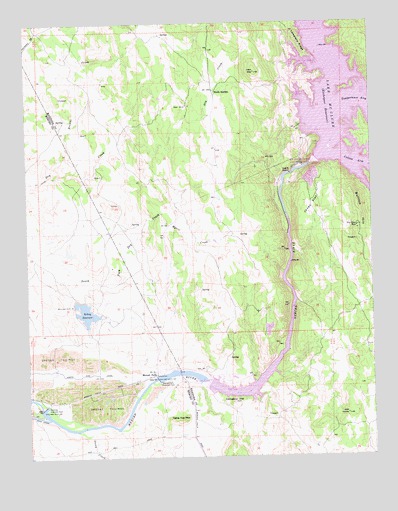
Merced Falls, CA USGS Topographic Map
Click on map above to begin viewing in our Map Viewer.

This topographic map contains these locations and features:
Feature Name Type Latitude Longitude GNIS ID View Map
Akoz MineMineN37.6013°W120.3171°233403View Map
Blue Moon MineMineN37.5660°W120.2560°233521View Map
Browns CreekStreamN37.5827°W120.3635°233551View Map
Bullion HillSummitN37.5722°W120.2560°1659701View Map
Cemetery HillSummitN37.5158°W120.3016°1659709View Map
Cemetery RidgeRidgeN37.6188°W120.2769°233647View Map
Crocker Diversion 58-000 DamDamN37.5149°W120.3710°1663471View Map
Jones FlatFlatN37.5724°W120.2727°234096View Map
Kelsey 662 DamDamN37.5435°W120.3585°1664007View Map
Kelsey ReservoirReservoirN37.5413°W120.3541°234106View Map
Lake McClureReservoirN37.5864°W120.2628°245652View Map
Lucky Quartz MineMineN37.5213°W120.3060°234214View Map
McClure Point Recreation AreaParkN37.6083°W120.2788°1809326View Map
Merced FallsPopulated PlaceN37.5230°W120.3324°1659752View Map
Merced Falls Diversion DamDamN37.5224°W120.3296°234277View Map
Myers CreekStreamN37.5694°W120.3274°234348View Map
New Exchequer DamDamN37.5850°W120.2713°1666173View Map
Snelling Diversion DamDamN37.5144°W120.3707°234757View Map
Stoney CreekStreamN37.5077°W120.3585°217928View Map
Stony CreekStreamN37.5077°W120.3582°233371View Map
Table Top MountainSummitN37.5102°W120.3199°235966View Map
Temperance ArmBayN37.6024°W120.2538°253874View Map
Webb StationLocaleN37.6058°W120.3074°237378View Map

Note: Coordinates in the location and feature list above are referenced to NAD83 datum.


Copyright (C) 2008-2024 Ryan Niemi / Sunset Dynamics ... All Rights Reserved