TopoQuest Logo
Do you find TopoQuest useful?
Help keep TopoQuest running and adding new maps/features by donating!
Bitcoin:  19c7KJd3qBynnjoSw5npx9KScwjBe4ifkT
Litecoin:  LXs6TkuXGGXo1vDsWCkWVdjQX94eUKd6ui
Home View Maps Find Maps Find Places Resources & Links


Mesa, Colorado Topographic Map

USGS Map Title: Mesa, CO
USGS Map MRC: 39108B2
DRG (GeoTIFF) Download: o39108b2.tif


Neighboring USGS Topographic Map Quads:


  Wagon Track Ridge, CO  
39108C3
 

  De Beque, CO  
39108C2
 

  Housetop Mountain, CO  
39108C1
 

  Cameo, CO  
39108B3
 

  Mesa, CO  
39108B2
 

  Molina, CO  
39108B1
 

  Palisade, CO  
39108A3
 

  Lands End, CO  
39108A2
 

  Mesa Lakes, CO  
39108A1


Map MRC Location:

N40°
W109°
N40°
W108°
H8 H7 H6 H5 H4 H3 H2 H1
G8 G7 G6 G5 G4 G3 G2 G1
F8 F7 F6 F5 F4 F3 F2 F1
E8 E7 E6 E5 E4 E3 E2 E1
D8 D7 D6 D5 D4 D3 D2 D1
C8 C7 C6 C5 C4 C3 C2 C1
B8 B7 B6 B5 B4 B3 B2 B1
A8 A7 A6 A5 A4 A3 A2 A1
N39°
W109°
N39°
W108°

Mesa, CO USGS 1:24K Topographic Map Preview:
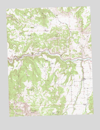
Mesa, CO USGS Topographic Map
Click on map above to begin viewing in our Map Viewer.

This topographic map contains these locations and features:
Feature Name Type Latitude Longitude GNIS ID View Map
Atwell GulchValleyN39.2058°W108.1396°174346View Map
Atwell HomesteadLocaleN39.1875°W108.1398°174443View Map
Barney HillSummitN39.1286°W108.1787°174460View Map
Baugh ReservoirReservoirN39.2281°W108.2067°174467View Map
Black MountainSummitN39.2161°W108.1767°174445View Map
Carver HomesteadLocaleN39.1553°W108.2159°174457View Map
Chalk MountainSummitN39.1305°W108.2120°174458View Map
Cobert FlatsFlatN39.1705°W108.2415°202244View Map
Coon CreekStreamN39.1900°W108.1317°174454View Map
East MonumentPillarN39.2269°W108.2140°174450View Map
Eddington HomesteadLocaleN39.2186°W108.2187°174448View Map
Fleming PointCliffN39.1969°W108.2134°174447View Map
Frank Ball HomesteadLocaleN39.1886°W108.1909°174466View Map
Harris HomesteadLocaleN39.2225°W108.1948°174446View Map
Indian PeakSummitN39.1928°W108.1354°174444View Map
John Held CornerPopulated PlaceN39.1366°W108.1362°174462View Map
Kimbell MesaSummitN39.2403°W108.2134°174451View Map
King GulchValleyN39.1868°W108.1655°174455View Map
Little WashStreamN39.1925°W108.2304°174456View Map
Long PointSummitN39.2275°W108.2490°202247View Map
Meeker TreeLocaleN39.1316°W108.1554°174461View Map
MesaPopulated PlaceN39.1664°W108.1390°174463View Map
Mesa CreekStreamN39.1886°W108.1395°174453View Map
Mesa Post OfficePost OfficeN39.1664°W108.1387°2750974View Map
Morris RanchLocaleN39.1272°W108.1840°174459View Map
Plateau ValleyValleyN39.1937°W108.1730°174442View Map
Plateau Valley Fire Protection DistrictBuildingN39.1739°W108.1376°2667138View Map
Plateau Valley Fire Protection District AmbulanceBuildingN39.1740°W108.1376°2716987View Map
Ray Ball HomesteadLocaleN39.1847°W108.1865°174465View Map
Shire GulchValleyN39.1941°W108.1724°174329View Map
Silvey FlatsFlatN39.2000°W108.2451°202246View Map
Tate CreekStreamN39.1644°W108.1420°174452View Map
West MonumentSummitN39.2208°W108.2298°174449View Map
Windger FlatsFlatN39.1794°W108.1981°174464View Map

Note: Coordinates in the location and feature list above are referenced to NAD83 datum.


Copyright (C) 2008-2025 Ryan Niemi / Sunset Dynamics ... All Rights Reserved