TopoQuest Logo
Do you find TopoQuest useful?
Help keep TopoQuest running and adding new maps/features by donating!
Bitcoin:  19c7KJd3qBynnjoSw5npx9KScwjBe4ifkT
Litecoin:  LXs6TkuXGGXo1vDsWCkWVdjQX94eUKd6ui
Home View Maps Find Maps Find Places Resources & Links


Mesa West, Washington Topographic Map

USGS Map Title: Mesa West, WA
USGS Map MRC: 46119E1
DRG (GeoTIFF) Download: o46119e1.tif


Neighboring USGS Topographic Map Quads:


  Eagle Lakes, WA  
46119F2
 

  Scooteney Reservoir, WA  
46119F1
 

  Frischknecht, WA  
46118F8
 

  Basin City, WA  
46119E2
 

  Mesa West, WA  
46119E1
 

  Mesa East, WA  
46118E8
 

  Mathews Corner, WA  
46119D2
 

  Eltopia, WA  
46119D1
 

  Rye Grass Coulee, WA  
46118D8


Map MRC Location:

N47°
W120°
N47°
W119°
H8 H7 H6 H5 H4 H3 H2 H1
G8 G7 G6 G5 G4 G3 G2 G1
F8 F7 F6 F5 F4 F3 F2 F1
E8 E7 E6 E5 E4 E3 E2 E1
D8 D7 D6 D5 D4 D3 D2 D1
C8 C7 C6 C5 C4 C3 C2 C1
B8 B7 B6 B5 B4 B3 B2 B1
A8 A7 A6 A5 A4 A3 A2 A1
N46°
W120°
N46°
W119°

Mesa West, WA USGS 1:24K Topographic Map Preview:
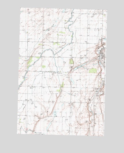
Mesa West, WA USGS Topographic Map
Click on map above to begin viewing in our Map Viewer.

This topographic map contains these locations and features:
Feature Name Type Latitude Longitude GNIS ID View Map
Bailie PondLakeN46.5959°W119.0011°1503124View Map
Bernsens 810 ReservoirReservoirN46.5680°W119.0328°1532461View Map
Bernsens 810 Reservoir Dam Number OneDamN46.5682°W119.0328°1532460View Map
Bernsens 810 Reservoir Dam Number ThreeDamN46.5665°W119.0295°1532463View Map
Bernsens 810 Reservoir Dam Number TwoDamN46.5665°W119.0311°1532462View Map
Bernsens Duck Pond DamDamN46.5715°W119.0111°1532473View Map
City of MesaCivilN46.5737°W119.0013°2411088View Map
Clark PondLakeN46.5213°W119.0713°1503997View Map
DPE ThirtynineCanalN46.5712°W119.1164°1510520View Map
Duck PondReservoirN46.5709°W119.0142°1532474View Map
EdwardsPopulated PlaceN46.5496°W119.0047°1510938View Map
Franklin County Public Hospital District 1 Ambulance ServiceBuildingN46.5779°W119.0052°2643435View Map
Hathaway Ranch Airport (historical)AirportN46.5582°W119.0367°1533837View Map
MesaPopulated PlaceN46.5762°W119.0067°1512459View Map
Mesa Elementary SchoolSchoolN46.5753°W119.0016°1515278View Map
Mesa LakeLakeN46.5678°W119.0379°1506636View Map
Mesa Post OfficePost OfficeN46.5794°W119.0065°2781679View Map
Old Maid CouleeValleyN46.5426°W119.0089°1507156View Map
Poe ParkParkN46.5785°W119.0003°1507502View Map
Slinkard AirfieldAirportN46.6032°W119.0628°1533839View Map
Worth LakeLakeN46.6039°W119.0846°1509636View Map

Note: Coordinates in the location and feature list above are referenced to NAD83 datum.


Copyright (C) 2008-2024 Ryan Niemi / Sunset Dynamics ... All Rights Reserved