TopoQuest Logo
Do you find TopoQuest useful?
Help keep TopoQuest running and adding new maps/features by donating!
Bitcoin:  19c7KJd3qBynnjoSw5npx9KScwjBe4ifkT
Litecoin:  LXs6TkuXGGXo1vDsWCkWVdjQX94eUKd6ui
Home View Maps Find Maps Find Places Resources & Links


Mesick, Michigan Topographic Map

USGS Map Title: Mesick, MI
USGS Map MRC: 44085D6
DRG (GeoTIFF) Download: o44085d6.tif


Neighboring USGS Topographic Map Quads:


  Harlan, MI  
44085D7
 

  Mesick, MI  
44085D6
 

  Mesick NE, MI  
44085D5
 

  Yuma, MI  
44085C7
 

  Harrietta, MI  
44085C6
 

  Boon, MI  
44085C5


Map MRC Location:

N45°
W86°
N45°
W85°
H8 H7 H6 H5 H4 H3 H2 H1
G8 G7 G6 G5 G4 G3 G2 G1
F8 F7 F6 F5 F4 F3 F2 F1
E8 E7 E6 E5 E4 E3 E2 E1
D8 D7 D6 D5 D4 D3 D2 D1
C8 C7 C6 C5 C4 C3 C2 C1
B8 B7 B6 B5 B4 B3 B2 B1
A8 A7 A6 A5 A4 A3 A2 A1
N44°
W86°
N44°
W85°

Mesick, MI USGS 1:24K Topographic Map Preview:
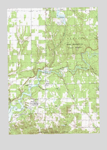
Mesick, MI USGS Topographic Map
Click on map above to begin viewing in our Map Viewer.

This topographic map contains these locations and features:
Feature Name Type Latitude Longitude GNIS ID View Map
Adams CreekStreamN44.4422°W85.6378°1618989View Map
Antioch ChurchChurchN44.4022°W85.6390°1619032View Map
Antioch Township CemeteryCemeteryN44.4025°W85.6403°2509260View Map
Bible Believers Fellowship ChurchChurchN44.4069°W85.7117°2509200View Map
Briar at Mesick Golf ClubLocaleN44.4033°W85.6903°2509248View Map
Briar HillSummitN44.3978°W85.6690°1622847View Map
Briar Hill Ski JumpLocaleN44.3986°W85.6667°1623255View Map
Burkett CreekStreamN44.4219°W85.7090°1619370View Map
Carpenter LakeLakeN44.4198°W85.6804°1619436View Map
Cole CreekStreamN44.4314°W85.6773°1619551View Map
Cornell CemeteryCemeteryN44.4969°W85.7133°2509256View Map
Cornell SchoolLocaleN44.4978°W85.7170°1619586View Map
Dennis Family CampgroundLocaleN44.4056°W85.7422°2509206View Map
East Branch Wheeler CreekStreamN44.4606°W85.6845°1619810View Map
Faith Lutheran ChurchChurchN44.4086°W85.7089°2509201View Map
First Wexford County Courthouse Historical MarkerParkN44.4247°W85.6989°2509249View Map
Fletcher CreekStreamN44.4031°W85.7467°1619926View Map
Free Methodist ChurchChurchN44.4050°W85.7117°2509203View Map
GlengaryPopulated PlaceN44.4231°W85.7212°1620025View Map
Harvey BridgeBridgeN44.4394°W85.6423°1623396View Map
Indian Crossing CampgroundLocaleN44.4514°W85.6333°2509091View Map
Jewett LakeLakeN44.3834°W85.6740°1620363View Map
Lake GitchegumeeReservoirN44.4913°W85.6759°1622237View Map
Lake of the WoodsLakeN44.4014°W85.7028°1622217View Map
MesickPopulated PlaceN44.4053°W85.7134°1620798View Map
Mesick High SchoolSchoolN44.4000°W85.7094°2509205View Map
Mesick Medical CenterHospitalN44.4069°W85.7125°2509202View Map
Mesick Middle SchoolSchoolN44.4053°W85.7100°2509204View Map
Mesick Post OfficePost OfficeN44.4058°W85.7208°2509193View Map
Mesick Public LibraryBuildingN44.4069°W85.7150°2509192View Map
Mesick Rescue SquadBuildingN44.4054°W85.7122°2662046View Map
Mesick Seventh Day Adventist ChurchChurchN44.4061°W85.7117°2509199View Map
Mesick Station (historical)LocaleN44.4047°W85.7169°2509197View Map
Mesick-Sherman CemeteryCemeteryN44.4094°W85.6978°2509261View Map
Oatly LakeLakeN44.4026°W85.6829°1621090View Map
Preston CreekStreamN44.4028°W85.7295°1621314View Map
ShermanPopulated PlaceN44.4239°W85.6967°1621586View Map
Sherman Post Office (historical)Post OfficeN44.4239°W85.6967°2509062View Map
Springville Township Volunteer Fire DepartmentBuildingN44.4063°W85.6997°2509191View Map
Township of AntiochCivilN44.3814°W85.6399°1625839View Map
Township of HanoverCivilN44.4685°W85.6373°1626432View Map
United Methodist ChurchChurchN44.4050°W85.7131°2509198View Map
Village of MesickCivilN44.4043°W85.7172°2399323View Map
Wheeler CreekStreamN44.4378°W85.6995°1622124View Map
WTCM-FM (Traverse City)TowerN44.4586°W85.7006°1625518View Map

Note: Coordinates in the location and feature list above are referenced to NAD83 datum.


Copyright (C) 2008-2025 Ryan Niemi / Sunset Dynamics ... All Rights Reserved