TopoQuest Logo
Do you find TopoQuest useful?
Help keep TopoQuest running and adding new maps/features by donating!
Bitcoin:  19c7KJd3qBynnjoSw5npx9KScwjBe4ifkT
Litecoin:  LXs6TkuXGGXo1vDsWCkWVdjQX94eUKd6ui
Home View Maps Find Maps Find Places Resources & Links


Mesita Del Gavilan, New Mexico Topographic Map

USGS Map Title: Mesita Del Gavilan, NM
USGS Map MRC: 35107F4
DRG (GeoTIFF) Download: o35107f4.tif


Neighboring USGS Topographic Map Quads:


  Whitehorse Rincon, NM  
35107G5
 

  Rincon Marquez, NM  
35107G4
 

  Tinian, NM  
35107G3
 

  Mesita Americana, NM  
35107F5
 

  Mesita Del Gavilan, NM  
35107F4
 

  Canada Calladita, NM  
35107F3
 

  El Dado, NM  
35107E5
 

  Mesa Cortada, NM  
35107E4
 

  Cerro Parido, NM  
35107E3


Map MRC Location:

N36°
W108°
N36°
W107°
H8 H7 H6 H5 H4 H3 H2 H1
G8 G7 G6 G5 G4 G3 G2 G1
F8 F7 F6 F5 F4 F3 F2 F1
E8 E7 E6 E5 E4 E3 E2 E1
D8 D7 D6 D5 D4 D3 D2 D1
C8 C7 C6 C5 C4 C3 C2 C1
B8 B7 B6 B5 B4 B3 B2 B1
A8 A7 A6 A5 A4 A3 A2 A1
N35°
W108°
N35°
W107°

Mesita Del Gavilan, NM USGS 1:24K Topographic Map Preview:
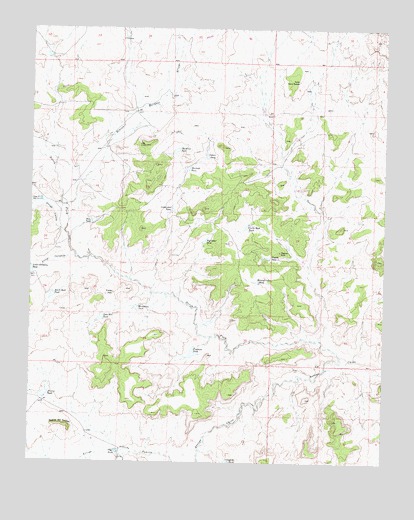
Mesita Del Gavilan, NM USGS Topographic Map
Click on map above to begin viewing in our Map Viewer.

This topographic map contains these locations and features:
Feature Name Type Latitude Longitude GNIS ID View Map
15T-543 Water WellWellN35.7006°W107.4912°922369View Map
Alcario TankReservoirN35.6442°W107.4953°885664View Map
Amos Pit ReservoirReservoirN35.7003°W107.4970°885728View Map
Arroyo CalladitoStreamN35.6836°W107.4839°897623View Map
Arroyo LuceroStreamN35.6909°W107.4887°897648View Map
Bench Rock TankReservoirN35.6727°W107.4928°886207View Map
Big Cedar TankReservoirN35.6888°W107.4391°886290View Map
Borderline TankReservoirN35.6693°W107.4628°886637View Map
Carreton CanyonValleyN35.6353°W107.4220°904794View Map
Castle Rock TankReservoirN35.6930°W107.4243°887271View Map
Cone HillPillarN35.6739°W107.4712°887780View Map
Cone Hill TankReservoirN35.6666°W107.4754°887781View Map
Cottonwood TankReservoirN35.6979°W107.4506°887945View Map
Echo TankReservoirN35.6944°W107.4782°888766View Map
Fishback TankReservoirN35.6565°W107.4430°889048View Map
Indian PondReservoirN35.7132°W107.4385°890311View Map
Martinez TankReservoirN35.7149°W107.4493°891658View Map
Mauled Cedar TankReservoirN35.6772°W107.4204°891683View Map
Mesita del GavilanSummitN35.6353°W107.4870°899788View Map
North Fork Arroyo ChicoStreamN35.6559°W107.3906°897423View Map
Pagoda RockPillarN35.6859°W107.4125°893019View Map
Pagoda TankReservoirN35.6843°W107.4164°893020View Map
Rancho Rincon MarquezLocaleN35.7350°W107.4064°893660View Map
Rincon Marquez ArroyoStreamN35.7120°W107.4920°893947View Map
Steamboat TankReservoirN35.6922°W107.4484°895322View Map
Stockade TankReservoirN35.7098°W107.4451°895361View Map
Vega TankReservoirN35.6280°W107.4692°896112View Map

Note: Coordinates in the location and feature list above are referenced to NAD83 datum.


Copyright (C) 2008-2025 Ryan Niemi / Sunset Dynamics ... All Rights Reserved