TopoQuest Logo
Do you find TopoQuest useful?
Help keep TopoQuest running and adding new maps/features by donating!
Bitcoin:  19c7KJd3qBynnjoSw5npx9KScwjBe4ifkT
Litecoin:  LXs6TkuXGGXo1vDsWCkWVdjQX94eUKd6ui
Home View Maps Find Maps Find Places Resources & Links


Meteor Crater, Arizona Topographic Map

USGS Map Title: Meteor Crater, AZ
USGS Map MRC: 35111A1
DRG (GeoTIFF) Download: o35111a1.tif


Neighboring USGS Topographic Map Quads:


  Babbitt Wash, AZ  
35111B2
 

  Canyon Diablo, AZ  
35111B1
 

  Tucker Mesa NW, AZ  
35110B8
 

  Anderson Canyon, AZ  
35111A2
 

  Meteor Crater, AZ  
35111A1
 

  Tucker Mesa SW, AZ  
35110A8
 

  Chavez Mountain NW, AZ  
34111H2
 

  Chavez Mountain NE, AZ  
34111H1
 

  West Sunset Mountain, AZ  
34110H8


Map MRC Location:

N36°
W112°
N36°
W111°
H8 H7 H6 H5 H4 H3 H2 H1
G8 G7 G6 G5 G4 G3 G2 G1
F8 F7 F6 F5 F4 F3 F2 F1
E8 E7 E6 E5 E4 E3 E2 E1
D8 D7 D6 D5 D4 D3 D2 D1
C8 C7 C6 C5 C4 C3 C2 C1
B8 B7 B6 B5 B4 B3 B2 B1
A8 A7 A6 A5 A4 A3 A2 A1
N35°
W112°
N35°
W111°

Meteor Crater, AZ USGS 1:24K Topographic Map Preview:
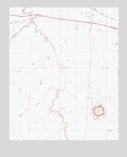
Meteor Crater, AZ USGS Topographic Map
Click on map above to begin viewing in our Map Viewer.

This topographic map contains these locations and features:
Feature Name Type Latitude Longitude GNIS ID View Map
Anderson CanyonValleyN35.1108°W111.0999°25645View Map
Bumpy Road WellWellN35.0650°W111.1160°2194View Map
Canyon Diablo DamDamN35.0250°W111.0007°20698View Map
Canyon Diablo ReservoirReservoirN35.0250°W111.0007°20700View Map
Canyon Diablo WellWellN35.0297°W111.0660°2441View Map
Chilson TankReservoirN35.1051°W111.0493°2839View Map
Clounch WellWellN35.0675°W111.0140°20718View Map
Corner LakeLakeN35.0539°W111.0905°3265View Map
Horse Pasture TankReservoirN35.0095°W111.0124°5982View Map
Meteor CraterCraterN35.0281°W111.0232°7945View Map
Meteor Crater InterchangeCrossingN35.1100°W111.0307°20898View Map
Old Two Guns RuinLocaleN35.1164°W111.0963°20936View Map
Phone Line TankReservoirN35.0778°W111.0783°9386View Map
Prosperity TankReservoirN35.0718°W111.0997°9793View Map
Rimmy JimsPopulated PlaceN35.1100°W111.0310°24581View Map
SunshinePopulated PlaceN35.1239°W111.0315°24635View Map
Sunshine Microwave Relay StationTowerN35.1158°W111.0346°21034View Map
Sunshine Railroad StationBuildingN35.1231°W111.0290°21035View Map
The Rock HouseLocaleN35.0686°W111.0615°12371View Map
Two GunsPopulated PlaceN35.1178°W111.0935°24665View Map
Two Guns InterchangeCrossingN35.1181°W111.0957°21093View Map
Wagon Box DrawValleyN35.1197°W111.1018°35800View Map
Wallace CanyonValleyN35.0681°W111.0654°35836View Map
Yaeger CanyonValleyN35.0472°W111.0682°36424View Map

Note: Coordinates in the location and feature list above are referenced to NAD83 datum.


Copyright (C) 2008-2025 Ryan Niemi / Sunset Dynamics ... All Rights Reserved