TopoQuest Logo
Do you find TopoQuest useful?
Help keep TopoQuest running and adding new maps/features by donating!
Bitcoin:  19c7KJd3qBynnjoSw5npx9KScwjBe4ifkT
Litecoin:  LXs6TkuXGGXo1vDsWCkWVdjQX94eUKd6ui
Home View Maps Find Maps Find Places Resources & Links


Methow, Washington Topographic Map

USGS Map Title: Methow, WA
USGS Map MRC: 48120B1
DRG (GeoTIFF) Download: o48120b1.tif


Neighboring USGS Topographic Map Quads:


  Twisp West, WA  
48120C2
 

  Twisp East, WA  
48120C1
 

  Thrapp Mountain, WA  
48119C8
 

  Hungry Mountain, WA  
48120B2
 

  Methow, WA  
48120B1
 

  Knowlton Knob, WA  
48119B8
 

  Oss Peak, WA  
48120A2
 

  Cooper Mountain, WA  
48120A1
 

  Pateros, WA  
48119A8


Map MRC Location:

N49°
W121°
N49°
W120°
H8 H7 H6 H5 H4 H3 H2 H1
G8 G7 G6 G5 G4 G3 G2 G1
F8 F7 F6 F5 F4 F3 F2 F1
E8 E7 E6 E5 E4 E3 E2 E1
D8 D7 D6 D5 D4 D3 D2 D1
C8 C7 C6 C5 C4 C3 C2 C1
B8 B7 B6 B5 B4 B3 B2 B1
A8 A7 A6 A5 A4 A3 A2 A1
N48°
W121°
N48°
W120°

Methow, WA USGS 1:24K Topographic Map Preview:
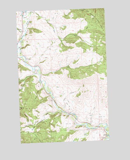
Methow, WA USGS Topographic Map
Click on map above to begin viewing in our Map Viewer.

This topographic map contains these locations and features:
Feature Name Type Latitude Longitude GNIS ID View Map
CarltonPopulated PlaceN48.2482°W120.1162°1517403View Map
Cow CreekStreamN48.1893°W120.0951°1518213View Map
Cumbo FlatFlatN48.1471°W120.0084°1518411View Map
Douglas - Okanogan County Fire District 15 Methow Station 30BuildingN48.1286°W120.0033°2643873View Map
French CreekStreamN48.1376°W120.0023°1519794View Map
Gold CreekStreamN48.1879°W120.0948°1520085View Map
Libby CreekStreamN48.2285°W120.1145°1522050View Map
Lightning Pine Recreational Vehicle ParkLocaleN48.1340°W120.0041°2608236View Map
McCall BasinBasinN48.1704°W120.1009°1522849View Map
McFarland CreekStreamN48.1535°W120.0654°1522894View Map
MethowPopulated PlaceN48.1301°W120.0037°1523030View Map
Methow Census Designated PlaceCensusN48.1287°W120.0056°2586740View Map
Methow Community ChurchChurchN48.1309°W120.0045°2609662View Map
Methow Post OfficePost OfficeN48.1290°W120.0034°2769193View Map
Mills FlatFlatN48.1415°W120.0573°1523197View Map
Morse CanyonValleyN48.1565°W120.0637°1523379View Map
Morse FlatFlatN48.1593°W120.0562°1523382View Map
Mulhollan GulchValleyN48.1351°W120.1065°1523506View Map
North Fork Texas CreekStreamN48.2254°W120.0420°1523859View Map
Petes CreekStreamN48.1382°W120.0312°1524369View Map
Puckett CreekStreamN48.2490°W120.1170°1524680View Map
South Fork Gold CreekStreamN48.1854°W120.1165°1526199View Map
Texas CreekStreamN48.2490°W120.1031°1527020View Map
Vinegar GulchValleyN48.1421°W120.1154°1527716View Map

Note: Coordinates in the location and feature list above are referenced to NAD83 datum.


Copyright (C) 2008-2025 Ryan Niemi / Sunset Dynamics ... All Rights Reserved