TopoQuest Logo
Do you find TopoQuest useful?
Help keep TopoQuest running and adding new maps/features by donating!
Bitcoin:  19c7KJd3qBynnjoSw5npx9KScwjBe4ifkT
Litecoin:  LXs6TkuXGGXo1vDsWCkWVdjQX94eUKd6ui
Home View Maps Find Maps Find Places Resources & Links


Metigoshe Lake, North Dakota Topographic Map

USGS Map Title: Metigoshe Lake, ND
USGS Map MRC: 48100H3
DRG (GeoTIFF) Download: o48100h3.tif


Neighboring USGS Topographic Map Quads:


  Lake Klingenberg, ND  
48100H4
 

  Metigoshe Lake, ND  
48100H3
 

  Boundary Lake, ND  
48100H2
 

  Bottineau, ND  
48100G4
 

  Bottineau SE, ND  
48100G3
 

  Lords Lake, ND  
48100G2


Map MRC Location:

N49°
W101°
N49°
W100°
H8 H7 H6 H5 H4 H3 H2 H1
G8 G7 G6 G5 G4 G3 G2 G1
F8 F7 F6 F5 F4 F3 F2 F1
E8 E7 E6 E5 E4 E3 E2 E1
D8 D7 D6 D5 D4 D3 D2 D1
C8 C7 C6 C5 C4 C3 C2 C1
B8 B7 B6 B5 B4 B3 B2 B1
A8 A7 A6 A5 A4 A3 A2 A1
N48°
W101°
N48°
W100°

Metigoshe Lake, ND USGS 1:24K Topographic Map Preview:
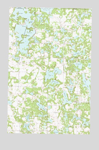
Metigoshe Lake, ND USGS Topographic Map
Click on map above to begin viewing in our Map Viewer.

This topographic map contains these locations and features:
Feature Name Type Latitude Longitude GNIS ID View Map
Bear IslandIslandN48.9939°W100.3624°1034706View Map
Bear LakeLakeN48.8771°W100.3017°1027843View Map
Bittener LakeLakeN48.9937°W100.2602°1028017View Map
Bottineau County Dive RescueBuildingN48.9836°W100.3567°2658778View Map
Bottineau Fire Department Station 2BuildingN48.9836°W100.3567°2658731View Map
Brager LakeLakeN48.9554°W100.2727°1028112View Map
Deep LakeLakeN48.9200°W100.2809°1028639View Map
Fish Lake CemeteryCemeteryN48.9428°W100.2919°2782004View Map
Grigg LakeLakeN48.8822°W100.3456°1029244View Map
Hahn's Bay Recreation AreaParkN48.9699°W100.3638°2749206View Map
Hemming LakeLakeN48.9104°W100.2874°1029397View Map
Hilton School Number 3SchoolN48.9581°W100.3465°1029473View Map
Hilton School Number 5SchoolN48.9145°W100.3490°1029475View Map
Homen State ForestForestN48.9555°W100.2585°2749201View Map
Klebe LakeLakeN48.9776°W100.2931°1029754View Map
Lake BennettLakeN48.9677°W100.3346°1027888View Map
Lake BessieLakeN48.9489°W100.3625°1027920View Map
Lake McDonaldLakeN48.9938°W100.3390°1030140View Map
Lake Metigoshe DamDamN48.9833°W100.3504°1033084View Map
Lake Metigoshe State ParkParkN48.9867°W100.3240°1029801View Map
Lake ThomasLakeN48.9024°W100.3251°1032470View Map
Lee LakeLakeN48.8912°W100.2720°1029855View Map
Long LakeLakeN48.9247°W100.2562°1030000View Map
Long Lake Boat RampLocaleN48.9289°W100.2637°2749213View Map
Loon LakeLakeN48.9347°W100.3091°1030013View Map
Loon Lake School Number 1SchoolN48.9833°W100.2671°1030014View Map
Loon Lake School Number 3SchoolN48.9069°W100.2760°1030015View Map
Loon Lake School Number 5SchoolN48.9503°W100.2754°1030016View Map
Mackay IslandIslandN48.9758°W100.3474°1030060View Map
Masonic IslandIslandN48.9853°W100.3443°1030116View Map
Metigoshe LakeReservoirN48.9793°W100.3536°1035888View Map
Mud LakeLakeN48.9633°W100.3642°1030334View Map
Mud LakeLakeN48.9773°W100.3176°1030335View Map
Norberg LakeLakeN48.9265°W100.2803°1030424View Map
Nordland CemeteryCemeteryN48.9283°W100.3606°2782495View Map
Norland ChurchChurchN48.9286°W100.3607°1030430View Map
Pelican LakeLakeN48.9439°W100.2694°1030662View Map
Pelican Sandy Recreation AreaParkN48.9469°W100.2536°2749214View Map
Rugby PointCapeN48.9720°W100.3476°1031032View Map
Sand LakeLakeN48.9437°W100.2522°1031343View Map
School Section LakeLakeN48.9895°W100.3284°1031989View Map
Sinclair LakeLakeN48.9786°W100.2503°1032101View Map
Sivertson LakeLakeN48.9841°W100.2708°1032107View Map
Smithsrund LakeLakeN48.8905°W100.3445°1035156View Map
South Loon LakeLakeN48.9263°W100.3056°1032195View Map
Squaw PointCapeN48.9886°W100.3504°1032270View Map
The NarrowsGapN48.9808°W100.3482°1032465View Map
Turtle Mountain Adventist CemeteryCemeteryN48.9491°W100.2756°2782480View Map
Vinje CemeteryCemeteryN48.8963°W100.3043°2782012View Map
Vinje Church (historical)ChurchN48.8967°W100.3037°1032648View Map

Note: Coordinates in the location and feature list above are referenced to NAD83 datum.


Copyright (C) 2008-2024 Ryan Niemi / Sunset Dynamics ... All Rights Reserved