TopoQuest Logo
Do you find TopoQuest useful?
Help keep TopoQuest running and adding new maps/features by donating!
Bitcoin:  19c7KJd3qBynnjoSw5npx9KScwjBe4ifkT
Litecoin:  LXs6TkuXGGXo1vDsWCkWVdjQX94eUKd6ui
Home View Maps Find Maps Find Places Resources & Links


Metzel Ranch, Montana Topographic Map

USGS Map Title: Metzel Ranch, MT
USGS Map MRC: 45112B2
DRG (GeoTIFF) Download: o45112b2.tif


Neighboring USGS Topographic Map Quads:


  Beaverhead Rock SE, MT  
45112C3
 

  Laurin Canyon, MT  
45112C2
 

  Alder, MT  
45112C1
 

  Mine Gulch, MT  
45112B3
 

  Metzel Ranch, MT  
45112B2
 

  Ruby Dam, MT  
45112B1
 

  Red Canyon, MT  
45112A3
 

  Belmont Park Ranch, MT  
45112A2
 

  Home Park Ranch, MT  
45112A1


Map MRC Location:

N46°
W113°
N46°
W112°
H8 H7 H6 H5 H4 H3 H2 H1
G8 G7 G6 G5 G4 G3 G2 G1
F8 F7 F6 F5 F4 F3 F2 F1
E8 E7 E6 E5 E4 E3 E2 E1
D8 D7 D6 D5 D4 D3 D2 D1
C8 C7 C6 C5 C4 C3 C2 C1
B8 B7 B6 B5 B4 B3 B2 B1
A8 A7 A6 A5 A4 A3 A2 A1
N45°
W113°
N45°
W112°

Metzel Ranch, MT USGS 1:24K Topographic Map Preview:
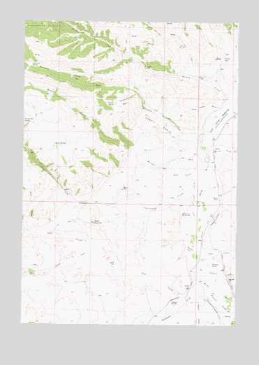
Metzel Ranch, MT USGS Topographic Map
Click on map above to begin viewing in our Map Viewer.

This topographic map contains these locations and features:
Feature Name Type Latitude Longitude GNIS ID View Map
07S04W31CDDC01 SpringSpringN45.1755°W112.1417°808313View Map
07S04W31DCB_01 WellWellN45.1802°W112.1386°808323View Map
08S04W06ABBA01 WellWellN45.1738°W112.1375°808307View Map
08S05W01AACC01 SpringSpringN45.1714°W112.1529°808299View Map
08S05W01AACC02 SpringSpringN45.1716°W112.1528°808302View Map
Antelope BasinBasinN45.2169°W112.1925°768270View Map
Antelope SpringSpringN45.2162°W112.1983°768309View Map
Ball PlacePopulated PlaceN45.1413°W112.1519°768482View Map
Barrel SpringsSpringN45.2005°W112.2333°768525View Map
Broadhead SloughStreamN45.1588°W112.1528°769229View Map
Brunzell SloughStreamN45.1408°W112.1417°769305View Map
Buffalo JumpsCliffN45.1694°W112.1389°769356View Map
Bum CreekStreamN45.1655°W112.2497°769391View Map
Burdick PlacePopulated PlaceN45.1749°W112.2133°769402View Map
Caldwell SpringsSpringN45.1350°W112.1616°769502View Map
Campbell PlacePopulated PlaceN45.1502°W112.1967°769554View Map
Cottonwood CreekStreamN45.1799°W112.1500°770162View Map
Fitzpatrick SpringSpringN45.2085°W112.2475°771410View Map
Fossil BasinBasinN45.2077°W112.1722°771532View Map
Garden CreekStreamN45.2202°W112.1308°771704View Map
Idaho CreekStreamN45.1974°W112.1428°785216View Map
Jack CreekStreamN45.1566°W112.1486°785369View Map
Jasmine CreekStreamN45.1516°W112.1475°785426View Map
Kelly Hill MineMineN45.1466°W112.1392°804564View Map
Kingrey PlacePopulated PlaceN45.2266°W112.1458°768042View Map
Leonard PlaceLocaleN45.2308°W112.1797°768041View Map
Lightning SpringSpringN45.2319°W112.2464°773334View Map
Maloney RanchLocaleN45.1774°W112.1369°773849View Map
Metzel RanchLocaleN45.1974°W112.1400°774118View Map
Metzel West Side DitchCanalN45.1771°W112.1517°774119View Map
Mormon CreekStreamN45.1885°W112.1453°774388View Map
Mud SpringSpringN45.1811°W112.1898°774469View Map
Peschi DrawValleyN45.1363°W112.1480°775166View Map
Peterson CreekStreamN45.2041°W112.1450°775172View Map
Peterson Creek MineMineN45.2188°W112.1692°804541View Map
Pioneer DitchCanalN45.1669°W112.1430°775260View Map
Puller Hot SpringsSpringN45.1710°W112.1539°775487View Map
Puller Hot Springs (historical)LocaleN45.1716°W112.1542°1797461View Map
Puller Springs Post Office (historical)Post OfficeN45.1749°W112.1500°1797463View Map
Puller Springs School (historical)SchoolN45.1749°W112.1500°1797462View Map
Ruby River ReservoirReservoirN45.2208°W112.1267°789841View Map
Sage CreekStreamN45.1385°W112.1522°776075View Map
Slate Stone (historical)LocaleN45.1708°W112.1536°1797603View Map
South Fork Sage CreekStreamN45.1560°W112.2030°776866View Map
Spring CreekStreamN45.2258°W112.1461°777014View Map
Stinking Water (historical)LocaleN45.1916°W112.1425°1797597View Map
Sweetwater CreekStreamN45.1444°W112.1494°777371View Map
Table MountainSummitN45.1674°W112.2089°777398View Map
Thompson SpringSpringN45.1495°W112.1398°777591View Map
Trudau LakeLakeN45.2344°W112.1343°777784View Map
Tucker GulchValleyN45.2146°W112.1347°777794View Map
Upper Ruby CemeteryCemeteryN45.1519°W112.1461°777936View Map
Upper Ruby School (historical)SchoolN45.1435°W112.1292°777937View Map
Warm SpringsSpringN45.2351°W112.1359°778113View Map

Note: Coordinates in the location and feature list above are referenced to NAD83 datum.


Copyright (C) 2008-2025 Ryan Niemi / Sunset Dynamics ... All Rights Reserved