TopoQuest Logo
Do you find TopoQuest useful?
Help keep TopoQuest running and adding new maps/features by donating!
Bitcoin:  19c7KJd3qBynnjoSw5npx9KScwjBe4ifkT
Litecoin:  LXs6TkuXGGXo1vDsWCkWVdjQX94eUKd6ui
Home View Maps Find Maps Find Places Resources & Links


Mexican Hat, Utah Topographic Map

USGS Map Title: Mexican Hat, UT
USGS Map MRC: 37109B7
DRG (GeoTIFF) Download: o37109b7.tif


Neighboring USGS Topographic Map Quads:


  Cedar Mesa South, UT  
37109C8
 

  Cigarette Spring Cave, UT  
37109C7
 

  Bluff SW, UT  
37109C6
 

  The Goosenecks, UT  
37109B8
 

  Mexican Hat, UT  
37109B7
 

  San Juan Hill, UT  
37109B6
 

  Mexican Hat SW, UT  
37109A8
 

  Mexican Hat SE, UT  
37109A7
 

  Moses Rock, UT  
37109A6


Map MRC Location:

N38°
W110°
N38°
W109°
H8 H7 H6 H5 H4 H3 H2 H1
G8 G7 G6 G5 G4 G3 G2 G1
F8 F7 F6 F5 F4 F3 F2 F1
E8 E7 E6 E5 E4 E3 E2 E1
D8 D7 D6 D5 D4 D3 D2 D1
C8 C7 C6 C5 C4 C3 C2 C1
B8 B7 B6 B5 B4 B3 B2 B1
A8 A7 A6 A5 A4 A3 A2 A1
N37°
W110°
N37°
W109°

Mexican Hat, UT USGS 1:24K Topographic Map Preview:
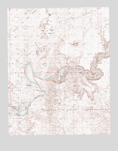
Mexican Hat, UT USGS Topographic Map
Click on map above to begin viewing in our Map Viewer.

This topographic map contains these locations and features:
Feature Name Type Latitude Longitude GNIS ID View Map
Devils WindowGapN37.2272°W109.8307°1435009View Map
Eight Foot RapidsRapidsN37.1850°W109.7854°1435010View Map
Flag ButteSummitN37.2281°W109.8201°1427981View Map
Gypsum CreekStreamN37.1453°W109.8598°1428458View Map
Gypsum Creek RapidsRapidsN37.1453°W109.8626°1435015View Map
Halgaitoh WashValleyN37.1250°W109.8640°1425010View Map
Ledge RapidsRapidsN37.1828°W109.8124°1435017View Map
Lime CreekStreamN37.1836°W109.8385°1429615View Map
Mexican HatPopulated PlaceN37.1519°W109.8671°1430248View Map
Mexican Hat Census Designated PlaceCensusN37.1731°W109.8731°2408827View Map
Mexican Hat Post OfficePost OfficeN37.1491°W109.8601°2769107View Map
Mexican Hat RockPillarN37.1742°W109.8487°1430249View Map
Raplee RidgeRidgeN37.1883°W109.8154°1431577View Map
San Juan CanyonValleyN37.1861°W109.7851°1432171View Map
San Juan Fire Department - Mexican Hat StationBuildingN37.1507°W109.8586°2768482View Map
Scotchman ButteSummitN37.2253°W109.8321°1432281View Map
Seven SailorsPillarN37.2433°W109.8243°1432336View Map
Soda BasinBasinN37.1914°W109.8021°1432616View Map
Soda Spring (historical)SpringN37.1814°W109.8126°1432618View Map
SugarloafSummitN37.2142°W109.7940°1433028View Map
The NarrowsValleyN37.1903°W109.7971°1433370View Map
Valles Trailer ParkParkN37.1506°W109.8590°1436567View Map
West Fork Lime CreekStreamN37.2333°W109.8215°1434076View Map

Note: Coordinates in the location and feature list above are referenced to NAD83 datum.


Copyright (C) 2008-2025 Ryan Niemi / Sunset Dynamics ... All Rights Reserved