TopoQuest Logo
Do you find TopoQuest useful?
Help keep TopoQuest running and adding new maps/features by donating!
Bitcoin:  19c7KJd3qBynnjoSw5npx9KScwjBe4ifkT
Litecoin:  LXs6TkuXGGXo1vDsWCkWVdjQX94eUKd6ui
Home View Maps Find Maps Find Places Resources & Links


Middlesex, North Carolina Topographic Map

USGS Map Title: Middlesex, NC
USGS Map MRC: 35078G2
DRG (GeoTIFF) Download: o35078g2.tif


Neighboring USGS Topographic Map Quads:


  Bunn West, NC  
35078H3
 

  Bunn East, NC  
35078H2
 

  Spring Hope, NC  
35078H1
 

  Zebulon, NC  
35078G3
 

  Middlesex, NC  
35078G2
 

  Bailey, NC  
35078G1
 

  Flowers, NC  
35078F3
 

  Stancils Chapel, NC  
35078F2
 

  Lucama, NC  
35078F1


Map MRC Location:

N36°
W79°
N36°
W78°
H8 H7 H6 H5 H4 H3 H2 H1
G8 G7 G6 G5 G4 G3 G2 G1
F8 F7 F6 F5 F4 F3 F2 F1
E8 E7 E6 E5 E4 E3 E2 E1
D8 D7 D6 D5 D4 D3 D2 D1
C8 C7 C6 C5 C4 C3 C2 C1
B8 B7 B6 B5 B4 B3 B2 B1
A8 A7 A6 A5 A4 A3 A2 A1
N35°
W79°
N35°
W78°

Middlesex, NC USGS 1:24K Topographic Map Preview:
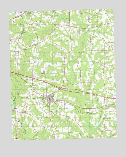
Middlesex, NC USGS Topographic Map
Click on map above to begin viewing in our Map Viewer.

This topographic map contains these locations and features:
Feature Name Type Latitude Longitude GNIS ID View Map
Big BranchStreamN35.7879°W78.1639°981344View Map
Camp BranchStreamN35.7763°W78.1436°1023873View Map
Camp CharlesLocaleN35.7604°W78.1478°982512View Map
Camp Charles LakeReservoirN35.7630°W78.1486°999367View Map
Camp Charles Lake DamDamN35.7602°W78.1497°999366View Map
Cattail BranchStreamN35.7738°W78.1978°982768View Map
Chamblees BridgeBridgeN35.8524°W78.2169°1006881View Map
Cone BridgeBridgeN35.8615°W78.1961°1006882View Map
Corbetts Pond Number OneReservoirN35.8002°W78.2091°999462View Map
Corbetts Pond Number One DamDamN35.8002°W78.2081°999461View Map
Creech BridgeBridgeN35.7685°W78.2414°1006872View Map
Creek School (historical)SchoolN35.7585°W78.1967°1951129View Map
Deans School (historical)SchoolN35.8288°W78.1853°1006876View Map
Driving BranchStreamN35.8518°W78.1597°984334View Map
Dry WellsLocaleN35.8007°W78.2236°984370View Map
Ferrells Volunteer Fire and Rescue DepartmentBuildingN35.8597°W78.1777°2639352View Map
Friendship ChurchChurchN35.7518°W78.2444°985446View Map
Haw BranchStreamN35.7579°W78.1525°986510View Map
JW Stone AirportAirportN35.8438°W78.1781°997984View Map
Lee ChapelChurchN35.7774°W78.2356°988295View Map
Little CreekStreamN35.7924°W78.2439°988589View Map
Mammings School (historical)SchoolN35.7902°W78.1522°1006874View Map
Mannings Store (historical)LocaleN35.7888°W78.1383°1951201View Map
MiddlesexPopulated PlaceN35.7902°W78.2039°1021436View Map
Middlesex CemeteryCemeteryN35.7793°W78.2033°989805View Map
Middlesex ChurchChurchN35.8468°W78.1761°989806View Map
Middlesex Elementary SchoolSchoolN35.7868°W78.2128°1006927View Map
Middlesex Memorial GardensCemeteryN35.7765°W78.1958°989807View Map
Middlesex Post OfficePost OfficeN35.7872°W78.2043°2774317View Map
Middlesex Volunteer Fire DepartmentBuildingN35.7884°W78.2055°2638290View Map
Morgan School (historical)SchoolN35.8202°W78.1367°1006875View Map
Murrays Mill (historical)LocaleN35.8652°W78.1778°1006878View Map
Murrays MillpondReservoirN35.8657°W78.1778°990815View Map
Murrays Pond DamDamN35.8657°W78.1778°999608View Map
MurraytownPopulated PlaceN35.8365°W78.2394°1021595View Map
Old Stanhope (historical)Populated PlaceN35.8613°W78.1280°1951494View Map
Press ProngStreamN35.8682°W78.1889°992786View Map
Rock Springs ChurchChurchN35.7824°W78.1333°993530View Map
Rocky CrossPopulated PlaceN35.8632°W78.2219°993580View Map
Rocky Cross ChurchChurchN35.8732°W78.2228°993581View Map
Rocky cross Church CemeteryCemeteryN35.8731°W78.2234°2779135View Map
Rogers CrossroadsPopulated PlaceN35.7860°W78.2169°993649View Map
Saint Bethel ChurchChurchN35.7865°W78.1972°993874View Map
Saint Marys ChurchChurchN35.8082°W78.1314°994032View Map
SamariaPopulated PlaceN35.8599°W78.1783°1022473View Map
Samaria Baptist ChurchChurchN35.8602°W78.1791°2746099View Map
Social PlainsPopulated PlaceN35.8482°W78.2475°995089View Map
Social Plains ChurchChurchN35.8465°W78.2481°1008405View Map
Stokes ChapelChurchN35.8029°W78.2231°995528View Map
Stokes School (historical)SchoolN35.8279°W78.2214°1006883View Map
Stony Hill ChurchChurchN35.8035°W78.1703°995570View Map
Stricklands Store (historical)LocaleN35.8421°W78.1347°1951231View Map
Taylors CrossroadsLocaleN35.8349°W78.1369°1006880View Map
Taylors Mill (historical)LocaleN35.7796°W78.2478°1006871View Map
Taylors MillpondReservoirN35.7817°W78.2477°999417View Map
Taylors Millpond DamDamN35.7802°W78.2481°999418View Map
Town of MiddlesexCivilN35.7894°W78.2048°2406157View Map
Township of Dry WellsCivilN35.7917°W78.2066°1026980View Map
Underwoods MillLocaleN35.7802°W78.1350°1006879View Map
Union HopePopulated PlaceN35.8427°W78.2194°1023041View Map
Union Hope ChapelChurchN35.8379°W78.2325°996505View Map
Union Hope School (historical)SchoolN35.8410°W78.2261°1951240View Map
White Oak Church (historical)ChurchN35.8557°W78.1658°1951340View Map
Whitleys CrossroadsLocaleN35.8563°W78.1555°1006877View Map
Wilder BridgeBridgeN35.7543°W78.2208°1006873View Map
Wolfharbor BranchStreamN35.8638°W78.2325°997548View Map

Note: Coordinates in the location and feature list above are referenced to NAD83 datum.


Copyright (C) 2008-2024 Ryan Niemi / Sunset Dynamics ... All Rights Reserved