TopoQuest Logo
Do you find TopoQuest useful?
Help keep TopoQuest running and adding new maps/features by donating!
Bitcoin:  19c7KJd3qBynnjoSw5npx9KScwjBe4ifkT
Litecoin:  LXs6TkuXGGXo1vDsWCkWVdjQX94eUKd6ui
Home View Maps Find Maps Find Places Resources & Links


Beauty Mountain, California Topographic Map

USGS Map Title: Beauty Mountain, CA
USGS Map MRC: 33116D6
DRG (GeoTIFF) Download: o33116d6.tif


Neighboring USGS Topographic Map Quads:


  Cahuilla Mountain, CA  
33116E7
 

  Anza, CA  
33116E6
 

  Butterfly Peak, CA  
33116E5
 

  Aguanga, CA  
33116D7
 

  Beauty Mountain, CA  
33116D6
 

  Bucksnort Mountain, CA  
33116D5
 

  Palomar Observatory, CA  
33116C7
 

  Warner Springs, CA  
33116C6
 

  Hot Springs Mountain, CA  
33116C5


Map MRC Location:

N34°
W117°
N34°
W116°
H8 H7 H6 H5 H4 H3 H2 H1
G8 G7 G6 G5 G4 G3 G2 G1
F8 F7 F6 F5 F4 F3 F2 F1
E8 E7 E6 E5 E4 E3 E2 E1
D8 D7 D6 D5 D4 D3 D2 D1
C8 C7 C6 C5 C4 C3 C2 C1
B8 B7 B6 B5 B4 B3 B2 B1
A8 A7 A6 A5 A4 A3 A2 A1
N33°
W117°
N33°
W116°

Beauty Mountain, CA USGS 1:24K Topographic Map Preview:
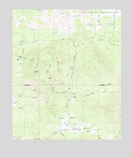
Beauty Mountain, CA USGS Topographic Map
Click on map above to begin viewing in our Map Viewer.

This topographic map contains these locations and features:
Feature Name Type Latitude Longitude GNIS ID View Map
Adobe SpringsSpringN33.3952°W116.6967°238431View Map
Beauty MountainSummitN33.4489°W116.7175°239131View Map
Beauty Mountain WildernessReserveN33.4446°W116.7207°2760086View Map
Beauty PeakSummitN33.4395°W116.7239°239132View Map
Boden FieldFlatN33.3825°W116.6647°239529View Map
C R and H TrailTrailN33.3764°W116.6509°239919View Map
Chihuahua ValleyValleyN33.3936°W116.6936°270417View Map
Cooper CanyonValleyN33.4159°W116.7150°240890View Map
Cooper CienegaSwampN33.4159°W116.6822°240893View Map
Cooper Cienega Truck TrailTrailN33.4567°W116.6767°240894View Map
Dick SpringSpringN33.4052°W116.7399°241493View Map
Iron SpringSpringN33.4290°W116.6950°243896View Map
Iron Spring CanyonValleyN33.4223°W116.6872°243901View Map
Iron Spring MountainSummitN33.4534°W116.6972°243902View Map
Lone Pine ReservoirReservoirN33.4278°W116.6416°245044View Map
Million Dollar CanyonValleyN33.4645°W116.7397°245943View Map
Million Dollar SpringSpringN33.4542°W116.7392°245944View Map
Mitchell CampLocaleN33.3953°W116.6836°246040View Map
Pawnee MineMineN33.4248°W116.7047°247314View Map
Previtt CanyonValleyN33.3756°W116.7367°273122View Map
Rock PileSummitN33.4514°W116.7425°1661320View Map
Talmadge CanyonValleyN33.4236°W116.7064°250241View Map
Talmadge SpringSpringN33.4344°W116.7095°250242View Map
Twin LakesLakeN33.4182°W116.6665°250743View Map
Twin LakesLakeN33.4186°W116.6824°250744View Map

Note: Coordinates in the location and feature list above are referenced to NAD83 datum.


Copyright (C) 2008-2024 Ryan Niemi / Sunset Dynamics ... All Rights Reserved