TopoQuest Logo
Do you find TopoQuest useful?
Help keep TopoQuest running and adding new maps/features by donating!
Bitcoin:  19c7KJd3qBynnjoSw5npx9KScwjBe4ifkT
Litecoin:  LXs6TkuXGGXo1vDsWCkWVdjQX94eUKd6ui
Home View Maps Find Maps Find Places Resources & Links


Middletown, North Carolina Topographic Map

USGS Map Title: Middletown, NC
USGS Map MRC: 35076C1
DRG (GeoTIFF) Download: o35076c1.tif


Neighboring USGS Topographic Map Quads:


  Fairfield, NC  
35076E2
 

  Engelhard West, NC  
35076E1
 

  Engelhard East, NC  
35075E8


  Middletown, NC  
35076C1


Map MRC Location:

N36°
W77°
N36°
W76°
H8 H7 H6 H5 H4 H3 H2 H1
G8 G7 G6 G5 G4 G3 G2 G1
F8 F7 F6 F5 F4 F3 F2 F1
E8 E7 E6 E5 E4 E3 E2 E1
D8 D7 D6 D5 D4 D3 D2 D1
C8 C7 C6 C5 C4 C3 C2 C1
B8 B7 B6 B5 B4 B3 B2 B1
A8 A7 A6 A5 A4 A3 A2 A1
N35°
W77°
N35°
W76°

Middletown, NC USGS 1:24K Topographic Map Preview:
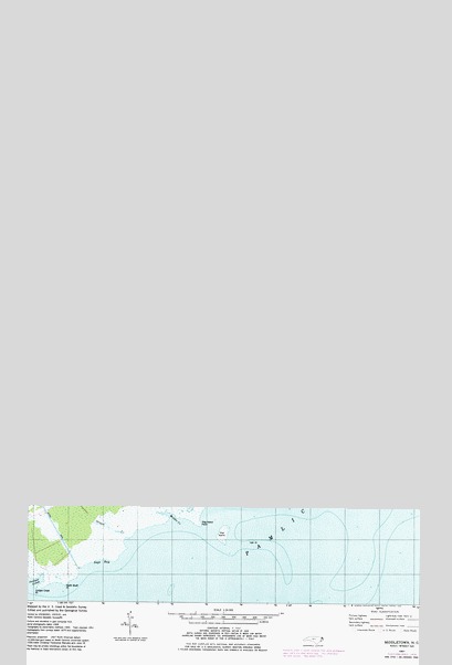
Middletown, NC USGS Topographic Map
Click on map above to begin viewing in our Map Viewer.

This topographic map contains these locations and features:
Feature Name Type Latitude Longitude GNIS ID View Map
Amity ChurchChurchN35.4877°W76.0399°980165View Map
Bensons PointCapeN35.3821°W76.0610°981015View Map
Brooks CreekCanalN35.4449°W76.0246°981975View Map
Browns IslandIslandN35.3982°W76.0724°982040View Map
Douglas BayBayN35.4177°W76.0616°984303View Map
Feds CreekStreamN35.4449°W76.0146°985029View Map
Gray DitchCanalN35.4599°W76.0752°985986View Map
Green PointCapeN35.4127°W76.0602°986076View Map
Gull RocksBarN35.3760°W76.0143°1023622View Map
GulrockPopulated PlaceN35.4143°W76.0896°1020576View Map
Hickory CreekStreamN35.3985°W76.0791°986693View Map
Hickory Creek BayBayN35.3963°W76.0788°986696View Map
Hillerys CoveBayN35.4160°W76.0180°986813View Map
Hog IslandIslandN35.3679°W76.0624°986881View Map
Hog Island PointCapeN35.3704°W76.0702°986888View Map
Hog Island ShoalBarN35.3652°W76.0491°1023623View Map
Jeanette CreekBayN35.4474°W76.0107°987535View Map
Jeanette HammockIslandN35.4543°W76.0063°987537View Map
Juniper CreekBayN35.3541°W76.1219°987843View Map
Juniper Creek PointCapeN35.3535°W76.1205°987852View Map
Lake LandingPopulated PlaceN35.4799°W76.0763°1023650View Map
Last ChancePopulated PlaceN35.4524°W76.0755°1021102View Map
Lone Tree CreekBayN35.4246°W76.0305°988873View Map
Long PointCapeN35.4177°W76.0252°988989View Map
Mackey PointCapeN35.4210°W76.0513°989212View Map
Middle CreekBayN35.3732°W76.0805°989768View Map
MiddletownPopulated PlaceN35.4782°W76.0121°989808View Map
Mount Pheasant BayBayN35.3910°W76.0732°1023624View Map
Mount PleasantPopulated PlaceN35.4152°W76.0830°1021555View Map
NebraskaPopulated PlaceN35.4577°W76.0632°1021607View Map
North Bluff PointCapeN35.3543°W76.1124°991197View Map
Old Hill BayBayN35.4041°W76.0749°991565View Map
Pleasant Grove ChurchChurchN35.4929°W76.0377°992477View Map
Rose CanalCanalN35.4485°W76.1219°993687View Map
Sage BayBayN35.3604°W76.1010°993846View Map
Sanger CreekGutN35.3693°W76.0991°994336View Map
SlocumPopulated PlaceN35.4560°W76.0891°1022668View Map
White PlainsPopulated PlaceN35.4516°W76.0294°1023207View Map
Wysocking BayBayN35.4082°W76.0496°997673View Map

Note: Coordinates in the location and feature list above are referenced to NAD83 datum.


Copyright (C) 2008-2025 Ryan Niemi / Sunset Dynamics ... All Rights Reserved