TopoQuest Logo
Do you find TopoQuest useful?
Help keep TopoQuest running and adding new maps/features by donating!
Bitcoin:  19c7KJd3qBynnjoSw5npx9KScwjBe4ifkT
Litecoin:  LXs6TkuXGGXo1vDsWCkWVdjQX94eUKd6ui
Home View Maps Find Maps Find Places Resources & Links


Miles, Texas Topographic Map

USGS Map Title: Miles, TX
USGS Map MRC: 31100E2
DRG (GeoTIFF) Download: o31100e2.tif


Neighboring USGS Topographic Map Quads:


  Tennyson, TX  
31100F3
 

  Miles NW, TX  
31100F2
 

  Rowena, TX  
31100F1
 

  Harriet, TX  
31100E3
 

  Miles, TX  
31100E2
 

  Lowake, TX  
31100E1
 

  Veribest, TX  
31100D3
 

  Mereta, TX  
31100D2
 

  Eola, TX  
31100D1


Map MRC Location:

N32°
W101°
N32°
W100°
H8 H7 H6 H5 H4 H3 H2 H1
G8 G7 G6 G5 G4 G3 G2 G1
F8 F7 F6 F5 F4 F3 F2 F1
E8 E7 E6 E5 E4 E3 E2 E1
D8 D7 D6 D5 D4 D3 D2 D1
C8 C7 C6 C5 C4 C3 C2 C1
B8 B7 B6 B5 B4 B3 B2 B1
A8 A7 A6 A5 A4 A3 A2 A1
N31°
W101°
N31°
W100°

Miles, TX USGS 1:24K Topographic Map Preview:
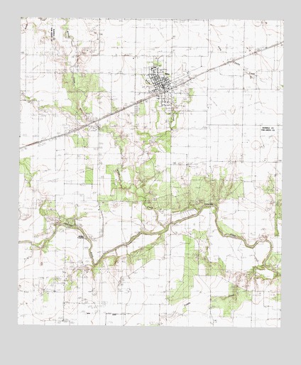
Miles, TX USGS Topographic Map
Click on map above to begin viewing in our Map Viewer.

This topographic map contains these locations and features:
Feature Name Type Latitude Longitude GNIS ID View Map
Battle CreekStreamN31.5552°W100.1945°1351597View Map
City of MilesCivilN31.6006°W100.1853°2411104View Map
J Thiele BuildingBuildingN31.5985°W100.1837°2030966View Map
Jeschke DamDamN31.5344°W100.1372°1860448View Map
Jeschke LakeReservoirN31.5335°W100.1370°1860449View Map
MilesPopulated PlaceN31.5974°W100.1823°1362837View Map
Miles CemeteryCemeteryN31.5888°W100.1948°1362838View Map
Miles City HallBuildingN31.5982°W100.1824°2753684View Map
Miles Post OfficePost OfficeN31.5996°W100.1830°2731260View Map
Mullins CemeteryCemeteryN31.5199°W100.2201°1363472View Map
Mullins CrossingPopulated PlaceN31.5363°W100.2184°1380226View Map
Puddle CreekStreamN31.5246°W100.1343°1365843View Map
Seventeen Mile CrossingPopulated PlaceN31.5471°W100.1643°1380518View Map
Sikes SchoolLocaleN31.5571°W100.2140°1368268View Map
Sixteen Mile CrossingPopulated PlaceN31.5421°W100.1784°1380550View Map
Soil Conservation Service Site Number 2 DamDamN31.6218°W100.2470°1863598View Map
Soil Conservation Service Site Number 2 ReservoirReservoirN31.6220°W100.2486°1863599View Map
Stoker LakeReservoirN31.5802°W100.1870°1864267View Map
Stoker Lake DamDamN31.5802°W100.1870°1864266View Map
Willow CreekStreamN31.5399°W100.1812°1376818View Map

Note: Coordinates in the location and feature list above are referenced to NAD83 datum.


Copyright (C) 2008-2025 Ryan Niemi / Sunset Dynamics ... All Rights Reserved