TopoQuest Logo
Do you find TopoQuest useful?
Help keep TopoQuest running and adding new maps/features by donating!
Bitcoin:  19c7KJd3qBynnjoSw5npx9KScwjBe4ifkT
Litecoin:  LXs6TkuXGGXo1vDsWCkWVdjQX94eUKd6ui
Home View Maps Find Maps Find Places Resources & Links


Mill Point, Montana Topographic Map

USGS Map Title: Mill Point, MT
USGS Map MRC: 45113B1
DRG (GeoTIFF) Download: o45113b1.tif


Neighboring USGS Topographic Map Quads:


  Tash Peak, MT  
45113C2
 

  Polaris, MT  
45113C1
 

  Ermont, MT  
45112C8
 

  Brays Canyon, MT  
45113B2
 

  Mill Point, MT  
45113B1
 

  Bannack, MT  
45112B8
 

  Bachelor Mountain, MT  
45113A2
 

  Grant, MT  
45113A1
 

  Eli Spring, MT  
45112A8


Map MRC Location:

N46°
W114°
N46°
W113°
H8 H7 H6 H5 H4 H3 H2 H1
G8 G7 G6 G5 G4 G3 G2 G1
F8 F7 F6 F5 F4 F3 F2 F1
E8 E7 E6 E5 E4 E3 E2 E1
D8 D7 D6 D5 D4 D3 D2 D1
C8 C7 C6 C5 C4 C3 C2 C1
B8 B7 B6 B5 B4 B3 B2 B1
A8 A7 A6 A5 A4 A3 A2 A1
N45°
W114°
N45°
W113°

Mill Point, MT USGS 1:24K Topographic Map Preview:
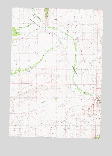
Mill Point, MT USGS Topographic Map
Click on map above to begin viewing in our Map Viewer.

This topographic map contains these locations and features:
Feature Name Type Latitude Longitude GNIS ID View Map
07S12W14CDDD01 WellWellN45.2210°W113.0389°808488View Map
07S12W17CDBC01 WellWellN45.2230°W113.1042°808495View Map
07S12W22ABBB01 WellWellN45.2196°W113.0589°808481View Map
07S12W22ABCC01 WellWellN45.2174°W113.0578°808469View Map
07S12W22BAAD01 WellWellN45.2188°W113.0606°808479View Map
08S12W01DABC01 WellWellN45.1685°W113.0131°808280View Map
08S12W07ABBC01 WellWellN45.1608°W113.1206°808238View Map
08S12W23BBBA01 WellWellN45.1330°W113.0459°808098View Map
08S12W23BBBB01 WellWellN45.1333°W113.0473°808100View Map
08S39E14CBBD01 WellWellN45.2266°W113.0473°808501View Map
Bannack CampgroundLocaleN45.1649°W113.0042°1797189View Map
Bannack CemeteryCemeteryN45.1743°W113.0152°779331View Map
Bannack State Park MineMineN45.1666°W113.0009°802306View Map
Buffalo CreekStreamN45.2238°W113.0473°780538View Map
Christensen RanchLocaleN45.1516°W113.0936°781250View Map
Cottonwood CreekStreamN45.2238°W113.0448°781734View Map
Dyce CreekStreamN45.2255°W113.0509°782745View Map
Grasshopper ValleyValleyN45.1680°W113.0156°793905View Map
Hayes CreekStreamN45.2327°W113.0828°801876View Map
Hendricks/Apex Mill SiteMineN45.1499°W113.0009°802307View Map
Mill PointCliffN45.2438°W113.0762°787392View Map
Mill Point (historical)LocaleN45.2305°W113.0814°1797372View Map
Mill Point School (historical)SchoolN45.2263°W113.0856°787394View Map
North Fork Hayes CreekStreamN45.2199°W113.1173°788178View Map
Old Knoll HomesteadLocaleN45.2491°W113.0186°788418View Map
Placer MinesMineN45.1630°W113.0123°788979View Map
Reservoir CreekStreamN45.1680°W113.0159°789537View Map
Sagebrush CreekStreamN45.1671°W113.0086°789919View Map
South Fork Hayes CreekStreamN45.2194°W113.1159°790978View Map
Swamp CreekStreamN45.2369°W113.0870°791761View Map
Taylor CreekStreamN45.1874°W113.0381°791910View Map

Note: Coordinates in the location and feature list above are referenced to NAD83 datum.


Copyright (C) 2008-2024 Ryan Niemi / Sunset Dynamics ... All Rights Reserved