TopoQuest Logo
Do you find TopoQuest useful?
Help keep TopoQuest running and adding new maps/features by donating!
Bitcoin:  19c7KJd3qBynnjoSw5npx9KScwjBe4ifkT
Litecoin:  LXs6TkuXGGXo1vDsWCkWVdjQX94eUKd6ui
Home View Maps Find Maps Find Places Resources & Links


Millstone Lake, North Carolina Topographic Map

USGS Map Title: Millstone Lake, NC
USGS Map MRC: 35079A6
DRG (GeoTIFF) Download: o35079a6.tif


Neighboring USGS Topographic Map Quads:


  Harrisville, NC  
35079B7
 

  Norman, NC  
35079B6
 

  West End, NC  
35079B5
 

  Ellerbe, NC  
35079A7
 

  Millstone Lake, NC  
35079A6
 

  Hoffman, NC  
35079A5
 

  Rockingham, NC  
34079H7
 

  Hamlet, NC  
34079H6
 

  Marston, NC  
34079H5


Map MRC Location:

N36°
W80°
N36°
W79°
H8 H7 H6 H5 H4 H3 H2 H1
G8 G7 G6 G5 G4 G3 G2 G1
F8 F7 F6 F5 F4 F3 F2 F1
E8 E7 E6 E5 E4 E3 E2 E1
D8 D7 D6 D5 D4 D3 D2 D1
C8 C7 C6 C5 C4 C3 C2 C1
B8 B7 B6 B5 B4 B3 B2 B1
A8 A7 A6 A5 A4 A3 A2 A1
N35°
W80°
N35°
W79°

Millstone Lake, NC USGS 1:24K Topographic Map Preview:
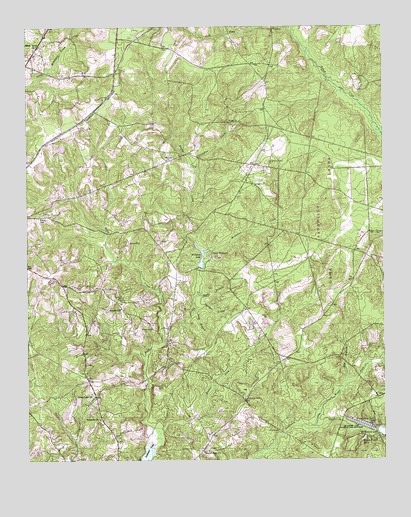
Millstone Lake, NC USGS Topographic Map
Click on map above to begin viewing in our Map Viewer.

This topographic map contains these locations and features:
Feature Name Type Latitude Longitude GNIS ID View Map
Beaver Dam CemeteryCemeteryN35.0026°W79.6878°1731881View Map
Beaver Dam ChurchChurchN35.0024°W79.6884°980807View Map
Beaver Dam CreekStreamN35.0077°W79.7042°980809View Map
Bells CreekStreamN35.0349°W79.7023°980962View Map
Big BranchStreamN35.0224°W79.6381°981327View Map
Bones ForkStreamN35.0096°W79.6495°981715View Map
Camp MillstoneLocaleN35.0590°W79.6856°982541View Map
Ellerbe CemeteryCemeteryN35.0701°W79.7459°984723View Map
Gibson CemeteryCemeteryN35.0088°W79.6617°985669View Map
Gibson CemeteryCemeteryN35.0382°W79.7064°985670View Map
Green Lake Acres PondReservoirN35.0173°W79.7322°998307View Map
Green Lake Acres Pond DamDamN35.0168°W79.7314°998306View Map
Green Lake CemeteryCemeteryN35.0190°W79.7270°1731883View Map
Green Lake ChurchChurchN35.0188°W79.7264°986064View Map
Juniper CreekStreamN35.0440°W79.6912°987844View Map
Lincoln SchoolSchoolN35.0179°W79.6737°988498View Map
Line BranchStreamN35.0432°W79.6914°988508View Map
McKinney Lake DamDamN35.0082°W79.6273°998296View Map
McLean CemeteryCemeteryN35.0868°W79.7006°1731888View Map
McLean ChurchChurchN35.0863°W79.7006°989610View Map
Millstone CreekStreamN35.0602°W79.6878°990031View Map
Millstone LakeReservoirN35.0570°W79.6886°990034View Map
Paradise CreekStreamN35.0838°W79.6900°991844View Map
Reedy BranchStreamN35.0479°W79.6900°993171View Map
Richards ChurchChurchN35.0121°W79.7248°993305View Map
Richmond CountyCivilN35.0060°W79.7478°1008581View Map
Rocky Ford BranchStreamN35.1232°W79.6564°993588View Map
Rourks CemeteryCemeteryN35.0440°W79.7173°1731890View Map
Rourks ChurchChurchN35.0438°W79.7173°993762View Map
Sandy Level ChurchChurchN35.1196°W79.7459°994288View Map
Township of Mineral SpringsCivilN35.1081°W79.7372°1027097View Map
Watson CemeteryCemeteryN35.0629°W79.7139°996865View Map
Woods Pond Number 1ReservoirN35.0110°W79.6315°1023696View Map
Woods Pond Number 2ReservoirN35.0062°W79.6323°1023697View Map

Note: Coordinates in the location and feature list above are referenced to NAD83 datum.


Copyright (C) 2008-2025 Ryan Niemi / Sunset Dynamics ... All Rights Reserved