TopoQuest Logo
Do you find TopoQuest useful?
Help keep TopoQuest running and adding new maps/features by donating!
Bitcoin:  19c7KJd3qBynnjoSw5npx9KScwjBe4ifkT
Litecoin:  LXs6TkuXGGXo1vDsWCkWVdjQX94eUKd6ui
Home View Maps Find Maps Find Places Resources & Links


Mink Creek, Idaho Topographic Map

USGS Map Title: Mink Creek, ID
USGS Map MRC: 42111B6
DRG (GeoTIFF) Download: o42111b6.tif


Neighboring USGS Topographic Map Quads:


  Treasureton, ID  
42111C7
 

  Oneida Narrows Reservoir, ID  
42111C6
 

  Midnight Mountain, ID  
42111C5
 

  Riverdale, ID  
42111B7
 

  Mink Creek, ID  
42111B6
 

  Paris Peak, ID  
42111B5
 

  Franklin, ID  
42111A7
 

  Mapleton, ID  
42111A6
 

  Egan Basin, ID  
42111A5


Map MRC Location:

N43°
W112°
N43°
W111°
H8 H7 H6 H5 H4 H3 H2 H1
G8 G7 G6 G5 G4 G3 G2 G1
F8 F7 F6 F5 F4 F3 F2 F1
E8 E7 E6 E5 E4 E3 E2 E1
D8 D7 D6 D5 D4 D3 D2 D1
C8 C7 C6 C5 C4 C3 C2 C1
B8 B7 B6 B5 B4 B3 B2 B1
A8 A7 A6 A5 A4 A3 A2 A1
N42°
W112°
N42°
W111°

Mink Creek, ID USGS 1:24K Topographic Map Preview:
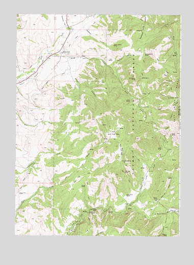
Mink Creek, ID USGS Topographic Map
Click on map above to begin viewing in our Map Viewer.

This topographic map contains these locations and features:
Feature Name Type Latitude Longitude GNIS ID View Map
Albert Moser CampgroundLocaleN42.1380°W111.6947°376497View Map
Aspen SpringSpringN42.1746°W111.6390°376761View Map
Bergquist SpringSpringN42.1373°W111.6424°377391View Map
Birch CreekStreamN42.2296°W111.7266°377647View Map
Budge SpringSpringN42.1826°W111.6320°378439View Map
Club River Guard StationLocaleN42.1391°W111.6758°379453View Map
Crib SpringSpringN42.2128°W111.6315°380064View Map
Dock SpringSpringN42.2246°W111.6769°380662View Map
GlendalePopulated PlaceN42.1299°W111.7049°395893View Map
Graham HollowValleyN42.2213°W111.6791°382487View Map
Graham Hollow SpringSpringN42.2277°W111.6528°382489View Map
Hillyard CanyonValleyN42.1383°W111.6355°383211View Map
Hillyard SpringSpringN42.1259°W111.6346°383212View Map
Horse BasinBasinN42.2135°W111.6522°383348View Map
Horse Basin SpringSpringN42.2135°W111.6593°383352View Map
Hull ValleyValleyN42.1419°W111.6636°383525View Map
Indian SpringSpringN42.1580°W111.6309°383714View Map
Log SpringSpringN42.2034°W111.6301°385969View Map
Mill CanyonValleyN42.2021°W111.6561°386914View Map
Mink CreekPopulated PlaceN42.2283°W111.7158°396904View Map
Mink Creek CanalCanalN42.2046°W111.7277°387023View Map
North Worm Creek BasinBasinN42.1816°W111.6755°387861View Map
Peterson HollowValleyN42.2413°W111.6977°388374View Map
Peterson Hollow SpringSpringN42.2328°W111.6769°388376View Map
Pine SpringSpringN42.2015°W111.6635°388525View Map
Rocky Bench SpringSpringN42.1480°W111.6661°389539View Map
Schoolhouse HollowValleyN42.2458°W111.6538°390028View Map
Sheep Dip HollowValleyN42.1458°W111.6399°390223View Map
Slate Rock SpringSpringN42.1613°W111.6673°390570View Map
South CanyonValleyN42.2210°W111.7044°390852View Map
South Fork Dry CreekStreamN42.2438°W111.6361°390926View Map
South Worm Creek BasinBasinN42.1730°W111.6708°391085View Map
Station Creek TunnelTunnelN42.1483°W111.7474°391379View Map
Strawberry CreekStreamN42.2410°W111.7122°391531View Map
Thomas SpringSpringN42.1459°W111.6420°392026View Map
Thorne SpringSpringN42.1531°W111.6968°392061View Map
Worm Basin SpringSpringN42.1671°W111.6698°393695View Map

Note: Coordinates in the location and feature list above are referenced to NAD83 datum.


Copyright (C) 2008-2025 Ryan Niemi / Sunset Dynamics ... All Rights Reserved