TopoQuest Logo
Do you find TopoQuest useful?
Help keep TopoQuest running and adding new maps/features by donating!
Bitcoin:  19c7KJd3qBynnjoSw5npx9KScwjBe4ifkT
Litecoin:  LXs6TkuXGGXo1vDsWCkWVdjQX94eUKd6ui
Home View Maps Find Maps Find Places Resources & Links


Minnekahta, South Dakota Topographic Map

USGS Map Title: Minnekahta, SD
USGS Map MRC: 43103D6
DRG (GeoTIFF) Download: o43103d6.tif


Neighboring USGS Topographic Map Quads:


  Jewel Cave SE, SD  
43103E7
 

  Argyle, SD  
43103E6
 

  Pringle, SD  
43103E5
 

  Edgemont NE, SD  
43103D7
 

  Minnekahta, SD  
43103D6
 

  Minnekahta NE, SD  
43103D5
 

  Edgemont, SD  
43103C7
 

  Flint Hill, SD  
43103C6
 

  Cascade Springs, SD  
43103C5


Map MRC Location:

N44°
W104°
N44°
W103°
H8 H7 H6 H5 H4 H3 H2 H1
G8 G7 G6 G5 G4 G3 G2 G1
F8 F7 F6 F5 F4 F3 F2 F1
E8 E7 E6 E5 E4 E3 E2 E1
D8 D7 D6 D5 D4 D3 D2 D1
C8 C7 C6 C5 C4 C3 C2 C1
B8 B7 B6 B5 B4 B3 B2 B1
A8 A7 A6 A5 A4 A3 A2 A1
N43°
W104°
N43°
W103°

Minnekahta, SD USGS 1:24K Topographic Map Preview:
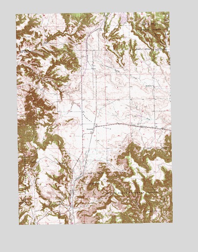
Minnekahta, SD USGS Topographic Map
Click on map above to begin viewing in our Map Viewer.

This topographic map contains these locations and features:
Feature Name Type Latitude Longitude GNIS ID View Map
Argyle CanyonValleyN43.4789°W103.6285°1261176View Map
Bradley FlatsFlatN43.4344°W103.6866°1261336View Map
Fossil Cycad National MonumentParkN43.3950°W103.7263°1261688View Map
Horse Trap MountainSummitN43.3819°W103.6463°1261841View Map
Ivanhoe (historical)Populated PlaceN43.4791°W103.6949°1264634View Map
Johnson RanchLocaleN43.4116°W103.7174°1261897View Map
Marty SchoolSchoolN43.3858°W103.7080°1262029View Map
Matias PeakSummitN43.4109°W103.7377°1262030View Map
McCall WellWellN43.4786°W103.6277°1263139View Map
MinnekahtaPopulated PlaceN43.4305°W103.6883°1262082View Map
Minnekahta Valley Volunteer Fire DepartmentBuildingN43.4342°W103.6393°2580794View Map
Parker PeakSummitN43.3989°W103.6911°1262183View Map
School Number 3SchoolN43.4339°W103.6969°1262374View Map
Spring on the Hill (historical)LocaleN43.4880°W103.7199°1264616View Map
Z R RanchLocaleN43.4564°W103.6405°1262755View Map

Note: Coordinates in the location and feature list above are referenced to NAD83 datum.


Copyright (C) 2008-2025 Ryan Niemi / Sunset Dynamics ... All Rights Reserved