TopoQuest Logo
Do you find TopoQuest useful?
Help keep TopoQuest running and adding new maps/features by donating!
Bitcoin:  19c7KJd3qBynnjoSw5npx9KScwjBe4ifkT
Litecoin:  LXs6TkuXGGXo1vDsWCkWVdjQX94eUKd6ui
Home View Maps Find Maps Find Places Resources & Links


Mission NW, South Dakota Topographic Map

USGS Map Title: Mission NW, SD
USGS Map MRC: 43100D6
DRG (GeoTIFF) Download: o43100d6.tif


Neighboring USGS Topographic Map Quads:


  Soldier Creek NE, SD  
43100D7
 

  Mission NW, SD  
43100D6
 

  Mission NE, SD  
43100D5
 

  Soldier Creek SE, SD  
43100C7
 

  Mission, SD  
43100C6
 

  Mission SE, SD  
43100C5


Map MRC Location:

N44°
W101°
N44°
W100°
H8 H7 H6 H5 H4 H3 H2 H1
G8 G7 G6 G5 G4 G3 G2 G1
F8 F7 F6 F5 F4 F3 F2 F1
E8 E7 E6 E5 E4 E3 E2 E1
D8 D7 D6 D5 D4 D3 D2 D1
C8 C7 C6 C5 C4 C3 C2 C1
B8 B7 B6 B5 B4 B3 B2 B1
A8 A7 A6 A5 A4 A3 A2 A1
N43°
W101°
N43°
W100°

Mission NW, SD USGS 1:24K Topographic Map Preview:
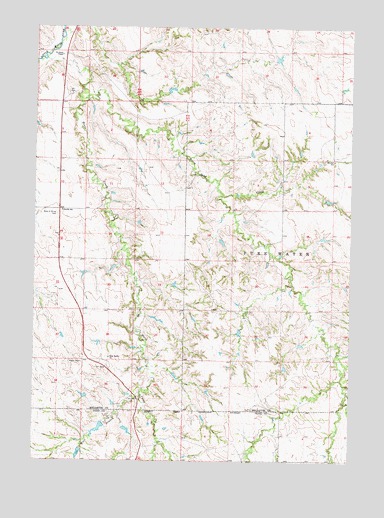
Mission NW, SD USGS Topographic Map
Click on map above to begin viewing in our Map Viewer.

This topographic map contains these locations and features:
Feature Name Type Latitude Longitude GNIS ID View Map
Astleford Number 3 DamDamN43.4133°W100.6537°1260744View Map
Body of Christ CemeteryCemeteryN43.4462°W100.7417°1253991View Map
Dolezal John Number 7 DamDamN43.4833°W100.7004°1260635View Map
Holy Family CemeteryCemeteryN43.4048°W100.7206°2779244View Map
Holy Family ChurchChurchN43.4056°W100.7193°1255626View Map
Horse CreekStreamN43.4914°W100.7449°1255653View Map
Horse Head CreekStreamN43.4794°W100.7318°1255660View Map
Jones Eugene Number 1 DamDamN43.4800°W100.6988°1260640View Map
Kolezal John Number 8 DamDamN43.4833°W100.6921°1260634View Map
Krogman Louie Number 3 DamDamN43.4567°W100.6988°1260643View Map
Krogman Number 5 DamDamN43.3950°W100.7288°1260766View Map
Mitchell SchoolSchoolN43.4617°W100.6324°1256503View Map
Neville SchoolSchoolN43.4472°W100.7393°1256675View Map
Rohloff Number 1 DamDamN43.4900°W100.6537°1260691View Map
Saint James ChapelChurchN43.4919°W100.7396°1257603View Map
Schmidt Road Number 1 DamDamN43.4517°W100.7171°1260637View Map
Sicangu Akicita Owicahe Veterans CemeteryCemeteryN43.4311°W100.7368°2773540View Map
West Branch Horse CreekStreamN43.3942°W100.7074°1258878View Map

Note: Coordinates in the location and feature list above are referenced to NAD83 datum.


Copyright (C) 2008-2024 Ryan Niemi / Sunset Dynamics ... All Rights Reserved