TopoQuest Logo
Do you find TopoQuest useful?
Help keep TopoQuest running and adding new maps/features by donating!
Bitcoin:  19c7KJd3qBynnjoSw5npx9KScwjBe4ifkT
Litecoin:  LXs6TkuXGGXo1vDsWCkWVdjQX94eUKd6ui
Home View Maps Find Maps Find Places Resources & Links


Mission Peak, Washington Topographic Map

USGS Map Title: Mission Peak, WA
USGS Map MRC: 47120C4
DRG (GeoTIFF) Download: o47120c4.tif


Neighboring USGS Topographic Map Quads:


  Tiptop, WA  
47120D5
 

  Monitor, WA  
47120D4
 

  Wenatchee, WA  
47120D3
 

  Blewett Pass, WA  
47120C5
 

  Mission Peak, WA  
47120C4
 

  Wenatchee Heights, WA  
47120C3
 

  Reecer Canyon, WA  
47120B5
 

  Naneum Canyon, WA  
47120B4
 

  Colockum Pass, WA  
47120B3


Map MRC Location:

N48°
W121°
N48°
W120°
H8 H7 H6 H5 H4 H3 H2 H1
G8 G7 G6 G5 G4 G3 G2 G1
F8 F7 F6 F5 F4 F3 F2 F1
E8 E7 E6 E5 E4 E3 E2 E1
D8 D7 D6 D5 D4 D3 D2 D1
C8 C7 C6 C5 C4 C3 C2 C1
B8 B7 B6 B5 B4 B3 B2 B1
A8 A7 A6 A5 A4 A3 A2 A1
N47°
W121°
N47°
W120°

Mission Peak, WA USGS 1:24K Topographic Map Preview:
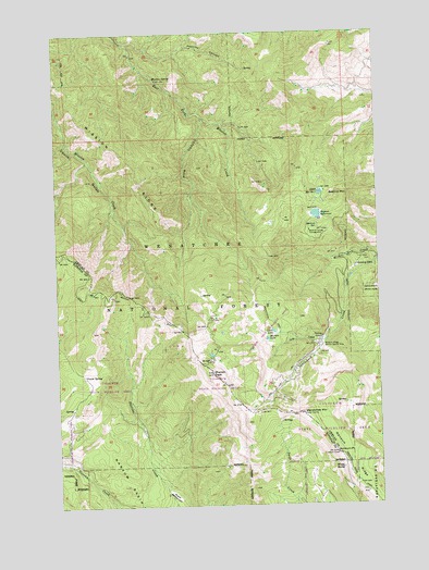
Mission Peak, WA USGS Topographic Map
Click on map above to begin viewing in our Map Viewer.

This topographic map contains these locations and features:
Feature Name Type Latitude Longitude GNIS ID View Map
Alphine CampgroundLocaleN47.3407°W120.4892°1515826View Map
Beehive DamDamN47.3262°W120.3978°1532006View Map
Beehive MountainSummitN47.3312°W120.3915°1516372View Map
Beehive ReservoirReservoirN47.3266°W120.3996°1516374View Map
Beehive SpringSpringN47.3232°W120.4027°1516375View Map
Beehive Spring CampgroundLocaleN47.3221°W120.4020°1516376View Map
Clara LakeLakeN47.2959°W120.4172°1517801View Map
Devils Gulch TrailTrailN47.3279°W120.4792°1518710View Map
Dutch SettlementPopulated PlaceN47.2537°W120.4578°1519027View Map
Grouse SpringSpringN47.2842°W120.4915°1520400View Map
H and H Reservoir Number OneReservoirN47.3324°W120.3983°1532312View Map
H and H Reservoir Number One DamDamN47.3332°W120.3978°1532311View Map
H and H Reservoir Number TwoReservoirN47.3361°W120.3985°1532520View Map
H and H Reservoir Number Two DamDamN47.3365°W120.3978°1532519View Map
King CanyonValleyN47.3523°W120.4426°1521676View Map
KPQ-FM (Wenatchee)TowerN47.2743°W120.4262°1534547View Map
Lake CreekStreamN47.2935°W120.3962°1521837View Map
Marion LakeLakeN47.2937°W120.4196°1522738View Map
Meadow CampgroundLocaleN47.3135°W120.4523°1522948View Map
Mission PeakSummitN47.2851°W120.4409°1523277View Map
Mission RidgeRidgeN47.3607°W120.4967°1523280View Map
Mission Ridge TrailTrailN47.3123°W120.4556°1523281View Map
Mission Ridge Winter Sports AreaLocaleN47.2918°W120.3990°1523282View Map
Mission SpringSpringN47.3631°W120.4621°1523283View Map
Naneum LookoutLocaleN47.2635°W120.3931°1530200View Map
Naneum PointCapeN47.2635°W120.3934°1523568View Map
Naneum RidgeRidgeN47.2532°W120.3817°1523569View Map
Peavine CanyonValleyN47.3710°W120.4490°1524290View Map
Pendleton CanyonValleyN47.3740°W120.4748°1524321View Map
Scout-a- VistaLocaleN47.3123°W120.3848°1525525View Map
Scout-A-Vista LodgeBuildingN47.3129°W120.3845°1529993View Map
Spring CampgroundLocaleN47.3118°W120.4267°1526401View Map
Squilchuck TrailTrailN47.2982°W120.4167°1526464View Map
Wenatchee MountainSummitN47.2740°W120.4059°1527904View Map
Windy SpringSpringN47.2598°W120.3910°1528241View Map

Note: Coordinates in the location and feature list above are referenced to NAD83 datum.


Copyright (C) 2008-2024 Ryan Niemi / Sunset Dynamics ... All Rights Reserved