TopoQuest Logo
Do you find TopoQuest useful?
Help keep TopoQuest running and adding new maps/features by donating!
Bitcoin:  19c7KJd3qBynnjoSw5npx9KScwjBe4ifkT
Litecoin:  LXs6TkuXGGXo1vDsWCkWVdjQX94eUKd6ui
Home View Maps Find Maps Find Places Resources & Links


Mitten Buttes, Arizona Topographic Map

USGS Map Title: Mitten Buttes, AZ
USGS Map MRC: 36110H1
DRG (GeoTIFF) Download: o36110h1.tif


Neighboring USGS Topographic Map Quads:


  Goulding, UT  
37110A2
 

  Monument Pass, UT  
37110A1
 

  Mexican Hat SW, UT  
37109A8
 

  Mystery Valley, AZ  
36110H2
 

  Mitten Buttes, AZ  
36110H1
 

  Rooster Rock, AZ  
36109H8
 

  Agathla Peak, AZ  
36110G2
 

  Baby Rocks, AZ  
36110G1
 

  Red Point, AZ  
36109G8


Map MRC Location:

N37°
W111°
N37°
W110°
H8 H7 H6 H5 H4 H3 H2 H1
G8 G7 G6 G5 G4 G3 G2 G1
F8 F7 F6 F5 F4 F3 F2 F1
E8 E7 E6 E5 E4 E3 E2 E1
D8 D7 D6 D5 D4 D3 D2 D1
C8 C7 C6 C5 C4 C3 C2 C1
B8 B7 B6 B5 B4 B3 B2 B1
A8 A7 A6 A5 A4 A3 A2 A1
N36°
W111°
N36°
W110°

Mitten Buttes, AZ USGS 1:24K Topographic Map Preview:
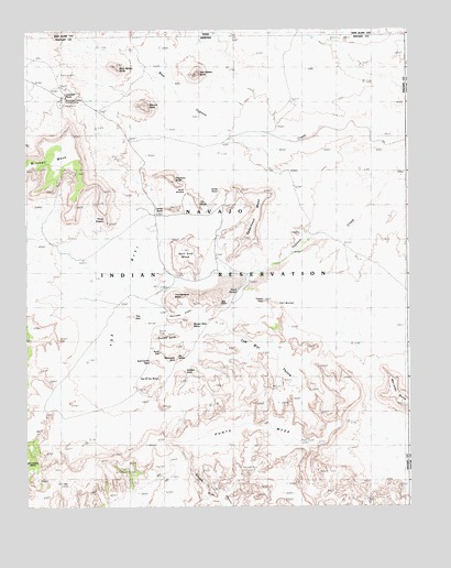
Mitten Buttes, AZ USGS Topographic Map
Click on map above to begin viewing in our Map Viewer.

This topographic map contains these locations and features:
Feature Name Type Latitude Longitude GNIS ID View Map
Big ChairSummitN36.9286°W110.0623°1302View Map
Big HoganArchN36.9142°W110.0756°1320View Map
Camel ButteSummitN36.9533°W110.0754°2388View Map
Clara Bernheimer Natural BridgeArchN36.8842°W110.0300°2570170View Map
Cly ButteSummitN36.9550°W110.0696°3043View Map
Donut ArchArchN36.9200°W110.0806°1678968View Map
Ear of the WindArchN36.9086°W110.0818°1678970View Map
East Mitten ButteSummitN36.9883°W110.0698°4292View Map
Echo Cave RuinLocaleN36.9061°W110.0823°4340View Map
Elephant ButteSummitN36.9617°W110.0782°4399View Map
Eye of the DoveArchN36.8842°W110.0547°2570171View Map
Hidden BridgeArchN36.9103°W110.0733°1678967View Map
Hunts MesaSummitN36.8931°W110.0718°6145View Map
Lookout PointCliffN36.9822°W110.1118°7368View Map
Meridian ButteSummitN36.9014°W110.0007°7879View Map
Merrick ButteSummitN36.9806°W110.0860°7886View Map
Mitchell MesaSummitN36.9722°W110.1110°8132View Map
Moccasin ArchArchN36.9136°W110.0761°1678969View Map
Monument Valley Navajo Tribal ParkParkN36.9167°W110.0840°23403View Map
Natural ArchArchN36.8847°W110.0958°2570173View Map
North WindowGapN36.9583°W110.0729°8805View Map
Rain God MesaSummitN36.9422°W110.0743°9912View Map
Sand SpringSpringN36.9319°W110.0562°42940View Map
Spearhead MesaSummitN36.9561°W110.0479°11666View Map
Spiderweb ArchArchN36.8850°W110.0931°1678959View Map
Suns EyeArchN36.9156°W110.0817°11955View Map
The HubSummitN36.9247°W110.0898°12335View Map
Three SistersSummitN36.9492°W110.0985°12427View Map
Thunderbird MesaSummitN36.9261°W110.0776°12447View Map
Totem PolePillarN36.9290°W110.0476°12649View Map
Tse BiyiBasinN36.9219°W110.0687°12757View Map
Vreeland ArchArchN36.8825°W110.0694°1678942View Map
West Mitten ButteSummitN36.9908°W110.0962°13513View Map
Yei BicheiSummitN36.9281°W110.0446°14045View Map

Note: Coordinates in the location and feature list above are referenced to NAD83 datum.


Copyright (C) 2008-2024 Ryan Niemi / Sunset Dynamics ... All Rights Reserved