TopoQuest Logo
Do you find TopoQuest useful?
Help keep TopoQuest running and adding new maps/features by donating!
Bitcoin:  19c7KJd3qBynnjoSw5npx9KScwjBe4ifkT
Litecoin:  LXs6TkuXGGXo1vDsWCkWVdjQX94eUKd6ui
Home View Maps Find Maps Find Places Resources & Links


Ahmeek, Michigan Topographic Map

USGS Map Title: Ahmeek, MI
USGS Map MRC: 47088C4
DRG (GeoTIFF) Download: o47088c4.tif


Neighboring USGS Topographic Map Quads:


  Phoenix, MI  
47088D3
 

  Muggun Creek, MI  
47088C5
 

  Ahmeek, MI  
47088C4
 

  Mohawk, MI  
47088C3
 

  Hancock, MI  
47088B5
 

  Laurium, MI  
47088B4
 

  Rice Lake, MI  
47088B3


Map MRC Location:

N48°
W89°
N48°
W88°
H8 H7 H6 H5 H4 H3 H2 H1
G8 G7 G6 G5 G4 G3 G2 G1
F8 F7 F6 F5 F4 F3 F2 F1
E8 E7 E6 E5 E4 E3 E2 E1
D8 D7 D6 D5 D4 D3 D2 D1
C8 C7 C6 C5 C4 C3 C2 C1
B8 B7 B6 B5 B4 B3 B2 B1
A8 A7 A6 A5 A4 A3 A2 A1
N47°
W89°
N47°
W88°

Ahmeek, MI USGS 1:24K Topographic Map Preview:
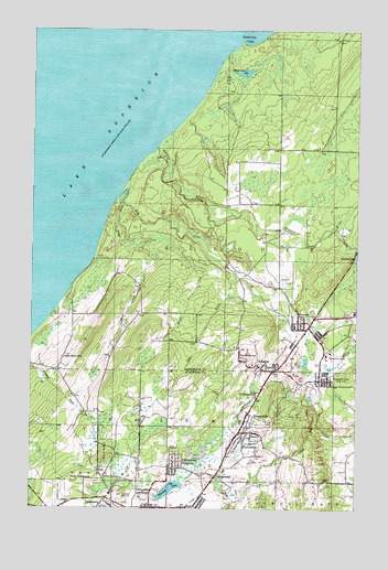
Ahmeek, MI USGS Topographic Map
Click on map above to begin viewing in our Map Viewer.

This topographic map contains these locations and features:
Feature Name Type Latitude Longitude GNIS ID View Map
AhmeekPopulated PlaceN47.2988°W88.3965°619873View Map
Ahmeek CemeteryCemeteryN47.3088°W88.4034°619874View Map
Ahmeek Fire DepartmentBuildingN47.2974°W88.3964°2626803View Map
Ahmeek MineMineN47.2891°W88.3846°619875View Map
Ahmeek Post OfficePost OfficeN47.2970°W88.3968°2112244View Map
Ahmeek Station (historical)LocaleN47.2986°W88.3928°2112245View Map
Ahmeek TownhallBuildingN47.2986°W88.3964°2112243View Map
AllouezPopulated PlaceN47.2871°W88.4096°620000View Map
Allouez Post Office (historical)Post OfficeN47.2872°W88.4094°2112241View Map
Allouez Station (historical)LocaleN47.2864°W88.4042°2112238View Map
Allouez Township Community CenterBuildingN47.2875°W88.4097°2112240View Map
Black CreekStreamN47.3294°W88.4662°621484View Map
BumbletownPopulated PlaceN47.2888°W88.4196°622249View Map
Calumet LakeLakeN47.2549°W88.4464°622469View Map
CentennialPopulated PlaceN47.2583°W88.4287°622971View Map
Centennial HeightsPopulated PlaceN47.2605°W88.4446°622972View Map
Charter Township of CalumetCivilN47.2577°W88.4406°1626023View Map
Copper CityPopulated PlaceN47.2835°W88.3871°623804View Map
Copper City Post OfficePost OfficeN47.2838°W88.3880°2124152View Map
Copper City Station (historical)LocaleN47.2833°W88.3944°2124151View Map
Copper City Volunteer Fire DepartmentBuildingN47.2839°W88.3877°2627009View Map
Finey CreekStreamN47.3158°W88.4418°625956View Map
Fulton CreekStreamN47.2819°W88.3912°626567View Map
Gratiot RiverStreamN47.3438°W88.4526°627233View Map
Hills CreekStreamN47.3302°W88.4651°1617986View Map
Kearsage Post Office (historical)Post OfficeN47.2750°W88.4161°2124045View Map
Kearsage Station (historical)LocaleN47.2753°W88.4164°2124044View Map
Kearsage Station (historical)LocaleN47.2750°W88.4161°2124007View Map
KearsargePopulated PlaceN47.2749°W88.4162°629487View Map
Lake Shore SchoolSchoolN47.2891°W88.4879°630001View Map
LakeviewPopulated PlaceN47.2738°W88.4737°1618744View Map
Lakeview CemeteryCemeteryN47.2538°W88.4876°630057View Map
Lower FallsFallsN47.3356°W88.4458°2112193View Map
PhillipsvillePopulated PlaceN47.2796°W88.4134°634766View Map
Red Jacket MineMineN47.2530°W88.4615°635711View Map
Schoolcraft CemeteryCemeteryN47.2558°W88.4329°2124347View Map
Sevenmile PointCapeN47.3716°W88.4201°637601View Map
Slaughterhouse CreekStreamN47.2721°W88.3901°638090View Map
Township of AllouezCivilN47.3343°W88.3777°1625825View Map
Turtle LakeLakeN47.3637°W88.4193°633050View Map
Upper FallsFallsN47.3314°W88.4372°2112192View Map
Village of AhmeekCivilN47.2985°W88.3971°2397918View Map
Village of Copper CityCivilN47.2842°W88.3875°2398625View Map
West TamarackPopulated PlaceN47.2574°W88.4760°1617932View Map
WolverinePopulated PlaceN47.2696°W88.4196°1616713View Map

Note: Coordinates in the location and feature list above are referenced to NAD83 datum.


Copyright (C) 2008-2024 Ryan Niemi / Sunset Dynamics ... All Rights Reserved