TopoQuest Logo
Do you find TopoQuest useful?
Help keep TopoQuest running and adding new maps/features by donating!
Bitcoin:  19c7KJd3qBynnjoSw5npx9KScwjBe4ifkT
Litecoin:  LXs6TkuXGGXo1vDsWCkWVdjQX94eUKd6ui
Home View Maps Find Maps Find Places Resources & Links


Mollie Hogans, Utah Topographic Map

USGS Map Title: Mollie Hogans, UT
USGS Map MRC: 38109G5
DRG (GeoTIFF) Download: o38109g5.tif


Neighboring USGS Topographic Map Quads:


  Thompson Springs, UT  
38109H6
 

  Sagers Flat, UT  
38109H5
 

  White House, UT  
38109H4
 

  Klondike Bluffs, UT  
38109G6
 

  Mollie Hogans, UT  
38109G5
 

  Cisco SW, UT  
38109G4
 

  Merrimac Butte, UT  
38109F6
 

  The Windows Section, UT  
38109F5
 

  Big Bend, UT  
38109F4


Map MRC Location:

N39°
W110°
N39°
W109°
H8 H7 H6 H5 H4 H3 H2 H1
G8 G7 G6 G5 G4 G3 G2 G1
F8 F7 F6 F5 F4 F3 F2 F1
E8 E7 E6 E5 E4 E3 E2 E1
D8 D7 D6 D5 D4 D3 D2 D1
C8 C7 C6 C5 C4 C3 C2 C1
B8 B7 B6 B5 B4 B3 B2 B1
A8 A7 A6 A5 A4 A3 A2 A1
N38°
W110°
N38°
W109°

Mollie Hogans, UT USGS 1:24K Topographic Map Preview:
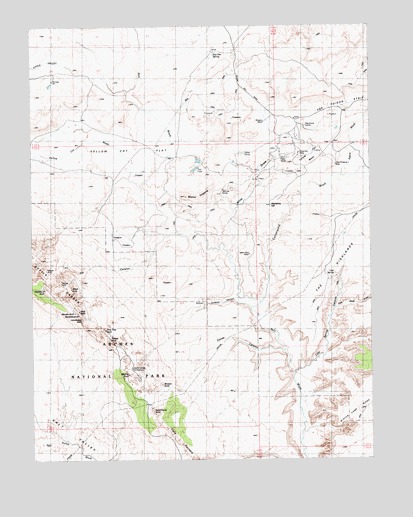
Mollie Hogans, UT USGS Topographic Map
Click on map above to begin viewing in our Map Viewer.

This topographic map contains these locations and features:
Feature Name Type Latitude Longitude GNIS ID View Map
Agate WashStreamN38.8316°W109.5112°1425056View Map
Arch de TriumpheArchN38.7814°W109.5853°1435065View Map
Bat Guano ArchArchN38.7914°W109.6103°1435087View Map
Black Ape MineMineN38.8233°W109.5385°1425648View Map
Black Cave ArchArchN38.8008°W109.6101°1435151View Map
Blackstone InclineMineN38.8483°W109.5276°1425747View Map
Box ArchArchN38.7528°W109.5725°1435185View Map
Box ArchArchN38.8008°W109.6147°2569404View Map
Broken ArchArchN38.7675°W109.5812°1435196View Map
Clover CanyonValleyN38.7811°W109.5326°1426730View Map
Clover Canyon BridgeArchN38.7700°W109.5723°1679089View Map
Coke Oven ArchArchN38.7900°W109.6075°1435331View Map
Cordova CanyonValleyN38.7934°W109.5450°2786833View Map
Cottonwood WashStreamN38.7939°W109.5451°1426961View Map
Crystal ArchArchN38.7947°W109.6018°1435376View Map
Devils GardenAreaN38.8039°W109.6137°1427369View Map
Devils Garden TrailheadLocaleN38.7828°W109.5951°1435418View Map
Double O ArchArchN38.7994°W109.6201°1427456View Map
Dry Oak SpringSpringN38.8664°W109.5579°1427576View Map
Fiery FurnacePillarN38.7508°W109.5671°1427920View Map
Fin CanyonValleyN38.8147°W109.5758°1427932View Map
Fish Seep DrawValleyN38.7938°W109.5140°1427959View Map
Gothic ArchArchN38.8333°W109.5840°1435596View Map
Johns InclineMineN38.8386°W109.5473°1429209View Map
Landscape ArchArchN38.7905°W109.6068°1429470View Map
Lemon Airport (historical)AirportN38.7541°W109.5507°1434565View Map
Little Eva MineMineN38.8386°W109.5271°1429728View Map
Little ValleyValleyN38.8629°W109.6118°1429821View Map
Lost SpringSpringN38.8035°W109.5140°1429950View Map
Lost Spring CanyonValleyN38.7743°W109.5296°1429954View Map
Memphis HillSummitN38.8231°W109.5373°1430223View Map
Memphis MinesMineN38.8266°W109.5307°1430224View Map
Mine DrawValleyN38.8087°W109.5522°1430354View Map
Mollie HogansSummitN38.8259°W109.5687°1430405View Map
Navajo ArchArchN38.7919°W109.6090°1430646View Map
Oval Canyon Natural BridgeArchN38.8013°W109.6161°1436078View Map
Parco MinesMineN38.8369°W109.5310°1431096View Map
Partition ArchArchN38.7919°W109.6076°1431123View Map
Piano Leg ArchArchN38.8000°W109.6173°1436124View Map
Pine Tree ArchArchN38.7875°W109.5985°1431278View Map
Ringtail MineMineN38.8475°W109.5396°1431847View Map
Sand Dune ArchArchN38.7628°W109.5812°1450489View Map
Shadow Box ArchArchN38.8000°W109.6173°1436337View Map
Skyline ArchArchN38.7744°W109.5901°1432527View Map
Tapestry ArchArchN38.7764°W109.5843°1436466View Map
Telluride MinesMineN38.8275°W109.5546°1433215View Map
The BiscuitsAreaN38.7778°W109.5757°1435148View Map
Top Story WindowArchN38.8050°W109.6201°1679088View Map
Tunnel ArchArchN38.7850°W109.5968°1433697View Map
Turban Head ArchArchN38.8000°W109.6173°1436528View Map
Wall Arch (historical)ArchN38.7925°W109.6068°1433934View Map
Yellow Bird MineMineN38.8097°W109.5446°1434495View Map
Yellow Cat FlatFlatN38.8375°W109.5840°1434496View Map
Yellow Cat MesaSummitN38.8379°W109.5222°1434497View Map
Yellow Cat WashStreamN38.8291°W109.5848°1434499View Map

Note: Coordinates in the location and feature list above are referenced to NAD83 datum.


Copyright (C) 2008-2024 Ryan Niemi / Sunset Dynamics ... All Rights Reserved