TopoQuest Logo
Do you find TopoQuest useful?
Help keep TopoQuest running and adding new maps/features by donating!
Bitcoin:  19c7KJd3qBynnjoSw5npx9KScwjBe4ifkT
Litecoin:  LXs6TkuXGGXo1vDsWCkWVdjQX94eUKd6ui
Home View Maps Find Maps Find Places Resources & Links


Monkeys Head, Arizona Topographic Map

USGS Map Title: Monkeys Head, AZ
USGS Map MRC: 34114C1
DRG (GeoTIFF) Download: o34114c1.tif


Neighboring USGS Topographic Map Quads:


  Standard Wash, AZ  
34114D2
 

  Mohave Springs, AZ  
34114D1
 

  Castaneda Hills, AZ  
34113D8
 

  Gene Wash, CA  
34114C2
 

  Monkeys Head, AZ  
34114C1
 

  Castaneda Hills SW, AZ  
34113C8
 

  Cross Roads, CA  
34114B2
 

  Osborne Well, AZ  
34114B1
 

  Planet, AZ  
34113B8


Map MRC Location:

N35°
W115°
N35°
W114°
H8 H7 H6 H5 H4 H3 H2 H1
G8 G7 G6 G5 G4 G3 G2 G1
F8 F7 F6 F5 F4 F3 F2 F1
E8 E7 E6 E5 E4 E3 E2 E1
D8 D7 D6 D5 D4 D3 D2 D1
C8 C7 C6 C5 C4 C3 C2 C1
B8 B7 B6 B5 B4 B3 B2 B1
A8 A7 A6 A5 A4 A3 A2 A1
N34°
W115°
N34°
W114°

Monkeys Head, AZ USGS 1:24K Topographic Map Preview:
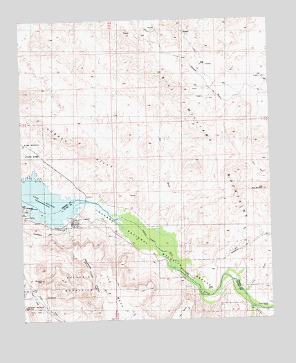
Monkeys Head, AZ USGS Topographic Map
Click on map above to begin viewing in our Map Viewer.

This topographic map contains these locations and features:
Feature Name Type Latitude Longitude GNIS ID View Map
Aubrey Landing (historical)LocaleN34.3000°W114.0774°23861View Map
Bill Williams MountainsRangeN34.3333°W114.0302°1412View Map
Bill Williams River National Wildlife RefugeParkN34.2763°W114.0461°2765204View Map
Bucksin Mountain State ParkParkN34.2514°W114.1230°24128View Map
Castle RockSummitN34.2556°W114.1249°2544View Map
Cave WashStreamN34.2747°W114.0008°2600View Map
Central Arizona Project AqueductCanalN34.2861°W114.1036°22750View Map
Fox WashStreamN34.2895°W114.0647°4815View Map
Goat SpringSpringN34.2603°W114.1141°5083View Map
Havasu National Wildlife RefugeParkN34.2820°W114.0549°24129View Map
Havasu SpringSpringN34.2940°W114.1247°5619View Map
Kohen RanchLocaleN34.2625°W114.0327°6761View Map
Larneds LandingPopulated PlaceN34.3083°W114.0522°25307View Map
Little Black MountainSummitN34.3039°W114.0041°7069View Map
Mineral WashStreamN34.2550°W114.0102°8107View Map
Monkeys HeadSummitN34.2672°W114.1169°8210View Map
Paloma ProspectMineN34.3717°W114.0580°9157View Map
Ramon Esquerra RanchLocaleN34.2553°W114.0049°9935View Map
The MesaSummitN34.2700°W114.0824°12348View Map

Note: Coordinates in the location and feature list above are referenced to NAD83 datum.


Copyright (C) 2008-2024 Ryan Niemi / Sunset Dynamics ... All Rights Reserved