TopoQuest Logo
Do you find TopoQuest useful?
Help keep TopoQuest running and adding new maps/features by donating!
Bitcoin:  19c7KJd3qBynnjoSw5npx9KScwjBe4ifkT
Litecoin:  LXs6TkuXGGXo1vDsWCkWVdjQX94eUKd6ui
Home View Maps Find Maps Find Places Resources & Links


Montezuma, Kansas Topographic Map

USGS Map Title: Montezuma, KS
USGS Map MRC: 37100E4
DRG (GeoTIFF) Download: o37100e4.tif


Neighboring USGS Topographic Map Quads:


  Copeland NE, KS  
37100F5
 

  Montezuma NW, KS  
37100F4
 

  Haggard, KS  
37100F3
 

  Copeland SE, KS  
37100E5
 

  Montezuma, KS  
37100E4
 

  Montezuma SE, KS  
37100E3
 

  Plains NE, KS  
37100D5
 

  Meade NW, KS  
37100D4
 

  Meade NE, KS  
37100D3


Map MRC Location:

N38°
W101°
N38°
W100°
H8 H7 H6 H5 H4 H3 H2 H1
G8 G7 G6 G5 G4 G3 G2 G1
F8 F7 F6 F5 F4 F3 F2 F1
E8 E7 E6 E5 E4 E3 E2 E1
D8 D7 D6 D5 D4 D3 D2 D1
C8 C7 C6 C5 C4 C3 C2 C1
B8 B7 B6 B5 B4 B3 B2 B1
A8 A7 A6 A5 A4 A3 A2 A1
N37°
W101°
N37°
W100°

Montezuma, KS USGS 1:24K Topographic Map Preview:
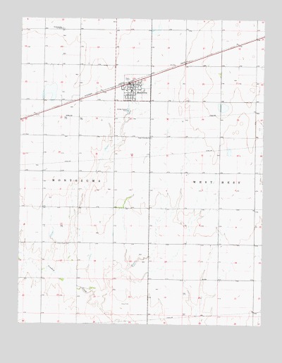
Montezuma, KS USGS Topographic Map
Click on map above to begin viewing in our Map Viewer.

This topographic map contains these locations and features:
Feature Name Type Latitude Longitude GNIS ID View Map
City of MontezumaCivilN37.5925°W100.4503°2395379View Map
Crooked Creek Country ClubLocaleN37.5874°W100.4412°2694557View Map
Dodge City Co - Operative Exchange Grain Elevator Number 14LocaleN37.5992°W100.4439°2695160View Map
Evans CemeteryCemeteryN37.5327°W100.4790°484336View Map
Gospel Fellowship ChurchChurchN37.5941°W100.4473°471707View Map
Gray County Emergency Medical Services Montezuma StationBuildingN37.5962°W100.4506°2696475View Map
Hess (historical)LocaleN37.5184°W100.3965°482234View Map
Homeland Mennonite ChurchChurchN37.5472°W100.4881°2689074View Map
MontezumaPopulated PlaceN37.5959°W100.4432°471706View Map
Montezuma Church of God in ChristChurchN37.6208°W100.4802°471705View Map
Montezuma City HallBuildingN37.5909°W100.4458°2693367View Map
Montezuma City PoliceBuildingN37.5908°W100.4456°2754330View Map
Montezuma Coop AirportAirportN37.5906°W100.4341°2651071View Map
Montezuma Elementary SchoolSchoolN37.5950°W100.4444°481038View Map
Montezuma Municipal AirportAirportN37.5897°W100.4693°2651104View Map
Montezuma Post OfficePost OfficeN37.5977°W100.4426°2693861View Map
Montezuma Public WorksBuildingN37.5909°W100.4458°2693305View Map
Montezuma Senior Center and Community HallBuildingN37.5984°W100.4427°2692950View Map
Montezuma Township LibraryBuildingN37.5986°W100.4427°2694858View Map
Montezuma United Methodist ChurchChurchN37.5963°W100.4461°2690450View Map
Montezuma Volunteer Fire DepartmentBuildingN37.5983°W100.4446°2111636View Map
Montezuma Wastewater PlantLocaleN37.5871°W100.4457°2693517View Map
Morningside Community ChurchChurchN37.5960°W100.4349°2689123View Map
North Mennonite CemeteryCemeteryN37.6208°W100.4786°2739715View Map
South Gray High SchoolSchoolN37.5956°W100.4433°481039View Map
South Gray High SchoolSchoolN37.5956°W100.4433°2427204View Map
Stauth Memorial MuseumBuildingN37.5968°W100.4427°2694272View Map
Township of MontezumaCivilN37.5960°W100.4289°470573View Map

Note: Coordinates in the location and feature list above are referenced to NAD83 datum.


Copyright (C) 2008-2024 Ryan Niemi / Sunset Dynamics ... All Rights Reserved