TopoQuest Logo
Do you find TopoQuest useful?
Help keep TopoQuest running and adding new maps/features by donating!
Bitcoin:  19c7KJd3qBynnjoSw5npx9KScwjBe4ifkT
Litecoin:  LXs6TkuXGGXo1vDsWCkWVdjQX94eUKd6ui
Home View Maps Find Maps Find Places Resources & Links


Monticello, Maine Topographic Map

USGS Map Title: Monticello, ME
USGS Map MRC: 46067C7
DRG (GeoTIFF) Download: o46067c7.tif


Neighboring USGS Topographic Map Quads:


  Packard Lake, ME  
46067D8
 

  Bridgewater, ME  
46067D7


  Harvey, ME  
46067C8
 

  Monticello, ME  
46067C7


  Twin Brook, ME  
46067B8
 

  Houlton North, ME  
46067B7


Map MRC Location:

N47°
W68°
N47°
W67°
H8 H7 H6 H5 H4 H3 H2 H1
G8 G7 G6 G5 G4 G3 G2 G1
F8 F7 F6 F5 F4 F3 F2 F1
E8 E7 E6 E5 E4 E3 E2 E1
D8 D7 D6 D5 D4 D3 D2 D1
C8 C7 C6 C5 C4 C3 C2 C1
B8 B7 B6 B5 B4 B3 B2 B1
A8 A7 A6 A5 A4 A3 A2 A1
N46°
W68°
N46°
W67°

Monticello, ME USGS 1:24K Topographic Map Preview:
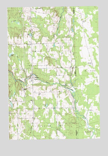
Monticello, ME USGS Topographic Map
Click on map above to begin viewing in our Map Viewer.

This topographic map contains these locations and features:
Feature Name Type Latitude Longitude GNIS ID View Map
Britton LakeLakeN46.2627°W67.8059°562985View Map
Britton SchoolSchoolN46.3409°W67.8045°562986View Map
Calvary Pentecostal ChurchChurchN46.3092°W67.8409°1910273View Map
Camp WilliamsLocaleN46.3098°W67.8653°1910275View Map
Dead StreamStreamN46.2834°W67.7828°582263View Map
Foster CemeteryCemeteryN46.3098°W67.8389°1910368View Map
Gentle LakeLakeN46.2821°W67.8224°566735View Map
HillPopulated PlaceN46.2731°W67.8414°568044View Map
Hoyt BrookStreamN46.3081°W67.8509°568409View Map
Jewell CemeteryCemeteryN46.3423°W67.8431°1910437View Map
Jewell LakeLakeN46.3490°W67.8434°568821View Map
Jewells CornerPopulated PlaceN46.3406°W67.8425°579435View Map
Lake SchoolSchoolN46.2873°W67.8714°569312View Map
Lowell HillSummitN46.2938°W67.8356°570466View Map
MonticelloPopulated PlaceN46.3084°W67.8425°571525View Map
Monticello Fire DepartmentBuildingN46.3077°W67.8409°2552809View Map
Monticello Post OfficePost OfficeN46.3091°W67.8416°1910498View Map
Monticello StationLocaleN46.2959°W67.8545°571527View Map
Monticello United Methodist ChurchChurchN46.3087°W67.8397°1910499View Map
Monticello Wesleyan ChurchChurchN46.3045°W67.8400°1910500View Map
Rideout LakeLakeN46.3301°W67.8711°574195View Map
Ross SchoolSchoolN46.2634°W67.8647°574469View Map
SharpPopulated PlaceN46.2867°W67.8422°575312View Map
Town of MonticelloCivilN46.3258°W67.8451°582604View Map
Village CemeteryCemeteryN46.3104°W67.8398°2678171View Map
Wellington SchoolSchoolN46.3069°W67.8391°1910699View Map
WXME-AM (Monticello)TowerN46.3418°W67.8181°582025View Map

Note: Coordinates in the location and feature list above are referenced to NAD83 datum.


Copyright (C) 2008-2024 Ryan Niemi / Sunset Dynamics ... All Rights Reserved