TopoQuest Logo
Do you find TopoQuest useful?
Help keep TopoQuest running and adding new maps/features by donating!
Bitcoin:  19c7KJd3qBynnjoSw5npx9KScwjBe4ifkT
Litecoin:  LXs6TkuXGGXo1vDsWCkWVdjQX94eUKd6ui
Home View Maps Find Maps Find Places Resources & Links


Moorefield, Nebraska Topographic Map

USGS Map Title: Moorefield, NE
USGS Map MRC: 40100F4
DRG (GeoTIFF) Download: o40100f4.tif


Neighboring USGS Topographic Map Quads:


  Wellfleet SE, NE  
40100G5
 

  Jeffrey Reservoir SW, NE  
40100G4
 

  Jeffrey Reservoir SE, NE  
40100G3
 

  Curtis, NE  
40100F5
 

  Moorefield, NE  
40100F4
 

  Stockville NE, NE  
40100F3
 

  Curtis SE, NE  
40100E5
 

  Stockville, NE  
40100E4
 

  Stockville SE, NE  
40100E3


Map MRC Location:

N41°
W101°
N41°
W100°
H8 H7 H6 H5 H4 H3 H2 H1
G8 G7 G6 G5 G4 G3 G2 G1
F8 F7 F6 F5 F4 F3 F2 F1
E8 E7 E6 E5 E4 E3 E2 E1
D8 D7 D6 D5 D4 D3 D2 D1
C8 C7 C6 C5 C4 C3 C2 C1
B8 B7 B6 B5 B4 B3 B2 B1
A8 A7 A6 A5 A4 A3 A2 A1
N40°
W101°
N40°
W100°

Moorefield, NE USGS 1:24K Topographic Map Preview:
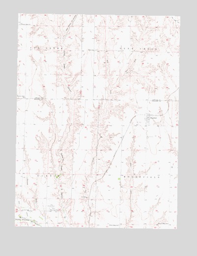
Moorefield, NE USGS Topographic Map
Click on map above to begin viewing in our Map Viewer.

This topographic map contains these locations and features:
Feature Name Type Latitude Longitude GNIS ID View Map
Arrowhead Meadow Golf CourseLocaleN40.6333°W100.4893°1841044View Map
Bethel School (historical)SchoolN40.7289°W100.4407°827385View Map
Curtis Election PrecinctCivilN40.6572°W100.4949°1928802View Map
Curtis Municipal AirportAirportN40.6370°W100.4726°837535View Map
East Curtis Creek CanyonValleyN40.7389°W100.4654°828953View Map
East Curtis SchoolSchoolN40.6345°W100.4671°828954View Map
East Fork Dry CreekStreamN40.7078°W100.4276°828960View Map
Elson Detention Dam 1-NDamN40.7002°W100.4789°1767382View Map
Elson Detention Dam 1-SDamN40.6851°W100.4711°1768161View Map
Elson Detention Reservoir 1-NLakeN40.7018°W100.4787°1767383View Map
Elson Reservoir Number 1-SReservoirN40.6857°W100.4713°1768162View Map
Fox CreekStreamN40.6297°W100.4910°829378View Map
Lower Medicine Creek Dam 200DamN40.6483°W100.4471°1768165View Map
Medicine Creek Reservoir 200ReservoirN40.6451°W100.4464°1768166View Map
MoorefieldLocaleN40.6900°W100.3993°1841033View Map
MoorefieldPopulated PlaceN40.6900°W100.3993°831402View Map
Moorefield CemeteryCemeteryN40.6789°W100.4001°831403View Map
Moorefield Election PrecinctCivilN40.6567°W100.3807°1929076View Map
Moorefield Post OfficePost OfficeN40.6901°W100.3999°1841034View Map
Moorefield Public School (historical)SchoolN40.6870°W100.4001°1841120View Map
Pleasant Home ChurchChurchN40.7436°W100.4993°832204View Map
Pleasant Home SchoolSchoolN40.7008°W100.4940°832205View Map
Pleasant Ridge School (historical)SchoolN40.6281°W100.3821°832218View Map
Tobiassen DrawValleyN40.6347°W100.4851°834127View Map
Township of CurtisCivilN40.6556°W100.4949°1841049View Map
Township of MoorefieldCivilN40.6556°W100.3810°1841062View Map
Village of MoorefieldCivilN40.6899°W100.4003°2399392View Map
Windy Ridge SchoolSchoolN40.6270°W100.4201°834812View Map

Note: Coordinates in the location and feature list above are referenced to NAD83 datum.


Copyright (C) 2008-2025 Ryan Niemi / Sunset Dynamics ... All Rights Reserved