TopoQuest Logo
Do you find TopoQuest useful?
Help keep TopoQuest running and adding new maps/features by donating!
Bitcoin:  19c7KJd3qBynnjoSw5npx9KScwjBe4ifkT
Litecoin:  LXs6TkuXGGXo1vDsWCkWVdjQX94eUKd6ui
Home View Maps Find Maps Find Places Resources & Links


Morrill, Nebraska Topographic Map

USGS Map Title: Morrill, NE
USGS Map MRC: 41103H8
DRG (GeoTIFF) Download: o41103h8.tif


Neighboring USGS Topographic Map Quads:


  Torrington SE, WY  
42104A1
 

  Dry Sheep Creek, NE  
42103A8
 

  Erdman Ranch, NE  
42103A7
 

  Lyman, NE  
41104H1
 

  Morrill, NE  
41103H8
 

  Mitchell, NE  
41103H7
 

  Robb Draw, WY  
41104G1
 

  Stegall, NE  
41103G8
 

  Roubadeau Pass, NE  
41103G7


Map MRC Location:

N42°
W104°
N42°
W103°
H8 H7 H6 H5 H4 H3 H2 H1
G8 G7 G6 G5 G4 G3 G2 G1
F8 F7 F6 F5 F4 F3 F2 F1
E8 E7 E6 E5 E4 E3 E2 E1
D8 D7 D6 D5 D4 D3 D2 D1
C8 C7 C6 C5 C4 C3 C2 C1
B8 B7 B6 B5 B4 B3 B2 B1
A8 A7 A6 A5 A4 A3 A2 A1
N41°
W104°
N41°
W103°

Morrill, NE USGS 1:24K Topographic Map Preview:
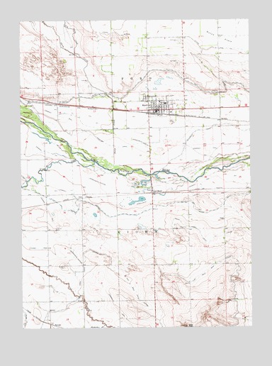
Morrill, NE USGS Topographic Map
Click on map above to begin viewing in our Map Viewer.

This topographic map contains these locations and features:
Feature Name Type Latitude Longitude GNIS ID View Map
Bald PeakSummitN41.8752°W103.9105°827156View Map
Bald Peak Group Detention DamDamN41.8966°W103.9255°1768047View Map
Caldwell (historical)Populated PlaceN41.9000°W103.9672°836012View Map
Caldwell CemeteryCemeteryN41.8998°W103.9770°827845View Map
Caldwell Post Office (historical)Post OfficeN41.9000°W103.9672°1827931View Map
Church of ChristChurchN41.9633°W103.9263°1828053View Map
Dry Sheep CreekStreamN41.9849°W103.9673°828849View Map
East Bald Peak LateralCanalN41.9019°W103.8830°828932View Map
EnterpriseLocaleN41.9591°W103.8908°1827869View Map
Ford Election PrecinctCivilN41.9750°W103.9264°1928876View Map
Forest Lawn CemeteryCemeteryN41.9917°W103.9133°829347View Map
HartmanPopulated PlaceN41.8766°W103.9852°835317View Map
Horse CreekStreamN41.9425°W103.9605°830140View Map
Independent Baptist ChurchChurchN41.9633°W103.9263°1828054View Map
JoycePopulated PlaceN41.9280°W103.9686°835343View Map
Kelley Bean Company Incorporated ElevatorLocaleN41.9633°W103.9263°1828072View Map
Kiowa DrainCanalN41.9075°W103.9911°830523View Map
Kiowa State Wildlife Management AreaParkN41.9222°W103.9380°1828113View Map
Lateral 10 MainCanalN41.9930°W103.9191°830625View Map
Lippencott ReservoirReservoirN41.8966°W103.9255°1768048View Map
Methodist ChurchChurchN41.9633°W103.9263°1828055View Map
MorrillPopulated PlaceN41.9633°W103.9263°831427View Map
Morrill Elementary SchoolSchoolN41.9666°W103.9241°1827953View Map
Morrill Fire DepartmentBuildingN41.9648°W103.9266°1828056View Map
Morrill High SchoolSchoolN41.9661°W103.9213°1827954View Map
Morrill Mobile Home EstatesPopulated PlaceN41.9633°W103.9263°1828057View Map
Morrill Police DepartmentBuildingN41.9635°W103.9288°1828058View Map
Morrill Post OfficePost OfficeN41.9632°W103.9259°1827926View Map
Morrill Public LibraryBuildingN41.9633°W103.9263°1828081View Map
Presbyterian ChurchChurchN41.9633°W103.9263°1828059View Map
Ramshorn CanalCanalN41.9502°W103.9544°832443View Map
Rolling Green Country ClubLocaleN41.9583°W103.9172°1828112View Map
Russell School (historical)SchoolN41.9186°W103.8902°832793View Map
Saint Ann Catholic ChurchChurchN41.9633°W103.9263°1828060View Map
Sheep CreekStreamN41.9387°W103.9395°833367View Map
South Horse Creek LateralCanalN41.8989°W103.9436°833598View Map
South MorrillPopulated PlaceN41.9297°W103.9283°835452View Map
Trinity Lutheran ChurchChurchN41.9633°W103.9263°1828061View Map
Village of MorrillCivilN41.9638°W103.9244°2399397View Map
West Bald Peak LateralCanalN41.8822°W103.9255°834560View Map

Note: Coordinates in the location and feature list above are referenced to NAD83 datum.


Copyright (C) 2008-2025 Ryan Niemi / Sunset Dynamics ... All Rights Reserved